
BRISTOL
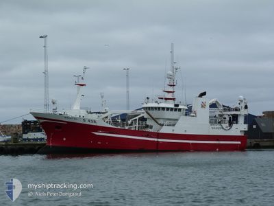
Trawler
Current Trip
| Time Travelled | 6 days |
|---|---|
| Remaining Time | 10 h, 5 mins |
| Distance Travelled | 669.54 nm |
| Remaining Distance | 125.82 nm |
| AVG Speed | 4.2 Knots |
| MAX Speed | 12 Knots |
| AVG Wind | 19.8 knots |
| MAX Wind | 27 knots |
| MIN Temp | 10.8°C / 51.44°F |
| MAX Temp | 15.4°C / 59.72°F |
| Draught | 6.7 m |
| Position Received | 1 h, 59 m ago |
Current Position
| Longitude | 5.54197° |
|---|---|
| Latitude | 56.03470° |
| Status | Under way using engine |
| Speed | 11 Knots |
| Course | 57.2° |
| Area | North Sea |
| Station | T-AIS |
| Position Received | 1 h, 59 m ago |
Info
Information
The current position of BRISTOL is in North Sea with coordinates 56.03470° / 5.54197° as reported on 2024-06-09 21:29 by AIS to our vessel tracker app. The vessel's current speed is 11 Knots and is heading at the port of HANSTHOLM. The estimated time of arrival as calculated by vessel tracking app is 2024-06-10 09:34 LT
The vessel BRISTOL (IMO: 9160322, MMSI: 219022326) is a Trawler that was built in 1997 ( 27 years old ). It's sailing under the flag of [DK] Denmark.
In this page you can find informations about the vessels current position, last detected port calls, and current voyage information. If the vessels is not in coverage by AIS you will find the latest position.
The current position of BRISTOL is detected by our AIS receivers and we are not responsible for the reliability of the data. The last position was recorded while the vessel was in Coverage by the Ais receivers of our vessel tracking app.
The current draught of BRISTOL as reported by AIS is 6.7 meters
Weather
| Temperature | 11.6°C / 52.88°F |
|---|---|
| Wind Speed | 24 knots |
| Direction | 283° WNW |
| Pressure | 1002.1 hPa |
| Humidity | 81 % |
| Cloud Coverage | 34 % |
Featured Company
Last Port Calls
| Port | Arrival | Departure | Time In Port |
|---|---|---|---|
| 2024-06-02 16:39 | 2024-06-03 02:42 | 10 h | |
| 2024-05-23 01:29 | 2024-05-23 15:56 | 14 h | |
| 2024-05-11 18:49 | 2024-05-12 10:01 | 15 h | |
| 2024-04-24 02:01 | 2024-05-01 15:47 | 7 d | |
| 2024-04-12 03:05 | 2024-04-19 17:20 | 7 d | |
| 2024-04-07 18:54 | 2024-04-07 21:00 | 2 h |
Last Trips
| Origin | Departure | Destination | Arrival | Distance | |
|---|---|---|---|---|---|
| 2024-05-23 17:56 | 2024-06-02 18:39 | 1019.32 nm | |||
| 2024-05-12 12:01 | 2024-05-23 03:29 | 1385.20 nm | |||
| 2024-05-01 17:47 | 2024-05-11 20:49 | 998.86 nm | |||
| 2024-04-19 19:20 | 2024-04-24 04:01 | 421.22 nm | |||
| 2024-04-07 23:00 | 2024-04-12 05:05 | 565.34 nm | |||
| 2024-03-22 18:41 | 2024-04-07 20:54 | 78.82 nm |
Events
| Time | Event | Details | Position / Dest | Info |
|---|---|---|---|---|
| 2024-06-09 21:29 | OUT of Coverage |
56.03470 / 5.54197
North Sea
|
Speed: 11 kn Course: 57.2° |
|
| 2024-06-09 20:32 | Status Changed | Under way using engine Engaged in Fishing |
55.94369 / 5.28558
HANSTHOLM
|
Speed: 10.4 kn Course: 55.4° |
| 2024-06-09 20:31 | Destination Changed | HANSTHOLM FISHING MIN CPA 0.7 |
55.94264 / 5.28257
HANSTHOLM
|
Speed: 10.4 kn Course: 55.4° |
| 2024-06-07 02:01 | START Moving |
56.15522 / 5.07843
FISHING MIN CPA 0.7
|
Speed: 3.2 kn Course: 170° |
|
| 2024-06-07 00:13 | STOP Moving |
56.14767 / 5.05248
FISHING MIN CPA 0.7
|
Speed: 0.3 kn Course: 150° |
|
| 2024-06-06 10:58 | START Moving |
55.99375 / 5.07655
FISHING MIN CPA 0.7
|
Speed: 3.1 kn Course: 319° |
|
| 2024-06-06 10:16 | STOP Moving |
55.99376 / 5.07063
FISHING MIN CPA 0.7
|
Speed: 0.3 kn Course: 157° |
|
| 2024-06-06 01:18 | START Moving |
56.10053 / 5.22280
FISHING MIN CPA 0.7
|
Speed: 4.5 kn Course: 293° |
|
| 2024-06-06 00:51 | STOP Moving |
56.09243 / 5.26673
FISHING MIN CPA 0.7
|
Speed: 0.3 kn Course: 163° |
|
| 2024-06-05 02:40 | START Moving |
56.13295 / 5.04593
FISHING MIN CPA 0.7
|
Speed: 5.3 kn Course: 249.6° |