
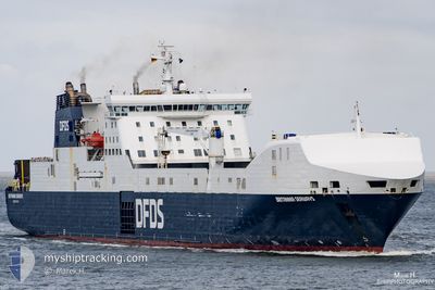
BRITANNIA SEAWAYS
Ro-Ro Cargo
Current Trip
| Time Travelled | 16 h, 3 mins |
|---|---|
| Remaining Time | 1 h, 48 mins |
| Distance Travelled | 292.07 nm |
| Remaining Distance | 38.67 nm |
| AVG Speed | 18.2 Knots |
| MAX Speed | 19.4 Knots |
| AVG Wind | 9.6 knots |
| MAX Wind | 14 knots |
| MIN Temp | 10.3°C / 50.54°F |
| MAX Temp | 14°C / 57.2°F |
| Draught | 6.8 m |
| Position Received | 1 m ago |
Current Position
| Longitude | 7.47770° |
|---|---|
| Latitude | 55.36592° |
| Status | Under way using engine |
| Speed | 19.3 Knots |
| Course | 81.6° |
| Area | North Sea |
| Station | T-AIS |
| Position Received | 1 m ago |
Info
Information
The current position of BRITANNIA SEAWAYS is in North Sea with coordinates 55.36592° / 7.47770° as reported on 2024-05-18 10:30 by AIS to our vessel tracker app. The vessel's current speed is 19.3 Knots and is heading at the port of ESBJERG. The estimated time of arrival as calculated by vessel tracking app is 2024-05-18 12:20 LT
The vessel BRITANNIA SEAWAYS (IMO: 9153032, MMSI: 219825000) is a Ro-Ro Cargo that was built in 2000 ( 24 years old ). It's sailing under the flag of [DK] Denmark.
In this page you can find informations about the vessels current position, last detected port calls, and current voyage information. If the vessels is not in coverage by AIS you will find the latest position.
The current position of BRITANNIA SEAWAYS is detected by our AIS receivers and we are not responsible for the reliability of the data. The last position was recorded while the vessel was in Coverage by the Ais receivers of our vessel tracking app.
The current draught of BRITANNIA SEAWAYS as reported by AIS is 6.8 meters
Weather
| Temperature | 13.9°C / 57.02°F |
|---|---|
| Wind Speed | 8 knots |
| Direction | 79° E |
| Pressure | 1014 hPa |
| Humidity | 83.8 % |
| Cloud Coverage | --- |
Featured Company
Last Port Calls
| Port | Arrival | Departure | Time In Port |
|---|---|---|---|
| 2024-05-17 13:16 | 2024-05-17 18:29 | 5 h | |
| 2024-05-16 12:59 | 2024-05-16 18:09 | 5 h | |
| 2024-05-15 13:11 | 2024-05-15 18:31 | 5 h | |
| 2024-05-14 12:51 | 2024-05-14 18:02 | 5 h | |
| 2024-05-12 16:01 | 2024-05-13 20:10 | 1 d | |
| 2024-05-11 12:51 | 2024-05-11 16:43 | 3 h | |
| 2024-05-10 13:23 | 2024-05-10 19:03 | 5 h | |
| 2024-05-09 12:47 | 2024-05-09 18:15 | 5 h | |
| 2024-05-08 13:15 | 2024-05-08 19:13 | 5 h | |
| 2024-05-06 18:07 | 2024-05-07 18:49 | 1 d |
Last Trips
| Origin | Departure | Destination | Arrival | Distance | |
|---|---|---|---|---|---|
| 2024-05-16 20:09 | 2024-05-17 14:16 | 329.19 nm | |||
| 2024-05-15 19:31 | 2024-05-16 14:59 | 330.94 nm | |||
| 2024-05-14 20:02 | 2024-05-15 14:11 | 330.94 nm | |||
| 2024-05-13 21:10 | 2024-05-14 14:51 | 331.22 nm | |||
| 2024-05-11 18:43 | 2024-05-12 17:01 | 328.97 nm | |||
| 2024-05-10 20:03 | 2024-05-11 14:51 | 331.36 nm | |||
| 2024-05-09 20:15 | 2024-05-10 14:23 | 329.24 nm | |||
| 2024-05-08 20:13 | 2024-05-09 14:47 | 331.04 nm | |||
| 2024-05-07 20:49 | 2024-05-08 14:15 | 329.10 nm | |||
| 2024-05-05 20:05 | 2024-05-06 20:07 | 330.99 nm |
Events
| Time | Event | Details | Position / Dest | Info |
|---|---|---|---|---|
| 2024-05-18 09:19 | Change Sea Area | Danish part of the North Sea German part of the North Sea |
55.31302 / 6.81623
North Sea
EBJ-IMM-EBJ
|
Speed: 19 kn Course: 81.9° |
| 2024-05-18 05:55 | Detected in Sea | German part of the North Sea |
55.03660 / 5.05323
North Sea
EBJ-IMM-EBJ
|
Speed: 18.4 kn Course: 74.1° |
| 2024-05-18 05:53 | Status Changed | Under way using engine Default |
55.03470 / 5.04132
EBJ-IMM-EBJ
|
Speed: 18.3 kn Course: 74° |
| 2024-05-18 05:11 | Status Changed | Default Under way using engine |
54.97833 / 4.67833
EBJ-IMM-EBJ
|
Speed: 18.5 kn Course: 74.4° |
| 2024-05-18 05:01 | Status Changed | Under way using engine Default |
54.96383 / 4.59053
EBJ-IMM-EBJ
|
Speed: 19 kn Course: 65° |
| 2024-05-18 04:44 | IN Coverage |
54.96410 / 4.59225
North Sea
EBJ-IMM-EBJ
|
Speed: 18.5 kn Course: 74.7° |
|
| 2024-05-18 03:29 | Status Changed | Default Under way using engine |
54.75834 / 3.85167
EBJ-IMM-EBJ
|
Speed: 18.8 kn Course: 63.2° |
| 2024-05-18 03:27 | OUT of Coverage |
54.75528 / 3.83807
North Sea
EBJ-IMM-EBJ
|
Speed: 18.8 kn Course: 63.2° |
|
| 2024-05-18 03:25 | Change Sea Area | Dutch part of the North Sea United Kingdom part of the North Sea |
54.75047 / 3.82110
North Sea
EBJ-IMM-EBJ
|
Speed: 18.8 kn Course: 64.2° |
| 2024-05-18 03:25 | Status Changed | Under way using engine Default |
54.75047 / 3.82110
EBJ-IMM-EBJ
|
Speed: 19 kn Course: 65° |