
BRIZZZO
Sailing
Aktuelle Reise
Unknown
| Bisherige Reisezeit | --- |
|---|---|
| Verbleibende Reisezeit | --- |
| Zurückgelegte Distanz | --- |
| Verbleibende Distanz | --- |
| Durchschnittliche Geschwindigkeit | --- |
| Maximale Geschwindigkeit | --- |
| Durchschnittliche Windgeschwindigkeit | --- |
| Maximale Windgeschwindigkeit | --- |
| Minimale Temperatur | --- |
| Maximale Temperatur | --- |
| Tiefgang | --- |
| Position erhalten | 5 d alt |
Aktuelle Position
| Länge | 3.93416° |
|---|---|
| Breite | 51.37850° |
| Zustand | Under way using engine |
| Geschwindigkeit | 8.7 Knoten |
| Kurs | 229° |
| Gebiet | North Sea |
| Station | T-AIS |
| Position erhalten | 5 d alt |
Schiffsdetails
Information
Die BRIZZZO befindet sich derzeit in North Sea mit den Koordinaten 51.37850° / 3.93416°, Diese Position wurde am 2024-09-20 11:27 von unserer Schiffsverfolgungs-App über AIS erfasst. Das Schiff fährt momentan mit einer Geschwindigkeit von 8.7 Knoten
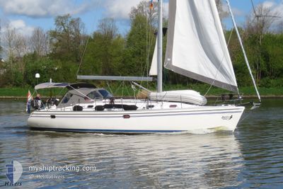
Das Schiff BRIZZZO (MMSI: 244700136) ist Sailing und fährt unter der Flagge von [NL] Netherlands.
Auf dieser Seite erhalten Sie Informationen zur aktuellen Position des Schiffes, zu den letzten bekannten Hafenanläufen und zu den aktuellen Reiseinformationen. Sollte das Schiff nicht durch AIS abgedeckt sein, wird die zuletzt erfasste Position angezeigt.
Die BRIZZZO wird durch unsere AIS-Empfänger ermittelt. Wir übernehmen keine Gewähr für die Richtigkeit der Daten. Die letzte Position wurde von unseren AIS-Empfängern aufgezeichnet, während das Schiff in Reichweite war.
Wetter
| Temperatur | 19.5°C / 67.1°F |
|---|---|
| Windgeschwindigkeit | 13 Knoten |
| Windrichtung | 83° E |
| Luftdruck | 1020.9 hPa |
| Luftfeuchtigkeit | 63.6 % |
| Wolken | --- |
Featured Company
Letzte Hafenanläufe
| Hafen | Ankunft | Abfahrt | Time In Port |
|---|---|---|---|
| 2024-09-17 14:08 | |||
| 2024-09-15 12:33 | 2024-09-17 05:46 | 1 d | |
| 2024-09-12 10:51 | 2024-09-14 08:59 | 1 d | |
| 2024-09-08 11:30 | 2024-09-12 08:53 | 3 d | |
| 2024-08-30 11:56 | 2024-09-01 09:41 | 1 d | |
| 2024-08-29 12:27 | 2024-08-29 12:39 | 11 m | |
| 2024-08-07 13:47 | 2024-08-27 08:37 | 19 d | |
| 2024-08-02 10:56 | 2024-08-03 07:06 | 20 h | |
| 2024-08-01 09:20 | |||
| 2024-07-12 10:29 | 2024-07-23 08:45 | 10 d |
Letzte Reisen
| Herkunft | Abfahrt | Ziel | Ankunft | Distanz | |
|---|---|---|---|---|---|
| 2024-09-17 07:46 | 2024-09-17 16:08 | 45.12 nm | |||
| 2024-09-14 10:59 | 2024-09-15 14:33 | 41.13 nm | |||
| 2024-09-12 10:53 | 2024-09-12 12:51 | 10.13 nm | |||
| 2024-09-01 11:41 | 2024-09-08 13:30 | 97.41 nm | |||
| 2024-08-29 14:39 | 2024-08-30 13:56 | 37.88 nm | |||
| 2024-08-27 10:37 | 2024-08-29 14:27 | 58.59 nm | |||
| 2024-08-03 09:06 | 2024-08-07 15:47 | 45.89 nm | |||
| 2024-08-01 11:20 | 2024-08-02 12:56 | 23.01 nm | |||
| 2024-07-01 13:01 | 2024-07-12 12:29 | 59.91 nm |
Events
| Zeit | Ereignis | Details | Position / Ziel | Information |
|---|---|---|---|---|
| 2024-09-20 11:27 | außerhalb Abdeckung |
51.37850 / 3.93416
North Sea
|
Geschwindigkeit: 8.7 kn Kurs: 230.4° |
|
| 2024-09-20 11:27 | Auf See entdeckt | Dutch part of the North Sea |
51.37850 / 3.93416
North Sea
|
Geschwindigkeit: 8.7 kn Kurs: 230.4° |
| 2024-09-20 11:27 | in Abdeckung |
51.37850 / 3.93416
North Sea
|
Geschwindigkeit: 8.7 kn Kurs: 230.4° |
|
| 2024-09-17 14:27 | außerhalb Abdeckung |
58.62534 / 16.79801
Baltic Sea
[SE] NAVEKVARN
|
Geschwindigkeit: Kurs: 360° |
|
| 2024-09-17 14:15 | STOP Bewegung |
58.62529 / 16.79794
[SE] NAVEKVARN
|
Geschwindigkeit: 0.1 kn Kurs: 360° |
|
| 2024-09-17 14:08 | ZIELHAFEN |
|
58.62165 / 16.80417
[SE] NAVEKVARN
|
Geschwindigkeit: 5.1 kn Kurs: 311° |
| 2024-09-17 05:46 | ABFAHRTSHAFEN |
|
58.89655 / 17.95694
|
Geschwindigkeit: 4.8 kn Kurs: 183.1° |
| 2024-09-17 05:43 | START Bewegung |
58.89987 / 17.95704
[SE] NYNASHAMN
|
Geschwindigkeit: 3.6 kn Kurs: 160.3° |