
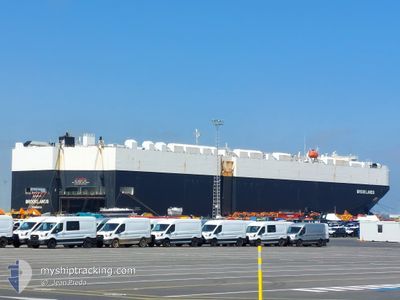
BROOKLANDS
Cargo
Current Trip
| Time Travelled | 7 days |
|---|---|
| Remaining Time | --- |
| Distance Travelled | 905.80 nm |
| Remaining Distance | 11.59 nm |
| AVG Speed | 15.5 Knots |
| MAX Speed | 20.3 Knots |
| AVG Wind | 7.1 knots |
| MAX Wind | 21 knots |
| MIN Temp | 20.5°C / 68.9°F |
| MAX Temp | 24.4°C / 75.92°F |
| Draught | 7.2 m |
| Position Received | 7 d ago |
Current Position
| Longitude | 136.85611° |
|---|---|
| Latitude | 34.14711° |
| Status | Under way using engine |
| Speed | 20.1 Knots |
| Course | 208° |
| Area | Philippine Sea |
| Station | T-AIS |
| Position Received | 7 d ago |
Info
Information
The current position of BROOKLANDS is in Philippine Sea with coordinates 34.14711° / 136.85611° as reported on 2024-06-10 09:35 by AIS to our vessel tracker app. The vessel's current speed is 20.1 Knots and is heading at the port of ZHOUSHAN. The estimated time of arrival as calculated by vessel tracking app is 2024-06-12 07:00 LT
The vessel BROOKLANDS (IMO: 9748289, MMSI: 636017767) is a Cargo It's sailing under the flag of [LR] Liberia.
In this page you can find informations about the vessels current position, last detected port calls, and current voyage information. If the vessels is not in coverage by AIS you will find the latest position.
The current position of BROOKLANDS is detected by our AIS receivers and we are not responsible for the reliability of the data. The last position was recorded while the vessel was in Coverage by the Ais receivers of our vessel tracking app.
The current draught of BROOKLANDS as reported by AIS is 7.2 meters
Weather
| Temperature | 21.1°C / 69.98°F |
|---|---|
| Wind Speed | 1 knots |
| Direction | 89° E |
| Pressure | 1007.6 hPa |
| Humidity | 89.9 % |
| Cloud Coverage | 59 % |
Featured Company
Last Port Calls
| Port | Arrival | Departure | Time In Port |
|---|---|---|---|
| 2024-06-09 21:17 | 2024-06-10 06:17 | 8 h | |
| 2024-06-06 22:06 | 2024-06-07 10:52 | 12 h | |
| 2024-05-29 16:29 | 2024-05-31 14:02 | 1 d | |
| 2024-05-26 22:20 | 2024-05-27 07:09 | 8 h | |
| 2024-05-22 01:31 | 2024-05-22 12:01 | 10 h | |
| 2024-04-19 02:11 | 2024-04-20 15:19 | 1 d | |
| 2024-04-15 18:10 | 2024-04-17 22:52 | 2 d | |
| 2024-04-14 01:16 | 2024-04-14 13:43 | 12 h | |
| 2024-04-02 09:39 | 2024-04-03 18:46 | 1 d | |
| 2024-04-01 18:29 |
Most Visited Ports (Last year)
| Port | Arrivals | |
|---|---|---|
| 8 | ||
| 8 | ||
| 8 | ||
| 8 | ||
| 8 | ||
| 7 |
Last Trips
| Origin | Departure | Destination | Arrival | Distance | |
|---|---|---|---|---|---|
| 2024-06-07 19:52 | 2024-06-10 06:17 | 221.90 nm | |||
| 2024-05-31 22:02 | 2024-06-07 07:06 | 1230.51 nm | |||
| 2024-05-27 15:09 | 2024-05-30 00:29 | 230.66 nm | |||
| 2024-05-22 20:01 | 2024-05-27 06:20 | 1732.16 nm | |||
| 2024-04-20 17:19 | 2024-05-22 09:31 | 12283.15 nm | |||
| 2024-04-18 00:52 | 2024-04-19 04:11 | 329.81 nm | |||
| 2024-04-14 15:43 | 2024-04-15 20:10 | 161.02 nm | |||
| 2024-04-03 14:46 | 2024-04-14 03:16 | 4089.16 nm | |||
| 2024-04-01 14:29 | 2024-04-02 05:39 | 162.81 nm |
Events
| Time | Event | Details | Position / Dest | Info |
|---|---|---|---|---|
| 2024-06-14 01:12 | STOP Moving | 10.08 nm, South of ZHOUSHAN |
29.80228 / 122.15859
CN ZOS
|
Speed: Course: 319° |
| 2024-06-14 00:01 | START Moving | 10.86 nm, South West of ZHOUSHAN |
29.79944 / 122.11974
CN ZOS
|
Speed: 3.7 kn Course: 88° |
| 2024-06-13 11:37 | STOP Moving | 11.15 nm, South West of ZHOUSHAN |
29.79761 / 122.11054
CN ZOS
|
Speed: 0.3 kn Course: 80° |
| 2024-06-13 06:25 | START Moving |
29.58610 / 122.73239
CN ZOS
|
Speed: 7.4 kn Course: 2° |
|
| 2024-06-12 07:52 | STOP Moving |
29.57576 / 122.73483
CN ZOS
|
Speed: 0.3 kn Course: 208° |
|
| 2024-06-10 09:41 | Status Changed | Default Under way using engine |
34.11737 / 136.83112
CN ZOS
|
Speed: 20.1 kn Course: 208° |
| 2024-06-10 09:35 | OUT of Coverage |
34.14711 / 136.85611
Philippine Sea
CN ZOS
|
Speed: 20.1 kn Course: 208° |
|
| 2024-06-10 09:34 | Status Changed | Under way using engine Default |
34.15101 / 136.85859
CN ZOS
|
Speed: 20.1 kn Course: 205° |
| 2024-06-10 08:53 | Status Changed | Default Under way using engine |
34.32709 / 137.00920
CN ZOS
|
Speed: 18.5 kn Course: 185.5° |
| 2024-06-10 08:38 | Status Changed | Under way using engine Default |
34.40143 / 137.01202
CN ZOS
|
Speed: 17.1 kn Course: 170° |