
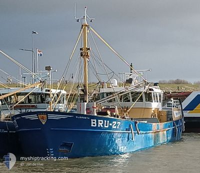
BRU-27 ELISABETH
Fishing Vessel
Current Trip
| Trip Time | 21 days |
|---|---|
| Trip Distance | 523.88 nm |
| AVG Speed | 4.7 Knots |
| MAX Speed | 4.7 Knots |
| Draught | 0.9 m |
| AVG Wind | 11.9 knots |
| MAX Wind | 22.8 knots |
| MIN Temp | 8.6°C / 47.48°F |
| MAX Temp | 19.9°C / 67.82°F |
| Position Received | 2 m ago |
Current Position
| Longitude | 4.04434° |
|---|---|
| Latitude | 51.81842° |
| Status | Under way using engine |
| Speed | |
| Course | --- |
| Area | North Sea |
| Station | T-AIS |
| Position Received | 2 m ago |
Info
Information
The current position of BRU-27 ELISABETH is in North Sea with coordinates 51.81842° / 4.04434° as reported on 2024-06-03 12:12 by AIS to our vessel tracker app. The vessel's current speed is 0 Knots and is currently inside the port of STELLENDAM.
The vessel BRU-27 ELISABETH (IMO: 8906365, MMSI: 244644000) is a Fishing Vessel that was built in 1989 ( 35 years old ). It's sailing under the flag of [NL] Netherlands.
In this page you can find informations about the vessels current position, last detected port calls, and current voyage information. If the vessels is not in coverage by AIS you will find the latest position.
The current position of BRU-27 ELISABETH is detected by our AIS receivers and we are not responsible for the reliability of the data. The last position was recorded while the vessel was in Coverage by the Ais receivers of our vessel tracking app.
The current draught of BRU-27 ELISABETH as reported by AIS is 0.9 meters
Weather
| Temperature | 13.6°C / 56.48°F |
|---|---|
| Wind Speed | 8 knots |
| Direction | 285° WNW |
| Pressure | 1020.9 hPa |
| Humidity | 81.8 % |
| Cloud Coverage | 100 % |
Featured Company
Last Port Calls
| Port | Arrival | Departure | Time In Port |
|---|---|---|---|
| 2024-06-03 05:27 | |||
| 2024-05-12 23:03 | 2024-05-12 23:18 | 15 m | |
| 2024-05-08 12:51 | 2024-05-12 08:39 | 3 d | |
| 2024-05-02 08:56 | 2024-05-05 21:05 | 3 d | |
| 2024-04-25 11:35 | 2024-04-28 20:19 | 3 d | |
| 2024-04-18 14:13 | 2024-04-21 20:23 | 3 d | |
| 2024-04-11 14:54 | 2024-04-14 20:21 | 3 d | |
| 2024-04-04 13:17 | 2024-04-07 20:31 | 3 d | |
| 2024-04-01 19:27 |
Most Visited Ports (Last year)
| Port | Arrivals | |
|---|---|---|
| 21 | ||
| 13 | ||
| 13 | ||
| 12 | ||
| 6 | ||
| 5 |
Last Trips
| Origin | Departure | Destination | Arrival | Distance | |
|---|---|---|---|---|---|
| 2024-05-13 01:18 | 2024-06-03 07:27 | 523.88 nm | |||
| 2024-05-12 10:39 | 2024-05-13 01:03 | 127.38 nm | |||
| 2024-05-05 23:05 | 2024-05-08 14:51 | 133.66 nm | |||
| 2024-04-28 22:19 | 2024-05-02 10:56 | 149.61 nm | |||
| 2024-04-21 22:23 | 2024-04-25 13:35 | 161.06 nm | |||
| 2024-04-14 22:21 | 2024-04-18 16:13 | 219.55 nm | |||
| 2024-04-07 22:31 | 2024-04-11 16:54 | 222.75 nm | |||
| 2024-04-01 21:27 | 2024-04-04 15:17 | 148.28 nm |
Events
| Time | Event | Details | Position / Dest | Info |
|---|---|---|---|---|
| 2024-06-03 05:32 | STOP Moving |
51.81919 / 4.04360
[NL] STELLENDAM
|
Speed: 0.3 kn Course: 511° |
|
| 2024-06-03 05:27 | PORT ARRIVAL |
|
51.82314 / 4.04968
[NL] STELLENDAM
|
Speed: 9.1 kn Course: 260.5° |
| 2024-06-03 02:32 | START Moving | 2.79 nm, North of SINT PHILIPSLAND |
51.66139 / 4.16704
BRUINISSE
|
Speed: 9.2 kn Course: 86° |
| 2024-06-03 02:14 | STOP Moving | 2.63 nm, East of BRUINISSE |
51.66114 / 4.15993
BRUINISSE
|
Speed: Course: 511° |
| 2024-06-03 01:53 | START Moving | 1.02 nm, South of BRUINISSE |
51.65354 / 4.10036
BRUINISSE
|
Speed: 7.2 kn Course: 72.9° |
| 2024-05-30 14:04 | STOP Moving | 1.09 nm, South of BRUINISSE |
51.65197 / 4.09894
BRUINISSE
|
Speed: 0.1 kn Course: 511° |
| 2024-05-30 13:04 | START Moving | 1.1 nm, North East of KATS |
51.58311 / 3.91760
BRUINISSE
|
Speed: 8.9 kn Course: 5.3° |
| 2024-05-30 12:58 | STOP Moving | 1.05 nm, North East of KATS |
51.58131 / 3.91781
BRUINISSE
|
Speed: 0.3 kn Course: 511° |
| 2024-05-30 11:18 | START Moving | 1.03 nm, South of BRUINISSE |
51.65354 / 4.10109
BRUINISSE
|
Speed: 5.5 kn Course: 100.5° |
| 2024-05-30 08:12 | STOP Moving | 1.09 nm, South of BRUINISSE |
51.65191 / 4.09901
BRUINISSE
|
Speed: 0.1 kn Course: 511° |