
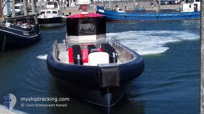
BRUUZER
Passenger
Current Trip
| Trip Time | --- |
|---|---|
| Trip Distance | --- |
| AVG Speed | --- |
| MAX Speed | --- |
| Draught | --- |
| AVG Wind | --- |
| MAX Wind | --- |
| MIN Temp | --- |
| MAX Temp | --- |
| Position Received | 11 h, 51 m ago |
Current Position
| Longitude | 4.84978° |
|---|---|
| Latitude | 53.04010° |
| Status | Under way using engine |
| Speed | |
| Course | --- |
| Area | North Sea |
| Station | T-AIS |
| Position Received | 11 h, 51 m ago |
Info
Information
The current position of BRUUZER is in North Sea with coordinates 53.04010° / 4.84978° as reported on 2024-06-18 02:04 by AIS to our vessel tracker app. The vessel's current speed is 0 Knots and is currently inside the port of OUDESCHILD.
The vessel BRUUZER (MMSI: 244013532) is a Passenger It's sailing under the flag of [NL] Netherlands.
In this page you can find informations about the vessels current position, last detected port calls, and current voyage information. If the vessels is not in coverage by AIS you will find the latest position.
The current position of BRUUZER is detected by our AIS receivers and we are not responsible for the reliability of the data. The last position was recorded while the vessel was in Coverage by the Ais receivers of our vessel tracking app.
Weather
| Temperature | 15°C / 59°F |
|---|---|
| Wind Speed | 7 knots |
| Direction | 208° SSW |
| Pressure | 1013.7 hPa |
| Humidity | 81.9 % |
| Cloud Coverage | 100 % |
Featured Company
Last Port Calls
| Port | Arrival | Departure | Time In Port |
|---|---|---|---|
| 2024-06-14 13:11 | 2024-06-15 12:13 | 23 h | |
| 2024-06-14 09:55 | 2024-06-14 12:05 | 2 h | |
| 2024-06-14 07:52 | 2024-06-14 08:11 | 18 m | |
| 2024-06-14 07:35 | |||
| 2024-06-09 13:40 | 2024-06-12 11:29 | 2 d | |
| 2024-06-09 09:36 | 2024-06-09 11:27 | 1 h | |
| 2024-06-09 09:06 | 2024-06-09 09:15 | 8 m | |
| 2024-06-09 07:16 | 2024-06-09 07:45 | 28 m | |
| 2024-06-08 14:47 | 2024-06-08 14:56 | 9 m | |
| 2024-06-08 13:41 | 2024-06-08 14:01 | 20 m |
Most Visited Ports (Last year)
| Port | Arrivals | |
|---|---|---|
| 289 | ||
| 54 | ||
| 11 | ||
| 1 | ||
| 1 |
Last Trips
| Origin | Departure | Destination | Arrival | Distance | |
|---|---|---|---|---|---|
| 2024-06-14 14:05 | 2024-06-14 15:11 | 16.55 nm | |||
| 2024-06-14 10:11 | 2024-06-14 11:55 | 24.04 nm | |||
| 2024-06-14 09:35 | 2024-06-14 09:52 | 4.78 nm | |||
| 2024-06-09 13:27 | 2024-06-09 15:40 | 28.96 nm | |||
| 2024-06-09 11:15 | 2024-06-09 11:36 | 4.93 nm | |||
| 2024-06-09 09:45 | 2024-06-09 11:06 | 8.86 nm | |||
| 2024-06-08 16:56 | 2024-06-09 09:16 | 10.61 nm | |||
| 2024-06-08 16:01 | 2024-06-08 16:47 | 12.38 nm | |||
| 2024-06-08 14:26 | 2024-06-08 15:41 | 22.73 nm | |||
| 2024-06-08 08:33 | 2024-06-08 13:51 | 44.77 nm |
Events
| Time | Event | Details | Position / Dest | Info |
|---|---|---|---|---|
| 2024-06-18 02:04 | OUT of Coverage |
53.04010 / 4.84978
North Sea
[NL] OUDESCHILD
|
Speed: Course: 511° |
|
| 2024-06-18 02:04 | IN Coverage |
53.04010 / 4.84978
North Sea
[NL] OUDESCHILD
|
Speed: Course: 511° |
|
| 2024-06-16 10:25 | Status Changed | Default Under way using engine |
52.99166 / 4.68833
TEXEL
|
Speed: 24 kn Course: 265.2° |
| 2024-06-16 10:16 | OUT of Coverage |
52.99326 / 4.78265
North Sea
|
Speed: 24 kn Course: 265.2° |
|
| 2024-06-16 10:07 | IN Coverage |
53.03293 / 4.84879
North Sea
|
Speed: 18.1 kn Course: 217.4° |
|
| 2024-06-15 13:56 | OUT of Coverage |
53.02678 / 4.83660
North Sea
|
Speed: 26.8 kn Course: 42.8° |
|
| 2024-06-15 13:36 | Status Changed | Under way using engine Default |
52.99253 / 4.69141
TEXEL
|
Speed: 24 kn Course: 278° |
| 2024-06-15 13:25 | Status Changed | Default Under way using engine |
52.98500 / 4.75167
TEXEL
|
Speed: 22.8 kn Course: 227.1° |
| 2024-06-15 12:15 | IN Coverage |
53.02582 / 4.83768
North Sea
|
Speed: 20.8 kn Course: 220.7° |
|
| 2024-06-15 12:13 | PORT DEPARTURE |
|
53.02676 / 4.83884
TEXEL
|
Speed: 0.2 kn Course: -1° |