
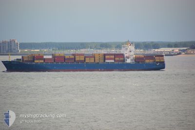
BSG BONAIRE
Container Ship
Current Trip
| Time Travelled | 2 days |
|---|---|
| Remaining Time | --- |
| Distance Travelled | 1139.50 nm |
| Remaining Distance | 2604.87 nm |
| AVG Speed | 16.2 Knots |
| MAX Speed | 17.5 Knots |
| AVG Wind | 21.8 knots |
| MAX Wind | 26 knots |
| MIN Temp | 23.2°C / 73.76°F |
| MAX Temp | 26.9°C / 80.42°F |
| Draught | 11.1 m |
| Position Received | 24 d ago |
Current Position
| Longitude | 54.46743° |
|---|---|
| Latitude | -21.10412° |
| Status | Under way using engine |
| Speed | 18.7 Knots |
| Course | 242.4° |
| Area | Indian Ocean |
| Station | T-AIS |
| Position Received | 24 d ago |
Info
Information
The current position of BSG BONAIRE is in Indian Ocean with coordinates -21.10412° / 54.46743° as reported on 2024-06-01 10:03 by AIS to our vessel tracker app. The vessel's current speed is 18.7 Knots and is heading at the port of MAPUTO.
The vessel BSG BONAIRE (IMO: 9303766, MMSI: 636093027) is a Container Ship that was built in 2006 ( 18 years old ). It's sailing under the flag of [LR] Liberia.
In this page you can find informations about the vessels current position, last detected port calls, and current voyage information. If the vessels is not in coverage by AIS you will find the latest position.
The current position of BSG BONAIRE is detected by our AIS receivers and we are not responsible for the reliability of the data. The last position was recorded while the vessel was in Coverage by the Ais receivers of our vessel tracking app.
The current draught of BSG BONAIRE as reported by AIS is 11.1 meters
Weather
| Temperature | 26.7°C / 80.06°F |
|---|---|
| Wind Speed | 20 knots |
| Direction | 107° ESE |
| Pressure | 1008 hPa |
| Humidity | 82.1 % |
| Cloud Coverage | 98 % |
Featured Company
Last Port Calls
| Port | Arrival | Departure | Time In Port |
|---|---|---|---|
| 2024-06-21 17:16 | 2024-06-23 00:56 | 1 d | |
| 2024-06-10 17:15 | 2024-06-14 07:39 | 3 d | |
| 2024-06-04 09:02 | 2024-06-05 23:32 | 1 d | |
| 2024-05-30 09:27 | 2024-06-01 07:09 | 1 d | |
| 2024-05-20 06:12 | 2024-05-21 06:43 | 1 d | |
| 2024-05-17 19:49 | 2024-05-19 18:53 | 1 d | |
| 2024-04-30 20:18 | 2024-05-02 11:43 | 1 d | |
| 2024-04-20 12:42 | 2024-04-23 01:03 | 2 d | |
| 2024-04-16 02:50 | 2024-04-18 08:50 | 2 d | |
| 2024-04-09 02:15 | 2024-04-10 16:39 | 1 d |
Last Trips
| Origin | Departure | Destination | Arrival | Distance | |
|---|---|---|---|---|---|
| 2024-06-14 09:39 | 2024-06-21 21:16 | 1543.03 nm | |||
| 2024-06-06 01:32 | 2024-06-10 19:15 | 513.85 nm | |||
| 2024-06-01 11:09 | 2024-06-04 11:02 | 1348.62 nm | |||
| 2024-05-21 14:43 | 2024-05-30 13:27 | 3487.78 nm | |||
| 2024-05-20 02:53 | 2024-05-20 14:12 | 43.27 nm | |||
| 2024-05-02 15:43 | 2024-05-18 03:49 | 3479.55 nm | |||
| 2024-04-23 03:03 | 2024-05-01 00:18 | 1589.67 nm | |||
| 2024-04-18 10:50 | 2024-04-20 14:42 | 532.47 nm | |||
| 2024-04-10 20:39 | 2024-04-16 04:50 | 1960.91 nm | |||
| 2024-03-31 15:44 | 2024-04-09 06:15 | 3466.19 nm |
Events
| Time | Event | Details | Position / Dest | Info |
|---|---|---|---|---|
| 2024-06-23 00:56 | PORT DEPARTURE |
|
-20.12936 / 57.46659
MAPUTO
|
Speed: 6.3 kn Course: 305° |
| 2024-06-23 00:44 | START Moving |
-20.14062 / 57.48632
[MU] PORT LOUIS
|
Speed: 4 kn Course: 282° |
|
| 2024-06-21 17:16 | STOP Moving |
-20.14146 / 57.49081
[MU] PORT LOUIS
|
Speed: 0.2 kn Course: 236° |
|
| 2024-06-21 17:16 | PORT ARRIVAL |
|
-20.14146 / 57.49081
[MU] PORT LOUIS
|
Speed: 2.8 kn Course: 107° |
| 2024-06-21 09:12 | START Moving | 11.09 nm, North West of PORT LOUIS |
-20.03561 / 57.32068
MAPUTO
|
Speed: 3.9 kn Course: 53° |
| 2024-06-21 07:21 | STOP Moving | 10.09 nm, North West of PORT LOUIS |
-20.04985 / 57.33184
MAPUTO
|
Speed: 0.2 kn Course: 152° |
| 2024-06-21 04:03 | START Moving |
-19.89436 / 56.61777
MAPUTO
|
Speed: 9.7 kn Course: 104° |
|
| 2024-06-19 14:56 | STOP Moving | 19.45 nm, West of PORT LOUIS |
-20.06124 / 57.14852
MAPUTO
|
Speed: 0.3 kn Course: 226° |