
BUCCOO REEF
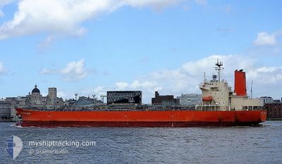
Tanker B
Current Trip
| Time Travelled | 4 days |
|---|---|
| Remaining Time | --- |
| Distance Travelled | 1272.14 nm |
| Remaining Distance | --- |
| AVG Speed | 12.9 Knots |
| MAX Speed | 15.3 Knots |
| AVG Wind | 13.4 knots |
| MAX Wind | 24.1 knots |
| MIN Temp | 11.4°C / 52.52°F |
| MAX Temp | 17.2°C / 62.96°F |
| Draught | 7.3 m |
| Position Received | 3 d ago |
Current Position
| Longitude | -5.85736° |
|---|---|
| Latitude | 51.99051° |
| Status | Under way using engine |
| Speed | 12.5 Knots |
| Course | 198.4° |
| Area | Celtic Sea |
| Station | T-AIS |
| Position Received | 3 d ago |
Info
Information
The current position of BUCCOO REEF is in Celtic Sea with coordinates 51.99051° / -5.85736° as reported on 2024-05-14 16:28 by AIS to our vessel tracker app. The vessel's current speed is 12.5 Knots and is heading at the port of POINT LISAS. The estimated time of arrival as calculated by vessel tracking app is 2024-05-27 15:00 LT
The vessel BUCCOO REEF (IMO: 9733674, MMSI: 431132000) is a Tanker B It's sailing under the flag of [JP] Japan.
In this page you can find informations about the vessels current position, last detected port calls, and current voyage information. If the vessels is not in coverage by AIS you will find the latest position.
The current position of BUCCOO REEF is detected by our AIS receivers and we are not responsible for the reliability of the data. The last position was recorded while the vessel was in Coverage by the Ais receivers of our vessel tracking app.
The current draught of BUCCOO REEF as reported by AIS is 7.3 meters
Weather
| Temperature | 16.9°C / 62.42°F |
|---|---|
| Wind Speed | 11 knots |
| Direction | 15° NNE |
| Pressure | 1020.8 hPa |
| Humidity | 71.9 % |
| Cloud Coverage | 96 % |
Featured Company
Last Port Calls
| Port | Arrival | Departure | Time In Port |
|---|---|---|---|
| 2024-05-12 14:39 | 2024-05-14 02:51 | 1 d | |
| 2024-05-11 10:57 | 2024-05-12 11:20 | 1 d | |
| 2024-05-10 06:29 | 2024-05-10 15:44 | 9 h | |
| 2024-05-10 05:23 | 2024-05-10 05:32 | 9 m | |
| 2024-05-05 18:22 | 2024-05-06 11:10 | 16 h | |
| 2024-04-30 23:05 | 2024-05-03 05:57 | 2 d | |
| 2024-04-12 05:00 | 2024-04-14 04:33 | 1 d | |
| 2024-03-20 21:13 | 2024-03-22 09:46 | 1 d | |
| 2024-03-20 12:50 | 2024-03-20 18:14 | 5 h | |
| 2024-03-18 20:27 | 2024-03-19 18:55 | 22 h |
Most Visited Ports (Last year)
| Port | Arrivals | |
|---|---|---|
| 7 | ||
| 6 | ||
| 5 | ||
| 4 | ||
| 3 | ||
| 3 |
Last Trips
| Origin | Departure | Destination | Arrival | Distance | |
|---|---|---|---|---|---|
| 2024-05-10 16:44 | 2024-05-12 15:39 | 262.30 nm | |||
| 2024-05-10 16:44 | 2024-05-11 11:57 | 234.97 nm | |||
| 2024-05-10 06:32 | 2024-05-10 07:29 | 5.21 nm | |||
| 2024-05-06 12:10 | 2024-05-10 06:23 | 880.51 nm | |||
| 2024-05-03 07:57 | 2024-05-05 19:22 | 292.51 nm | |||
| 2024-04-13 23:33 | 2024-05-01 01:05 | 5033.83 nm | |||
| 2024-03-22 09:46 | 2024-04-12 00:00 | 5865.66 nm | |||
| 2024-03-19 18:55 | 2024-03-20 21:13 | 260.04 nm | |||
| 2024-03-19 18:55 | 2024-03-20 12:50 | 233.99 nm | |||
| 2024-03-18 19:30 | 2024-03-18 20:27 | 5.31 nm |
Events
| Time | Event | Details | Position / Dest | Info |
|---|---|---|---|---|
| 2024-05-14 16:57 | Status Changed | Default Under way using engine |
51.89132 / -5.90554
TT PTS
|
Speed: 12.5 kn Course: 198.4° |
| 2024-05-14 16:28 | Status Changed | Under way using engine Default |
51.99051 / -5.85736
TT PTS
|
Speed: 12.3 kn Course: 201° |
| 2024-05-14 16:28 | OUT of Coverage |
51.99051 / -5.85736
Celtic Sea
TT PTS
|
Speed: 12.5 kn Course: 198.4° |
|
| 2024-05-14 16:16 | Status Changed | Default Under way using engine |
52.02697 / -5.83608
TT PTS
|
Speed: 12 kn Course: 205.7° |
| 2024-05-14 16:10 | Change Sea Area | United Kingdom part of the Celtic Sea United Kingdom part of the Irish Sea and St. George's Channel |
52.04810 / -5.82265
Celtic Sea
TT PTS
|
Speed: 12.1 kn Course: 208.2° |
| 2024-05-14 14:58 | Draught Changed | 7.3 6.3 |
52.27065 / -5.64070
TT PTS
|
Speed: 12.2 kn Course: 201.9° |
| 2024-05-14 14:50 | Change Sea Area | United Kingdom part of the Irish Sea and St. George's Channel Irish part of the Irish Sea and St. George's Channel |
52.29668 / -5.62499
Irish Sea and St. George's Channel
TT PTS
|
Speed: 12.2 kn Course: 200.3° |
| 2024-05-14 13:59 | Status Changed | Under way using engine Default |
52.45602 / -5.52778
TT PTS
|
Speed: 11.9 kn Course: 202° |
| 2024-05-14 13:51 | Status Changed | Default Under way using engine |
52.48056 / -5.51239
TT PTS
|
Speed: 11.7 kn Course: 200.3° |
| 2024-05-14 13:40 | Change Sea Area | Irish part of the Irish Sea and St. George's Channel United Kingdom part of the Irish Sea and St. George's Channel |
52.51226 / -5.49215
Irish Sea and St. George's Channel
TT PTS
|
Speed: 11.5 kn Course: 202.5° |