
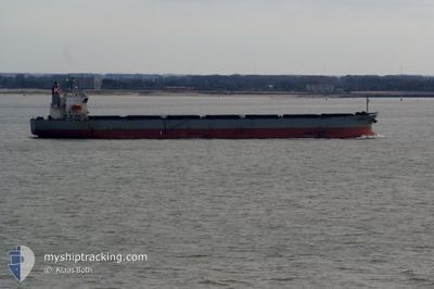
BULK XAYMACA
Bulk Carrier
Current Trip
JM PRH>US GRY
| Time Travelled | 2 days |
|---|---|
| Remaining Time | --- |
| Distance Travelled | 19.12 nm |
| Remaining Distance | --- |
| AVG Speed | 6.1 Knots |
| MAX Speed | 7.1 Knots |
| AVG Wind | 5.9 knots |
| MAX Wind | 8 knots |
| MIN Temp | 23.4°C / 74.12°F |
| MAX Temp | 26.2°C / 79.16°F |
| Draught | 10.9 m |
| Position Received | 10 h, 13 m ago |
Current Position
| Longitude | -90.66324° |
|---|---|
| Latitude | 30.05226° |
| Status | Moored |
| Speed | |
| Course | 248° |
| Area | Gulf of Mexico |
| Station | T-AIS |
| Position Received | 10 h, 13 m ago |
Info
Information
The current position of BULK XAYMACA is in Gulf of Mexico with coordinates 30.05226° / -90.66324° as reported on 2024-05-19 13:27 by AIS to our vessel tracker app. The vessel's current speed is 0 Knots
The vessel BULK XAYMACA (IMO: 9362190, MMSI: 353408000) is a Bulk Carrier that was built in 2006 ( 18 years old ). It's sailing under the flag of [PA] Panama.
In this page you can find informations about the vessels current position, last detected port calls, and current voyage information. If the vessels is not in coverage by AIS you will find the latest position.
The current position of BULK XAYMACA is detected by our AIS receivers and we are not responsible for the reliability of the data. The last position was recorded while the vessel was in Coverage by the Ais receivers of our vessel tracking app.
The current draught of BULK XAYMACA as reported by AIS is 10.9 meters
Weather
| Temperature | 30°C / 86°F |
|---|---|
| Wind Speed | 3 knots |
| Direction | 91° E |
| Pressure | 1011.8 hPa |
| Humidity | 56.8 % |
| Cloud Coverage | 6 % |
Featured Company
Last Port Calls
| Port | Arrival | Departure | Time In Port |
|---|---|---|---|
| 2024-05-17 03:56 | 2024-05-17 10:02 | 6 h | |
| 2024-05-08 01:05 | 2024-05-13 10:29 | 5 d | |
| 2024-04-24 06:57 | 2024-04-24 13:10 | 6 h | |
| 2024-04-13 03:02 | 2024-04-20 11:34 | 7 d | |
| 2024-03-29 10:20 | 2024-03-29 16:11 | 5 h | |
| 2024-03-15 11:59 | 2024-03-25 06:17 | 9 d |
Most Visited Ports (Last year)
| Port | Arrivals | |
|---|---|---|
| 15 | ||
| 14 |
Last Trips
| Origin | Departure | Destination | Arrival | Distance | |
|---|---|---|---|---|---|
| 2024-05-13 05:29 | 2024-05-16 22:56 | 1057.61 nm | |||
| 2024-04-24 08:10 | 2024-05-07 20:05 | 1364.36 nm | |||
| 2024-04-20 06:34 | 2024-04-24 01:57 | 1059.12 nm | |||
| 2024-03-29 11:11 | 2024-04-12 22:02 | 1358.18 nm | |||
| 2024-03-25 01:17 | 2024-03-29 05:20 | 1059.98 nm | |||
| 2024-02-28 11:24 | 2024-03-15 06:59 | 1361.11 nm |
Events
| Time | Event | Details | Position / Dest | Info |
|---|---|---|---|---|
| 2024-05-19 13:33 | Status Changed | Default Moored |
30.05225 / -90.66323
JM PRH>US GRY
|
Speed: Course: 248° |
| 2024-05-19 13:27 | Status Changed | Moored Default |
30.05226 / -90.66324
JM PRH>US GRY
|
Speed: Course: 248° |
| 2024-05-19 13:27 | IN Coverage |
30.05226 / -90.66324
Gulf of Mexico
|
Speed: Course: 150.5° |
|
| 2024-05-19 13:27 | OUT of Coverage |
30.05226 / -90.66324
Gulf of Mexico
|
Speed: Course: 150.5° |
|
| 2024-05-18 07:57 | Status Changed | Default Moored |
30.05227 / -90.66322
JM PRH>US GRY
|
Speed: Course: 248° |
| 2024-05-18 07:51 | OUT of Coverage |
30.05226 / -90.66322
Gulf of Mexico
|
Speed: Course: 174.4° |
|
| 2024-05-18 07:48 | Status Changed | Moored Default |
30.05228 / -90.66320
JM PRH>US GRY
|
Speed: Course: 248° |
| 2024-05-18 07:30 | IN Coverage |
30.05228 / -90.66320
Gulf of Mexico
|
Speed: 0.1 kn Course: 170.2° |
|
| 2024-05-17 13:22 | STOP Moving | 1.93 nm, North East of LUTCHER |
30.05219 / -90.66345
JM PRH>US GRY
|
Speed: 0.2 kn Course: 248° |
| 2024-05-17 10:02 | PORT DEPARTURE |
|
29.95466 / -90.39335
JM PRH>US GRY
|
Speed: 6.9 kn Course: 319° |