
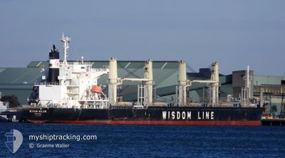
BUNUN KALON
Cargo
Current Trip
| Time Travelled | 3 days |
|---|---|
| Remaining Time | --- |
| Distance Travelled | 879.14 nm |
| Remaining Distance | --- |
| AVG Speed | 12.1 Knots |
| MAX Speed | 14.1 Knots |
| AVG Wind | 13.5 knots |
| MAX Wind | 27 knots |
| MIN Temp | 9.4°C / 48.92°F |
| MAX Temp | 13.8°C / 56.84°F |
| Draught | 9 m |
| Position Received | 1 d ago |
Current Position
| Longitude | -4.17180° |
|---|---|
| Latitude | 58.72270° |
| Status | Under way using engine |
| Speed | 12.7 Knots |
| Course | 272.8° |
| Area | North Atlantic Ocean |
| Station | T-AIS |
| Position Received | 1 d ago |
Info
Information
The current position of BUNUN KALON is in North Atlantic Ocean with coordinates 58.72270° / -4.17180° as reported on 2024-05-22 13:37 by AIS to our vessel tracker app. The vessel's current speed is 12.7 Knots and is heading at the port of VERACRUZ. The estimated time of arrival as calculated by vessel tracking app is 2024-06-10 05:00 LT
The vessel BUNUN KALON (IMO: 9768033, MMSI: 371576000) is a Cargo It's sailing under the flag of [PA] Panama.
In this page you can find informations about the vessels current position, last detected port calls, and current voyage information. If the vessels is not in coverage by AIS you will find the latest position.
The current position of BUNUN KALON is detected by our AIS receivers and we are not responsible for the reliability of the data. The last position was recorded while the vessel was in Coverage by the Ais receivers of our vessel tracking app.
The current draught of BUNUN KALON as reported by AIS is 9 meters
Weather
| Temperature | 10.6°C / 51.08°F |
|---|---|
| Wind Speed | 21 knots |
| Direction | 151° SSE |
| Pressure | 1017.4 hPa |
| Humidity | 83.5 % |
| Cloud Coverage | 100 % |
Featured Company
Last Port Calls
| Port | Arrival | Departure | Time In Port |
|---|---|---|---|
| 2024-05-18 19:55 | 2024-05-20 21:01 | 2 d | |
| 2024-05-16 18:55 | 2024-05-18 19:37 | 2 d | |
| 2024-04-18 21:59 | 2024-04-20 20:36 | 1 d | |
| 2024-04-15 10:25 | 2024-04-17 00:57 | 1 d | |
| 2024-04-07 11:15 | 2024-04-12 19:10 | 5 d | |
| 2024-04-01 04:35 | 2024-04-02 00:30 | 19 h | |
| 2024-03-31 19:32 | 2024-03-31 20:07 | 35 m |
Last Trips
| Origin | Departure | Destination | Arrival | Distance | |
|---|---|---|---|---|---|
| 2024-05-18 21:37 | 2024-05-18 21:55 | 0.32 nm | |||
| 2024-04-20 22:36 | 2024-05-16 20:55 | 1490.42 nm | |||
| 2024-04-17 02:57 | 2024-04-18 23:59 | 496.81 nm | |||
| 2024-04-12 21:10 | 2024-04-15 12:25 | 753.50 nm | |||
| 2024-04-02 01:30 | 2024-04-07 13:15 | 1233.38 nm | |||
| 2024-03-31 21:07 | 2024-04-01 05:35 | 31.66 nm | |||
| 2024-02-08 17:01 | 2024-03-31 20:32 | 14032.50 nm |
Events
| Time | Event | Details | Position / Dest | Info |
|---|---|---|---|---|
| 2024-05-22 13:41 | Status Changed | Default Under way using engine |
58.72313 / -4.20207
MXVER
|
Speed: 12.7 kn Course: 272.8° |
| 2024-05-22 13:37 | OUT of Coverage |
58.72270 / -4.17180
North Atlantic Ocean
MXVER
|
Speed: 12.7 kn Course: 272.8° |
|
| 2024-05-22 11:46 | Change Sea Area | United Kingdom part of the North Atlantic Ocean United Kingdom part of the North Sea |
58.72180 / -3.41470
North Atlantic Ocean
MXVER
|
Speed: 13 kn Course: 267.5° |
| 2024-05-22 10:11 | Status Changed | Under way using engine Default |
58.70367 / -2.77559
MXVER
|
Speed: 10.8 kn Course: 281° |
| 2024-05-22 10:10 | Status Changed | Default Under way using engine |
58.70274 / -2.76908
MXVER
|
Speed: 11.2 kn Course: 275.6° |
| 2024-05-22 09:56 | Change Sea Area | United Kingdom part of the North Sea Norwegian part of the North Sea |
58.69784 / -2.68182
North Sea
MXVER
|
Speed: 11.7 kn Course: 276.5° |
| 2024-05-22 09:56 | Status Changed | Under way using engine Default |
58.69784 / -2.68182
MXVER
|
Speed: 11.7 kn Course: 275° |
| 2024-05-22 09:43 | IN Coverage |
58.69784 / -2.68182
North Sea
MXVER
|
Speed: 11.7 kn Course: 276.5° |
|
| 2024-05-21 20:51 | Status Changed | Default Under way using engine |
58.29239 / 2.33801
MXVER
|
Speed: 11.9 kn Course: 274.6° |
| 2024-05-21 20:42 | OUT of Coverage |
58.29018 / 2.39009
North Sea
MXVER
|
Speed: 11.9 kn Course: 274.6° |