
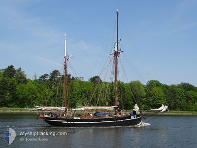
BV2 VEGESACK
Sailing
Current Trip
| Time Travelled | 2 days |
|---|---|
| Remaining Time | --- |
| Distance Travelled | 170.28 nm |
| Remaining Distance | --- |
| AVG Speed | 5.8 Knots |
| MAX Speed | 10.2 Knots |
| AVG Wind | 10.8 knots |
| MAX Wind | 20.9 knots |
| MIN Temp | 12.5°C / 54.5°F |
| MAX Temp | 16.9°C / 62.42°F |
| Draught | 2.5 m |
| Position Received | 2 m ago |
Current Position
| Longitude | 10.67194° |
|---|---|
| Latitude | 54.75211° |
| Status | Under way sailing |
| Speed | |
| Course | --- |
| Area | Kattegat |
| Station | T-AIS |
| Position Received | 2 m ago |
Info
Information
The current position of BV2 VEGESACK is in Kattegat with coordinates 54.75211° / 10.67194° as reported on 2024-05-31 23:41 by AIS to our vessel tracker app. The vessel's current speed is 0 Knots
The vessel BV2 VEGESACK (MMSI: 211226120) is a Sailing It's sailing under the flag of [DE] Germany.
In this page you can find informations about the vessels current position, last detected port calls, and current voyage information. If the vessels is not in coverage by AIS you will find the latest position.
The current position of BV2 VEGESACK is detected by our AIS receivers and we are not responsible for the reliability of the data. The last position was recorded while the vessel was in Coverage by the Ais receivers of our vessel tracking app.
The current draught of BV2 VEGESACK as reported by AIS is 2.5 meters
Weather
| Temperature | 15.3°C / 59.54°F |
|---|---|
| Wind Speed | 13 knots |
| Direction | 46° NE |
| Pressure | 1011.9 hPa |
| Humidity | 90.4 % |
| Cloud Coverage | 78 % |
Featured Company
Last Port Calls
| Port | Arrival | Departure | Time In Port |
|---|---|---|---|
| 2024-05-28 13:41 | 2024-05-29 04:26 | 14 h | |
| 2024-05-27 15:07 | 2024-05-28 09:25 | 18 h | |
| 2024-05-25 14:14 | 2024-05-27 07:56 | 1 d | |
| 2024-05-24 09:14 | 2024-05-25 07:02 | 21 h | |
| 2024-05-23 11:36 | 2024-05-24 08:36 | 21 h | |
| 2024-05-22 12:04 | 2024-05-23 08:53 | 20 h | |
| 2024-05-21 14:38 | 2024-05-21 15:05 | 26 m | |
| 2024-05-20 16:26 | 2024-05-21 14:21 | 21 h | |
| 2024-05-18 15:25 | 2024-05-19 07:55 | 16 h | |
| 2024-05-18 14:03 | 2024-05-18 14:04 | 1 m |
Last Trips
| Origin | Departure | Destination | Arrival | Distance | |
|---|---|---|---|---|---|
| 2024-05-28 11:25 | 2024-05-28 15:41 | 6.57 nm | |||
| 2024-05-27 09:56 | 2024-05-27 17:07 | 23.37 nm | |||
| 2024-05-25 09:02 | 2024-05-25 16:14 | 28.53 nm | |||
| 2024-05-24 10:36 | 2024-05-24 11:14 | 2.53 nm | |||
| 2024-05-23 10:53 | 2024-05-23 13:36 | 17.67 nm | |||
| 2024-05-21 17:05 | 2024-05-22 14:04 | 23.78 nm | |||
| 2024-05-21 16:21 | 2024-05-21 16:38 | 1.24 nm | |||
| 2024-05-19 09:55 | 2024-05-20 18:26 | 49.59 nm | |||
| 2024-05-18 16:04 | 2024-05-18 17:25 | 4.13 nm | |||
| 2024-05-18 10:23 | 2024-05-18 16:03 | 21.40 nm |
Events
| Time | Event | Details | Position / Dest | Info |
|---|---|---|---|---|
| 2024-05-31 23:11 | IN Coverage |
54.75210 / 10.67194
Kattegat
DE KEL
|
Speed: Course: 121.7° |
|
| 2024-05-31 22:10 | OUT of Coverage |
54.75209 / 10.67192
Kattegat
DE KEL
|
Speed: Course: 121.7° |
|
| 2024-05-31 19:03 | IN Coverage |
54.75208 / 10.67192
Kattegat
DE KEL
|
Speed: Course: 121.7° |
|
| 2024-05-31 17:34 | OUT of Coverage |
54.75226 / 10.67154
Kattegat
DE KEL
|
Speed: 0.3 kn Course: 131° |
|
| 2024-05-31 17:34 | STOP Moving | 8.14 nm, South East of MARSTAL |
54.75226 / 10.67154
DE KEL
|
Speed: 0.3 kn Course: 511° |
| 2024-05-31 17:22 | Change Sea Area | Danish part of the Kattegat Danish part of the Baltic Sea |
54.74908 / 10.65675
Kattegat
DE KEL
|
Speed: 5.9 kn Course: 10.5° |
| 2024-05-31 16:34 | Change Sea Area | Danish part of the Baltic Sea Danish part of the Kattegat |
54.72693 / 10.73811
Baltic Sea
DE KEL
|
Speed: 6.8 kn Course: 203.3° |
| 2024-05-31 14:17 | START Moving | 2.96 nm, East of SPODSBJERG |
54.93752 / 10.91901
DE KEL
|
Speed: 3.5 kn Course: 10.9° |
| 2024-05-31 14:09 | STOP Moving | 2.92 nm, East of SPODSBJERG |
54.93583 / 10.91795
DE KEL
|
Speed: 0.3 kn Course: 511° |
| 2024-05-31 08:25 | IN Coverage |
55.22098 / 11.02398
Kattegat
DE KEL
|
Speed: 4.4 kn Course: 191.8° |