
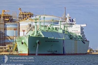
BW PAVILIONARANTHERA
Tanker C
Current Trip
| Time Travelled | 28 days |
|---|---|
| Remaining Time | --- |
| Distance Travelled | 9605.63 nm |
| Remaining Distance | --- |
| AVG Speed | 15 Knots |
| MAX Speed | 19.1 Knots |
| AVG Wind | 11.2 knots |
| MAX Wind | 32 knots |
| MIN Temp | 9.5°C / 49.1°F |
| MAX Temp | 31.3°C / 88.34°F |
| Draught | 9.8 m |
| Position Received | 2 d ago |
Current Position
| Longitude | 18.06048° |
|---|---|
| Latitude | -34.74446° |
| Status | Under way using engine |
| Speed | 16.9 Knots |
| Course | 295.8° |
| Area | South Atlantic Ocean |
| Station | T-AIS |
| Position Received | 2 d ago |
Info
Information
The current position of BW PAVILIONARANTHERA is in South Atlantic Ocean with coordinates -34.74446° / 18.06048° as reported on 2024-05-16 19:55 by AIS to our vessel tracker app. The vessel's current speed is 16.9 Knots and is heading at the port of MARSAXLOKK. The estimated time of arrival as calculated by vessel tracking app is 2024-06-06 00:01 LT
The vessel BW PAVILIONARANTHERA (IMO: 9850678, MMSI: 563104600) is a Tanker C It's sailing under the flag of [SG] Singapore.
In this page you can find informations about the vessels current position, last detected port calls, and current voyage information. If the vessels is not in coverage by AIS you will find the latest position.
The current position of BW PAVILIONARANTHERA is detected by our AIS receivers and we are not responsible for the reliability of the data. The last position was recorded while the vessel was in Coverage by the Ais receivers of our vessel tracking app.
The current draught of BW PAVILIONARANTHERA as reported by AIS is 9.8 meters
Weather
| Temperature | 18.6°C / 65.48°F |
|---|---|
| Wind Speed | 1 knots |
| Direction | 157° SSE |
| Pressure | 1021.3 hPa |
| Humidity | 69.3 % |
| Cloud Coverage | 59 % |
Featured Company
Last Trips
| Origin | Departure | Destination | Arrival | Distance |
|---|
Events
| Time | Event | Details | Position / Dest | Info |
|---|---|---|---|---|
| 2024-05-16 19:59 | Status Changed | Default Under way using engine |
-34.73621 / 18.04029
FREEPORT
|
Speed: 16.9 kn Course: 295.8° |
| 2024-05-16 19:55 | Status Changed | Under way using engine Default |
-34.74446 / 18.06048
FREEPORT
|
Speed: 16.8 kn Course: 283° |
| 2024-05-16 19:55 | OUT of Coverage |
-34.74446 / 18.06048
South Atlantic Ocean
FREEPORT
|
Speed: 16.9 kn Course: 295.8° |
|
| 2024-05-16 19:23 | Status Changed | Default Under way using engine |
-34.76684 / 18.23547
FREEPORT
|
Speed: 16.6 kn Course: 280.7° |
| 2024-05-16 19:10 | Status Changed | Under way using engine Default |
-34.77682 / 18.31029
FREEPORT
|
Speed: 16 kn Course: 282° |
| 2024-05-16 19:07 | Status Changed | Default Under way using engine |
-34.77833 / 18.32500
FREEPORT
|
Speed: 16.5 kn Course: 278.9° |
| 2024-05-16 18:48 | Status Changed | Under way using engine Default |
-34.79941 / 18.43115
FREEPORT
|
Speed: 16 kn Course: 290° |
| 2024-05-16 18:43 | IN Coverage |
-34.79816 / 18.42607
South Atlantic Ocean
FREEPORT
|
Speed: 16.6 kn Course: 283.4° |
|
| 2024-05-16 17:19 | Status Changed | Default Under way using engine |
-34.91833 / 18.92333
FREEPORT
|
Speed: 16.6 kn Course: 284.3° |
| 2024-05-16 17:14 | OUT of Coverage |
-34.92485 / 18.94849
South Atlantic Ocean
FREEPORT
|
Speed: 16.6 kn Course: 284.3° |