
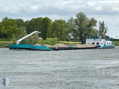
CADENZA
Other Type
Current Trip
| Time Travelled | 4 days |
|---|---|
| Remaining Time | --- |
| Distance Travelled | 172.68 nm |
| Remaining Distance | --- |
| AVG Speed | 8.4 Knots |
| MAX Speed | 11 Knots |
| AVG Wind | 8.8 knots |
| MAX Wind | 10.8 knots |
| MIN Temp | 8.9°C / 48.02°F |
| MAX Temp | 16.9°C / 62.42°F |
| Draught | 0.2 m |
| Position Received | 2 d ago |
Current Position
| Longitude | 6.14382° |
|---|---|
| Latitude | 52.06316° |
| Status | Under way using engine |
| Speed | 8.9 Knots |
| Course | 67.1° |
| Area | North Sea |
| Station | T-AIS |
| Position Received | 2 d ago |
Info
Information
The current position of CADENZA is in North Sea with coordinates 52.06316° / 6.14382° as reported on 2024-06-13 12:47 by AIS to our vessel tracker app. The vessel's current speed is 8.9 Knots
The vessel CADENZA (MMSI: 244660923) is a Other Type It's sailing under the flag of [NL] Netherlands.
In this page you can find informations about the vessels current position, last detected port calls, and current voyage information. If the vessels is not in coverage by AIS you will find the latest position.
The current position of CADENZA is detected by our AIS receivers and we are not responsible for the reliability of the data. The last position was recorded while the vessel was in Coverage by the Ais receivers of our vessel tracking app.
The current draught of CADENZA as reported by AIS is 0.2 meters
Weather
| Temperature | 16.3°C / 61.34°F |
|---|---|
| Wind Speed | 10 knots |
| Direction | 210° SSW |
| Pressure | 1015.9 hPa |
| Humidity | 58.7 % |
| Cloud Coverage | 55 % |
Featured Company
Last Port Calls
| Port | Arrival | Departure | Time In Port |
|---|---|---|---|
| 2024-06-10 21:09 | 2024-06-11 13:01 | 15 h | |
| 2024-06-06 18:52 | 2024-06-06 19:18 | 25 m | |
| 2024-06-06 18:13 | 2024-06-06 18:36 | 22 m | |
| 2024-06-06 08:56 | 2024-06-06 14:43 | 5 h | |
| 2024-06-06 07:51 | 2024-06-06 08:21 | 30 m | |
| 2024-06-05 14:34 | 2024-06-06 04:06 | 13 h | |
| 2024-06-03 13:53 | 2024-06-03 14:37 | 44 m | |
| 2024-05-30 16:37 | 2024-05-30 17:03 | 26 m | |
| 2024-05-29 20:30 | 2024-05-30 07:54 | 11 h | |
| 2024-05-27 13:35 | 2024-05-28 08:13 | 18 h |
Last Trips
| Origin | Departure | Destination | Arrival | Distance | |
|---|---|---|---|---|---|
| 2024-06-06 21:18 | 2024-06-10 23:09 | 102.85 nm | |||
| 2024-06-06 20:36 | 2024-06-06 20:52 | 0.75 nm | |||
| 2024-06-06 16:43 | 2024-06-06 20:13 | 23.78 nm | |||
| 2024-06-06 10:21 | 2024-06-06 10:56 | 3.55 nm | |||
| 2024-06-06 06:06 | 2024-06-06 09:51 | 31.97 nm | |||
| 2024-06-03 16:37 | 2024-06-05 16:34 | 130.29 nm | |||
| 2024-05-30 19:03 | 2024-06-03 15:53 | 99.42 nm | |||
| 2024-05-30 09:54 | 2024-05-30 18:37 | 58.99 nm | |||
| 2024-05-28 10:13 | 2024-05-29 22:30 | 71.11 nm | |||
| 2024-05-15 10:34 | 2024-05-27 15:35 | 331.79 nm |
Events
| Time | Event | Details | Position / Dest | Info |
|---|---|---|---|---|
| 2024-06-13 12:47 | OUT of Coverage |
52.06316 / 6.14382
North Sea
|
Speed: 8.9 kn Course: 67.1° |
|
| 2024-06-13 10:39 | Destination Changed | DEVENTER 000000 |
51.88318 / 6.02801
DEVENTER
|
Speed: 9.9 kn Course: 340° |
| 2024-06-13 10:32 | Destination Changed | 000000 RHEINBERG |
51.87155 / 6.04799
000000
|
Speed: 10 kn Course: 293.6° |
| 2024-06-13 09:49 | IN Coverage |
51.82949 / 6.22831
North Sea
|
Speed: 10.3 kn Course: 268.6° |
|
| 2024-06-13 08:09 | OUT of Coverage |
51.66283 / 6.52036
North Sea
|
Speed: 10.3 kn Course: 267.8° |
|
| 2024-06-13 07:49 | IN Coverage |
51.64613 / 6.60596
North Sea
|
Speed: 10.5 kn Course: 346.6° |
|
| 2024-06-13 05:49 | OUT of Coverage |
51.56974 / 6.66037
North Sea
|
Speed: Course: 511° |
|
| 2024-06-13 05:49 | IN Coverage |
51.56974 / 6.66037
North Sea
|
Speed: Course: 511° |
|
| 2024-06-12 20:20 | OUT of Coverage |
51.56958 / 6.66121
North Sea
|
Speed: 0.8 kn Course: 224.1° |
|
| 2024-06-12 18:38 | IN Coverage |
51.65775 / 6.54422
North Sea
|
Speed: 6.5 kn Course: 92.3° |