
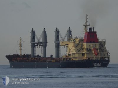
CAGLA
Bulk Carrier
Current Trip
| Time Travelled | 4 days |
|---|---|
| Remaining Time | 1 h, 17 mins |
| Distance Travelled | 960.32 nm |
| Remaining Distance | 161.08 nm |
| AVG Speed | 9.4 Knots |
| MAX Speed | 11.6 Knots |
| AVG Wind | 15.6 knots |
| MAX Wind | 24.8 knots |
| MIN Temp | 16.4°C / 61.52°F |
| MAX Temp | 27.1°C / 80.78°F |
| Draught | 6.1 m |
| Position Received | 14 h, 34 m ago |
Current Position
| Longitude | 29.25447° |
|---|---|
| Latitude | 41.46583° |
| Status | Under way using engine |
| Speed | 9.8 Knots |
| Course | 9.8° |
| Area | Black Sea |
| Station | T-AIS |
| Position Received | 14 h, 34 m ago |
Info
Information
The current position of CAGLA is in Black Sea with coordinates 41.46583° / 29.25447° as reported on 2024-06-29 01:25 by AIS to our vessel tracker app. The vessel's current speed is 9.8 Knots and is heading at the port of CONSTANTA. The estimated time of arrival as calculated by vessel tracking app is 2024-06-29 17:17 LT
The vessel CAGLA (IMO: 9375953, MMSI: 636023443) is a Bulk Carrier that was built in 2008 ( 16 years old ). It's sailing under the flag of [LR] Liberia.
In this page you can find informations about the vessels current position, last detected port calls, and current voyage information. If the vessels is not in coverage by AIS you will find the latest position.
The current position of CAGLA is detected by our AIS receivers and we are not responsible for the reliability of the data. The last position was recorded while the vessel was in Coverage by the Ais receivers of our vessel tracking app.
The current draught of CAGLA as reported by AIS is 6.1 meters
Weather
| Temperature | 24.4°C / 75.92°F |
|---|---|
| Wind Speed | 10 knots |
| Direction | 46° NE |
| Pressure | 1015 hPa |
| Humidity | 72.2 % |
| Cloud Coverage | --- |
Featured Company
Last Port Calls
| Port | Arrival | Departure | Time In Port |
|---|---|---|---|
| 2024-06-21 09:04 | 2024-06-25 05:05 | 3 d | |
| 2024-06-12 11:25 | 2024-06-13 11:41 | 1 d | |
| 2024-06-07 19:16 | 2024-06-07 20:32 | 1 h | |
| 2024-05-31 22:13 | 2024-06-02 09:01 | 1 d | |
| 2024-04-17 03:34 | 2024-04-17 04:54 | 1 h | |
| 2024-04-03 18:13 |
Most Visited Ports (Last year)
| Port | Arrivals | |
|---|---|---|
| 6 | ||
| 3 | ||
| 2 | ||
| 1 | ||
| 1 | ||
| 1 |
Last Trips
| Origin | Departure | Destination | Arrival | Distance | |
|---|---|---|---|---|---|
| 2024-06-13 13:41 | 2024-06-21 11:04 | 42.93 nm | |||
| 2024-06-07 23:32 | 2024-06-12 13:25 | 760.16 nm | |||
| 2024-06-02 12:01 | 2024-06-07 22:16 | 455.59 nm | |||
| 2024-04-17 07:54 | 2024-06-01 01:13 | 872.76 nm | |||
| 2024-04-03 19:13 | 2024-04-17 06:34 | 2338.86 nm |
Events
| Time | Event | Details | Position / Dest | Info |
|---|---|---|---|---|
| 2024-06-29 01:29 | Status Changed | Default Under way using engine |
41.47762 / 29.25639
RO CND
|
Speed: 9.8 kn Course: 9.8° |
| 2024-06-29 01:25 | OUT of Coverage |
41.46583 / 29.25447
Black Sea
RO CND
|
Speed: 9.8 kn Course: 9.8° |
|
| 2024-06-28 23:55 | Change Sea Area | Turkish part of the Black Sea Turkish part of the Sea of Marmara |
41.23022 / 29.14499
Black Sea
RO CND
|
Speed: 10.3 kn Course: 44.7° |
| 2024-06-28 20:00 | START Moving | 10.5 nm, South West of MALTEPE |
40.76594 / 29.00854
RO CND
|
Speed: 3.4 kn Course: 73° |
| 2024-06-28 16:55 | STOP Moving | 8.55 nm, South West of MALTEPE |
40.78753 / 29.04565
RO CND
|
Speed: 0.3 kn Course: 83° |
| 2024-06-28 15:27 | START Moving | 14.41 nm, South of YESILKOY |
40.72323 / 28.90774
RO CND
|
Speed: 3.3 kn Course: 114° |
| 2024-06-28 12:30 | STOP Moving | 13.07 nm, South of YESILKOY |
40.75371 / 28.93428
RO CND
|
Speed: 0.3 kn Course: 95° |
| 2024-06-28 11:29 | ETA Changed | 2024/06/29 12:00 2024/06/28 22:00 |
40.76210 / 28.92976
RO CND
|
Speed: 1.1 kn Course: 82° |
| 2024-06-28 08:25 | Status Changed | Under way using engine Default |
40.81808 / 28.52378
RO CND
|
Speed: 11.4 kn Course: 82° |
| 2024-06-28 07:29 | Status Changed | Default Under way using engine |
40.79418 / 28.29482
RO CND
|
Speed: 10.8 kn Course: 81° |