
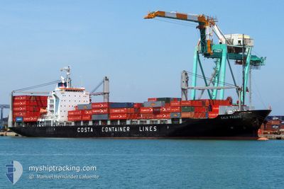
CALA PAGURO
Container Ship
Current Trip
| Time Travelled | 3 days |
|---|---|
| Remaining Time | 21 h, 7 mins |
| Distance Travelled | 1200.67 nm |
| Remaining Distance | 341.85 nm |
| AVG Speed | 14.8 Knots |
| MAX Speed | 16.2 Knots |
| AVG Wind | 12.2 knots |
| MAX Wind | 23.9 knots |
| MIN Temp | 27.1°C / 80.78°F |
| MAX Temp | 30.4°C / 86.72°F |
| Draught | 9.5 m |
| Position Received | 2 d ago |
Current Position
| Longitude | 109.25397° |
|---|---|
| Latitude | 14.65875° |
| Status | Under way using engine |
| Speed | 15.5 Knots |
| Course | 173° |
| Area | South China Sea |
| Station | T-AIS |
| Position Received | 2 d ago |
Info
Information
The current position of CALA PAGURO is in South China Sea with coordinates 14.65875° / 109.25397° as reported on 2024-06-16 09:00 by AIS to our vessel tracker app. The vessel's current speed is 15.5 Knots and is heading at the port of PORT KLANG. The estimated time of arrival as calculated by vessel tracking app is 2024-06-19 10:45 LT
The vessel CALA PAGURO (IMO: 9412787, MMSI: 636017440) is a Container Ship that was built in 2007 ( 17 years old ). It's sailing under the flag of [LR] Liberia.
In this page you can find informations about the vessels current position, last detected port calls, and current voyage information. If the vessels is not in coverage by AIS you will find the latest position.
The current position of CALA PAGURO is detected by our AIS receivers and we are not responsible for the reliability of the data. The last position was recorded while the vessel was in Coverage by the Ais receivers of our vessel tracking app.
The current draught of CALA PAGURO as reported by AIS is 9.5 meters
Weather
| Temperature | 29.4°C / 84.92°F |
|---|---|
| Wind Speed | 10 knots |
| Direction | 186° S |
| Pressure | 1009.1 hPa |
| Humidity | 73.5 % |
| Cloud Coverage | 100 % |
Featured Company
Last Port Calls
| Port | Arrival | Departure | Time In Port |
|---|---|---|---|
| 2024-06-14 08:29 | 2024-06-15 04:01 | 19 h | |
| 2024-06-06 03:09 | 2024-06-06 20:51 | 17 h | |
| 2024-05-27 02:37 | 2024-05-28 00:04 | 21 h | |
| 2024-05-22 05:35 | 2024-05-22 21:58 | 16 h | |
| 2024-05-15 11:06 | 2024-05-18 00:48 | 2 d | |
| 2024-05-08 19:08 | 2024-05-09 12:48 | 17 h | |
| 2024-05-03 13:20 | 2024-05-04 13:40 | 1 d | |
| 2024-04-29 08:12 | 2024-04-30 02:17 | 18 h | |
| 2024-04-22 05:16 | 2024-04-25 05:16 | 3 d | |
| 2024-04-16 22:59 | 2024-04-17 19:37 | 20 h |
Most Visited Ports (Last year)
| Port | Arrivals | |
|---|---|---|
| 18 | ||
| 14 | ||
| 14 | ||
| 14 | ||
| 2 | ||
| 1 |
Last Trips
| Origin | Departure | Destination | Arrival | Distance | |
|---|---|---|---|---|---|
| 2024-06-07 04:51 | 2024-06-14 16:29 | 1579.68 nm | |||
| 2024-05-28 08:04 | 2024-06-06 11:09 | 1790.74 nm | |||
| 2024-05-23 05:58 | 2024-05-27 10:37 | 58.19 nm | |||
| 2024-05-18 06:48 | 2024-05-22 13:35 | 1543.77 nm | |||
| 2024-05-09 20:48 | 2024-05-15 17:06 | 1426.60 nm | |||
| 2024-05-04 21:40 | 2024-05-09 03:08 | 1466.11 nm | |||
| 2024-04-30 10:17 | 2024-05-03 21:20 | 1272.06 nm | |||
| 2024-04-25 11:16 | 2024-04-29 16:12 | 1552.01 nm | |||
| 2024-04-18 03:37 | 2024-04-22 11:16 | 1394.04 nm | |||
| 2024-04-13 07:49 | 2024-04-17 06:59 | 1460.49 nm |
Events
| Time | Event | Details | Position / Dest | Info |
|---|---|---|---|---|
| 2024-06-16 09:12 | Status Changed | Default Under way using engine |
14.60688 / 109.26547
MYPKG
|
Speed: 15.5 kn Course: 173° |
| 2024-06-16 09:00 | OUT of Coverage |
14.65875 / 109.25397
South China Sea
MYPKG
|
Speed: 15.5 kn Course: 173° |
|
| 2024-06-16 08:47 | Change Sea Area | Vietnamese part of the South China Sea Chinese part of the South China Sea |
14.71320 / 109.24825
South China Sea
MYPKG
|
Speed: 15.5 kn Course: 177° |
| 2024-06-16 08:47 | Status Changed | Under way using engine Default |
14.71420 / 109.24822
MYPKG
|
Speed: 15.7 kn Course: 175° |
| 2024-06-16 08:47 | IN Coverage |
14.71320 / 109.24825
South China Sea
MYPKG
|
Speed: 15.5 kn Course: 177° |
|
| 2024-06-15 18:46 | Status Changed | Default Under way using engine |
18.11483 / 108.46592
MYPKG
|
Speed: 15.9 kn Course: 150° |
| 2024-06-15 18:43 | OUT of Coverage |
18.12757 / 108.45847
South China Sea
MYPKG
|
Speed: 15.9 kn Course: 150° |
|
| 2024-06-15 18:42 | Status Changed | Under way using engine Default |
18.12997 / 108.45707
MYPKG
|
Speed: 15.9 kn Course: 151° |
| 2024-06-15 18:33 | IN Coverage |
18.12757 / 108.45847
South China Sea
MYPKG
|
Speed: 15.9 kn Course: 150° |
|
| 2024-06-15 13:12 | OUT of Coverage |
19.42800 / 108.17765
South China Sea
MYPKG
|
Speed: 14.9 kn Course: 179° |