
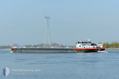
CALCIT 11
Tanker
Current Trip
TERNEUZEN
| Time Travelled | 1 day |
|---|---|
| Remaining Time | --- |
| Distance Travelled | 53.00 nm |
| Remaining Distance | --- |
| AVG Speed | 6.2 Knots |
| MAX Speed | 8.3 Knots |
| AVG Wind | 5.1 knots |
| MAX Wind | 7.8 knots |
| MIN Temp | 22.3°C / 72.14°F |
| MAX Temp | 28.1°C / 82.58°F |
| Draught | 2.6 m |
| Position Received | 15 h, 55 m ago |
Current Position
| Longitude | 5.69448° |
|---|---|
| Latitude | 50.81272° |
| Status | Under way using engine |
| Speed | 8.3 Knots |
| Course | 19.4° |
| Area | North Sea |
| Station | T-AIS |
| Position Received | 15 h, 55 m ago |
Info
Information
The current position of CALCIT 11 is in North Sea with coordinates 50.81272° / 5.69448° as reported on 2024-06-26 10:29 by AIS to our vessel tracker app. The vessel's current speed is 8.3 Knots
The vessel CALCIT 11 (MMSI: 244690484) is a Tanker It's sailing under the flag of [NL] Netherlands.
In this page you can find informations about the vessels current position, last detected port calls, and current voyage information. If the vessels is not in coverage by AIS you will find the latest position.
The current position of CALCIT 11 is detected by our AIS receivers and we are not responsible for the reliability of the data. The last position was recorded while the vessel was in Coverage by the Ais receivers of our vessel tracking app.
The current draught of CALCIT 11 as reported by AIS is 2.6 meters
Weather
| Temperature | 24.9°C / 76.82°F |
|---|---|
| Wind Speed | 3 knots |
| Direction | 57° ENE |
| Pressure | 1010.6 hPa |
| Humidity | 64 % |
| Cloud Coverage | 17 % |
Featured Company
Last Port Calls
| Port | Arrival | Departure | Time In Port |
|---|---|---|---|
| 2024-06-25 11:07 | 2024-06-25 11:44 | 36 m | |
| 2024-06-25 06:57 | 2024-06-25 10:32 | 3 h | |
| 2024-06-24 22:44 | 2024-06-25 04:24 | 5 h | |
| 2024-06-24 06:25 | 2024-06-24 10:03 | 3 h | |
| 2024-06-19 15:45 | 2024-06-19 18:24 | 2 h | |
| 2024-06-18 13:50 | 2024-06-19 13:00 | 23 h | |
| 2024-06-18 09:51 | 2024-06-18 12:05 | 2 h | |
| 2024-06-07 13:59 | 2024-06-07 16:02 | 2 h | |
| 2024-06-06 16:29 | 2024-06-07 11:59 | 19 h | |
| 2024-06-06 09:13 | 2024-06-06 13:01 | 3 h |
Last Trips
| Origin | Departure | Destination | Arrival | Distance | |
|---|---|---|---|---|---|
| 2024-06-25 12:32 | 2024-06-25 13:07 | 1.78 nm | |||
| 2024-06-25 06:24 | 2024-06-25 08:57 | 23.14 nm | |||
| 2024-06-24 12:03 | 2024-06-25 00:44 | 23.88 nm | |||
| 2024-06-19 20:24 | 2024-06-24 08:25 | 110.82 nm | |||
| 2024-06-19 15:00 | 2024-06-19 17:45 | 23.30 nm | |||
| 2024-06-18 14:05 | 2024-06-18 15:50 | 21.90 nm | |||
| 2024-06-07 18:02 | 2024-06-18 11:51 | 115.65 nm | |||
| 2024-06-07 13:59 | 2024-06-07 15:59 | 24.54 nm | |||
| 2024-06-06 15:01 | 2024-06-06 18:29 | 22.24 nm | |||
| 2024-06-02 16:02 | 2024-06-06 11:13 | 109.77 nm |
Events
| Time | Event | Details | Position / Dest | Info |
|---|---|---|---|---|
| 2024-06-26 10:29 | OUT of Coverage |
50.81272 / 5.69448
North Sea
|
Speed: 8.3 kn Course: 19.4° |
|
| 2024-06-26 10:21 | START Moving | 0.42 nm, West of WAOLENWIERT |
50.79779 / 5.69113
TERNEUZEN
|
Speed: 5.3 kn Course: 1° |
| 2024-06-26 09:39 | STOP Moving | 0.46 nm, South West of WAOLENWIERT |
50.79395 / 5.69107
TERNEUZEN
|
Speed: 0.3 kn Course: 511° |
| 2024-06-26 09:32 | IN Coverage |
50.79070 / 5.69107
North Sea
|
Speed: 2.7 kn Course: 354.2° |
|
| 2024-06-26 08:07 | OUT of Coverage |
50.78913 / 5.69117
North Sea
|
Speed: Course: 511° |
|
| 2024-06-26 07:58 | STOP Moving | 0.63 nm, South West of WAOLENWIERT |
50.78913 / 5.69120
TERNEUZEN
|
Speed: Course: 511° |
| 2024-06-26 07:43 | IN Coverage |
50.79511 / 5.68701
North Sea
|
Speed: 5.9 kn Course: 162.9° |
|
| 2024-06-25 13:44 | OUT of Coverage |
51.17841 / 4.76989
North Sea
|
Speed: 6.9 kn Course: 96.4° |
|
| 2024-06-25 12:23 | START Moving | 1.08 nm, South East of WIJNEGEM |
51.22653 / 4.53751
TERNEUZEN
|
Speed: 3.2 kn Course: 112° |
| 2024-06-25 12:22 | Status Changed | Under way using engine Default |
51.22683 / 4.53668
TERNEUZEN
|
Speed: Course: -1° |