
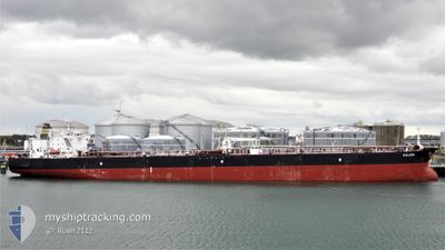
CALIDA
Crude Oil Tanker
Current Trip
| Time Travelled | 31 days |
|---|---|
| Remaining Time | --- |
| Distance Travelled | 7169.70 nm |
| Remaining Distance | --- |
| AVG Speed | 11.2 Knots |
| MAX Speed | 16.3 Knots |
| AVG Wind | 11.5 knots |
| MAX Wind | 22.8 knots |
| MIN Temp | 3.5°C / 38.3°F |
| MAX Temp | 30.9°C / 87.62°F |
| Draught | 8 m |
| Position Received | 1 m ago |
Current Position
| Longitude | 23.51414° |
|---|---|
| Latitude | 37.83867° |
| Status | At anchor |
| Speed | 0.1 Knots |
| Course | 120° |
| Area | Aegean Sea |
| Station | T-AIS |
| Position Received | 1 m ago |
Info
Information
The current position of CALIDA is in Aegean Sea with coordinates 37.83867° / 23.51414° as reported on 2024-06-03 16:04 by AIS to our vessel tracker app. The vessel's current speed is 0.1 Knots
The vessel CALIDA (IMO: 9522128, MMSI: 256380000) is a Crude Oil Tanker that was built in 2012 ( 12 years old ). It's sailing under the flag of [MT] Malta.
In this page you can find informations about the vessels current position, last detected port calls, and current voyage information. If the vessels is not in coverage by AIS you will find the latest position.
The current position of CALIDA is detected by our AIS receivers and we are not responsible for the reliability of the data. The last position was recorded while the vessel was in Coverage by the Ais receivers of our vessel tracking app.
The current draught of CALIDA as reported by AIS is 8 meters
Weather
| Temperature | 24.1°C / 75.38°F |
|---|---|
| Wind Speed | 10 knots |
| Direction | 130° SE |
| Pressure | 1012.2 hPa |
| Humidity | 68.7 % |
| Cloud Coverage | 100 % |
Featured Company
Events
| Time | Event | Details | Position / Dest | Info |
|---|---|---|---|---|
| 2024-06-03 11:55 | ETA Changed | 2024/06/03 06:00 2025/01/01 06:00 |
37.83612 / 23.51469
GRPIR
|
Speed: 0.1 kn Course: 51° |
| 2024-06-03 11:49 | ETA Changed | 2025/01/01 06:00 2024/06/03 06:00 |
37.83604 / 23.51479
GRPIR
|
Speed: Course: 50° |
| 2024-06-03 06:01 | ETA Changed | 2024/06/03 06:00 2025/01/01 06:00 |
37.83787 / 23.51878
GRPIR
|
Speed: 0.1 kn Course: 251° |
| 2024-06-03 05:55 | ETA Changed | 2025/01/01 06:00 2024/06/03 06:00 |
37.83790 / 23.51901
GRPIR
|
Speed: 0.1 kn Course: 254° |
| 2024-06-03 05:40 | Status Changed | At anchor Under way using engine |
37.83782 / 23.51904
GRPIR
|
Speed: 0.1 kn Course: 253° |
| 2024-06-03 05:37 | STOP Moving | 3.57 nm, South East of MAROUDI |
37.83779 / 23.51888
GRPIR
|
Speed: 0.2 kn Course: 249° |
| 2024-06-02 18:25 | Change Sea Area | Greek part of the Aegean Sea Greek part of the Mediterranean Sea - Eastern Basin |
36.38562 / 23.11002
Aegean Sea
GRPIR
|
Speed: 10.1 kn Course: 94.8° |
| 2024-06-02 18:25 | Status Changed | Under way using engine Default |
36.38562 / 23.11002
GRPIR
|
Speed: 10.2 kn Course: 102° |
| 2024-06-02 18:25 | IN Coverage |
36.38562 / 23.11002
Aegean Sea
GRPIR
|
Speed: 10.1 kn Course: 94.8° |
|
| 2024-06-02 11:12 | OUT of Coverage |
36.32279 / 21.58948
Mediterranean Sea - Eastern Basin
GRPIR
|
Speed: 10.5 kn Course: 95° |