
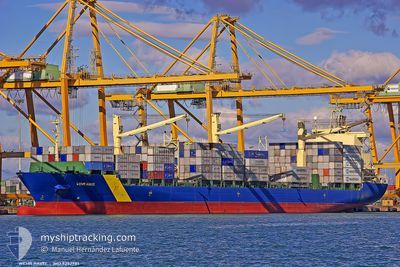
CALLIOPE
Container Ship
Aktuelle Reise
| Trip Time | 3 Tage |
|---|---|
| Trip Distanz | 820.14 nm |
| Durchschnittliche Geschwindigkeit | 14 Knoten |
| Maximale Geschwindigkeit | 16.8 Knoten |
| Tiefgang | 10.9 m |
| Durchschnittliche Windgeschwindigkeit | 9.3 Knoten |
| Maximale Windgeschwindigkeit | 21.8 Knoten |
| Minimale Temperatur | 22°C / 71.6°F |
| Maximale Temperatur | 29.4°C / 84.92°F |
| Position erhalten | 3 d alt |
Aktuelle Position
| Länge | --- |
|---|---|
| Breite | --- |
| Zustand | Under way using engine |
| Geschwindigkeit | 16.3 Knoten |
| Kurs | 287.8° |
| Gebiet | Caribbean Sea |
| Station | T-AIS |
| Position erhalten | 3 d alt |
Schiffsdetails
Information
Die CALLIOPE befindet sich derzeit in Caribbean Sea mit den Koordinaten 12.46493° / -70.49071°, Diese Position wurde am 2024-11-09 05:20 von unserer Schiffsverfolgungs-App über AIS erfasst. Das Schiff fährt momentan mit einer Geschwindigkeit von 16.3 Knoten und liegt im Hafen von COLON .
Das Schiff CALLIOPE (IMO: 9252981, MMSI: 636018257) ist Container Ship das wurde im Jahr 2002 ( 22 Jahre alt ) gebaut. und fährt unter der Flagge von [LR] Liberia.
Auf dieser Seite erhalten Sie Informationen zur aktuellen Position des Schiffes, zu den letzten bekannten Hafenanläufen und zu den aktuellen Reiseinformationen. Sollte das Schiff nicht durch AIS abgedeckt sein, wird die zuletzt erfasste Position angezeigt.
Die CALLIOPE wird durch unsere AIS-Empfänger ermittelt. Wir übernehmen keine Gewähr für die Richtigkeit der Daten. Die letzte Position wurde von unseren AIS-Empfängern aufgezeichnet, während das Schiff in Reichweite war.
Der aktuelle Entwurf von CALLIOPE, wie von AIS gemeldet, betragt 10.9 meter
Wetter
| Temperatur | 27.9°C / 82.22°F |
|---|---|
| Windgeschwindigkeit | 4 Knoten |
| Windrichtung | 195° SSW |
| Luftdruck | 1008.3 hPa |
| Luftfeuchtigkeit | 83.2 % |
| Wolken | 100 % |
Featured Company
Letzte Hafenanläufe
| Hafen | Ankunft | Abfahrt | Time In Port |
|---|---|---|---|
| 2024-11-12 11:12 | |||
| 2024-11-06 13:47 | 2024-11-08 16:27 | 2 d | |
| 2024-11-03 04:33 | 2024-11-05 21:59 | 2 d | |
| 2024-10-31 13:24 | 2024-11-02 16:41 | 2 d | |
| 2024-10-28 13:53 | 2024-10-29 08:51 | 18 h | |
| 2024-10-23 05:32 | 2024-10-24 01:13 | 19 h | |
| 2024-10-12 22:50 | 2024-10-15 04:18 | 2 d | |
| 2024-10-10 19:48 | 2024-10-12 16:27 | 1 d | |
| 2024-10-07 23:10 | 2024-10-08 22:06 | 22 h | |
| 2024-10-06 00:57 | 2024-10-07 22:35 | 1 d |
Meistbesuchte Häfen (Letztes Jahr)
| Hafen | Ankünfte | |
|---|---|---|
| 27 | ||
| 25 | ||
| 23 | ||
| 21 | ||
| 10 | ||
| 4 |
Letzte Reisen
| Herkunft | Abfahrt | Ziel | Ankunft | Distanz | |
|---|---|---|---|---|---|
| 2024-11-08 12:27 | 2024-11-12 06:12 | 820.14 nm | |||
| 2024-11-05 17:59 | 2024-11-06 09:47 | 214.95 nm | |||
| 2024-11-02 12:41 | 2024-11-03 00:33 | 149.19 nm | |||
| 2024-10-29 03:51 | 2024-10-31 09:24 | 611.32 nm | |||
| 2024-10-23 20:13 | 2024-10-28 08:53 | 468.53 nm | |||
| 2024-10-15 00:18 | 2024-10-23 00:32 | 819.12 nm | |||
| 2024-10-12 12:27 | 2024-10-12 18:50 | 66.60 nm | |||
| 2024-10-08 17:06 | 2024-10-10 15:48 | 612.83 nm | |||
| 2024-10-07 17:35 | 2024-10-07 18:10 | 1.90 nm | |||
| 2024-10-02 00:23 | 2024-10-05 19:57 | 393.01 nm |
Events
| Zeit | Ereignis | Details | Position / Ziel | Information |
|---|---|---|---|---|
| 2024-11-12 11:12 | STOP Bewegung |
9.36960 / -79.88549
[PA] COLON
|
Geschwindigkeit: Kurs: 246° |
|
| 2024-11-12 11:12 | ZIELHAFEN |
|
9.36960 / -79.88549
[PA] COLON
|
Geschwindigkeit: 2.3 kn Kurs: 249° |
| 2024-11-12 08:34 | START Bewegung | 5.92 nm, North of LAS MINAS |
9.49023 / -79.81407
VELAG
|
Geschwindigkeit: 5.7 kn Kurs: 232° |
| 2024-11-10 22:26 | STOP Bewegung | 6.25 nm, North of LAS MINAS |
9.49563 / -79.81258
VELAG
|
Geschwindigkeit: 0.1 kn Kurs: 211° |
| 2024-11-09 05:26 | geänderter Status | Default Under way using engine |
12.47334 / -70.51707
VELAG
|
Geschwindigkeit: 16.3 kn Kurs: 287.8° |
| 2024-11-09 05:20 | außerhalb Abdeckung |
12.46493 / -70.49071
Caribbean Sea
|
Geschwindigkeit: 16.3 kn Kurs: 287.8° |
|
| 2024-11-09 05:13 | Ändere Seegebiet | Venezuelan part of the Caribbean Sea Aruban part of the Caribbean Sea |
12.45567 / -70.46023
Caribbean Sea
|
Geschwindigkeit: 16.3 kn Kurs: 286.1° |
| 2024-11-09 05:13 | geänderter Status | Under way using engine Default |
12.45567 / -70.46023
VELAG
|
Geschwindigkeit: 16.3 kn Kurs: 286° |
| 2024-11-09 04:54 | geänderter Status | Default Under way using engine |
12.43107 / -70.37640
VELAG
|
Geschwindigkeit: 16.2 kn Kurs: 286.4° |
| 2024-11-09 04:04 | Ändere Seegebiet | Aruban part of the Caribbean Sea Venezuelan part of the Caribbean Sea |
12.35540 / -70.16454
Caribbean Sea
|
Geschwindigkeit: 15.6 kn Kurs: 294.2° |