
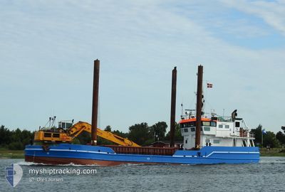
CAMILLA HOEJ
Dredger
Current Trip
| Trip Time | 21 h, 5 mins |
|---|---|
| Trip Distance | 115.29 nm |
| AVG Speed | 6.6 Knots |
| MAX Speed | 8.7 Knots |
| Draught | 3 m |
| AVG Wind | 10 knots |
| MAX Wind | 14 knots |
| MIN Temp | 13°C / 55.4°F |
| MAX Temp | 19.8°C / 67.64°F |
| Position Received | 1 m ago |
Current Position
| Longitude | 9.85946° |
|---|---|
| Latitude | 55.85758° |
| Status | Under way using engine |
| Speed | |
| Course | 156° |
| Area | Kattegat |
| Station | T-AIS |
| Position Received | 1 m ago |
Info
Information
The current position of CAMILLA HOEJ is in Kattegat with coordinates 55.85758° / 9.85946° as reported on 2024-06-03 18:52 by AIS to our vessel tracker app. The vessel's current speed is 0 Knots and is currently inside the port of HORSENS.
The vessel CAMILLA HOEJ (IMO: 7236311, MMSI: 219777000) is a Dredger that was built in 1972 ( 52 years old ). It's sailing under the flag of [DK] Denmark.
In this page you can find informations about the vessels current position, last detected port calls, and current voyage information. If the vessels is not in coverage by AIS you will find the latest position.
The current position of CAMILLA HOEJ is detected by our AIS receivers and we are not responsible for the reliability of the data. The last position was recorded while the vessel was in Coverage by the Ais receivers of our vessel tracking app.
The current draught of CAMILLA HOEJ as reported by AIS is 3 meters
Weather
| Temperature | 13.5°C / 56.3°F |
|---|---|
| Wind Speed | 12 knots |
| Direction | 297° WNW |
| Pressure | 1014.2 hPa |
| Humidity | 75.3 % |
| Cloud Coverage | 100 % |
Featured Company
Last Port Calls
| Port | Arrival | Departure | Time In Port |
|---|---|---|---|
| 2024-06-02 01:49 | |||
| 2024-06-01 03:59 | 2024-06-01 04:44 | 45 m | |
| 2024-05-31 15:36 | 2024-05-31 16:17 | 40 m | |
| 2024-05-31 11:38 | 2024-05-31 12:26 | 48 m | |
| 2024-05-31 04:02 | 2024-05-31 04:36 | 34 m | |
| 2024-05-30 17:01 | 2024-05-30 17:38 | 36 m | |
| 2024-05-29 19:47 | 2024-05-30 04:01 | 8 h | |
| 2024-05-28 06:36 | 2024-05-28 13:09 | 6 h | |
| 2024-05-20 14:15 | 2024-05-23 04:28 | 2 d | |
| 2024-05-13 02:34 | 2024-05-18 04:12 | 5 d |
Most Visited Ports (Last year)
| Port | Arrivals | |
|---|---|---|
| 305 | ||
| 105 | ||
| 62 | ||
| 23 | ||
| 10 | ||
| 6 |
Last Trips
| Origin | Departure | Destination | Arrival | Distance | |
|---|---|---|---|---|---|
| 2024-06-01 06:44 | 2024-06-02 03:49 | 115.29 nm | |||
| 2024-05-31 18:17 | 2024-06-01 05:59 | 10.05 nm | |||
| 2024-05-31 14:26 | 2024-05-31 17:36 | 9.97 nm | |||
| 2024-05-31 06:36 | 2024-05-31 13:38 | 10.04 nm | |||
| 2024-05-30 19:38 | 2024-05-31 06:02 | 10.01 nm | |||
| 2024-05-30 06:01 | 2024-05-30 19:01 | 29.95 nm | |||
| 2024-05-28 15:09 | 2024-05-29 21:47 | 55.45 nm | |||
| 2024-05-23 06:28 | 2024-05-28 08:36 | 230.49 nm | |||
| 2024-05-18 06:12 | 2024-05-20 16:15 | 159.59 nm | |||
| 2024-05-08 16:33 | 2024-05-13 04:34 | 278.33 nm |
Events
| Time | Event | Details | Position / Dest | Info |
|---|---|---|---|---|
| 2024-06-02 02:00 | STOP Moving |
55.85733 / 9.85973
[DK] HORSENS
|
Speed: 0.3 kn Course: 156° |
|
| 2024-06-02 01:49 | PORT ARRIVAL |
|
55.85499 / 9.88213
[DK] HORSENS
|
Speed: 7.3 kn Course: 282.6° |
| 2024-06-01 16:38 | START Moving | 5.12 nm, West of BOEJDEN |
55.10106 / 9.93289
HORSENS
|
Speed: 6.9 kn Course: 164.2° |
| 2024-06-01 16:18 | STOP Moving | 5.16 nm, West of BOEJDEN |
55.10285 / 9.93142
HORSENS
|
Speed: 0.2 kn Course: 163° |
| 2024-06-01 16:15 | START Moving | 5.1 nm, West of BOEJDEN |
55.10025 / 9.93358
HORSENS
|
Speed: 7.7 kn Course: 354.5° |
| 2024-06-01 15:23 | STOP Moving | 5.08 nm, West of BOEJDEN |
55.09828 / 9.93442
HORSENS
|
Speed: 0.2 kn Course: 253° |
| 2024-06-01 13:05 | Change Sea Area | Danish part of the Kattegat Danish part of the Baltic Sea |
54.80226 / 10.14938
Kattegat
HORSENS
|
Speed: 8.6 kn Course: 346.3° |
| 2024-06-01 12:35 | Change Sea Area | Danish part of the Baltic Sea German part of the Baltic Sea |
54.78070 / 10.16490
Baltic Sea
HORSENS
|
Speed: 8.5 kn Course: 341.5° |
| 2024-06-01 09:54 | START Moving | 3.8 nm, East of WENDTORF |
54.43106 / 10.38443
HORSENS
|
Speed: 6.1 kn Course: 342.7° |
| 2024-06-01 08:47 | Destination Changed | HORSENS WENDTORF |
54.42941 / 10.38659
HORSENS
|
Speed: Course: 276° |