
CANKA
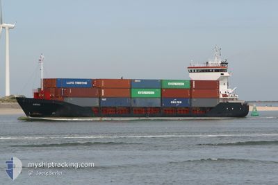
General Cargo
Current Trip
| Trip Time | 4 days |
|---|---|
| Trip Distance | 1190.56 nm |
| AVG Speed | 11.8 Knots |
| MAX Speed | 14.1 Knots |
| Draught | 3.6 m |
| AVG Wind | 9.6 knots |
| MAX Wind | 23.8 knots |
| MIN Temp | 10.8°C / 51.44°F |
| MAX Temp | 21.1°C / 69.98°F |
| Position Received | 2 d ago |
Current Position
| Longitude | 29.64942° |
|---|---|
| Latitude | 41.26093° |
| Status | Under way using engine |
| Speed | 12.4 Knots |
| Course | 92.4° |
| Area | Black Sea |
| Station | T-AIS |
| Position Received | 2 d ago |
Info
Information
The current position of CANKA is in Black Sea with coordinates 41.26093° / 29.64942° as reported on 2024-05-17 08:34 by AIS to our vessel tracker app. The vessel's current speed is 12.4 Knots and is currently inside the port of KARASU.
The vessel CANKA (IMO: 9103740, MMSI: 354562000) is a General Cargo that was built in 1995 ( 29 years old ). It's sailing under the flag of [PA] Panama.
In this page you can find informations about the vessels current position, last detected port calls, and current voyage information. If the vessels is not in coverage by AIS you will find the latest position.
The current position of CANKA is detected by our AIS receivers and we are not responsible for the reliability of the data. The last position was recorded while the vessel was in Coverage by the Ais receivers of our vessel tracking app.
The current draught of CANKA as reported by AIS is 3.6 meters
Weather
| Temperature | 15.4°C / 59.72°F |
|---|---|
| Wind Speed | 3 knots |
| Direction | 268° W |
| Pressure | 1013.5 hPa |
| Humidity | 72.9 % |
| Cloud Coverage | 62 % |
Featured Company
Last Port Calls
| Port | Arrival | Departure | Time In Port |
|---|---|---|---|
| 2024-05-18 05:08 | |||
| 2024-05-10 20:47 | 2024-05-13 10:18 | 2 d | |
| 2024-05-04 02:18 | 2024-05-05 19:14 | 1 d | |
| 2024-04-22 10:34 | 2024-04-25 09:15 | 2 d | |
| 2024-04-17 16:08 | 2024-04-18 18:19 | 1 d | |
| 2024-04-07 13:28 | 2024-04-10 16:37 | 3 d | |
| 2024-04-04 21:06 | 2024-04-05 15:19 | 18 h | |
| 2024-03-29 05:18 | 2024-03-30 03:23 | 22 h | |
| 2024-03-27 14:50 | 2024-03-28 10:02 | 19 h | |
| 2024-03-18 15:00 | 2024-03-20 01:29 | 1 d |
Last Trips
| Origin | Departure | Destination | Arrival | Distance | |
|---|---|---|---|---|---|
| 2024-05-13 12:18 | 2024-05-18 08:08 | 1190.56 nm | |||
| 2024-05-05 22:14 | 2024-05-10 22:47 | 1179.56 nm | |||
| 2024-04-25 12:15 | 2024-05-04 05:18 | 458.72 nm | |||
| 2024-04-18 20:19 | 2024-04-22 13:34 | 1100.07 nm | |||
| 2024-04-10 18:37 | 2024-04-17 18:08 | 414.78 nm | |||
| 2024-04-05 16:19 | 2024-04-07 15:28 | 563.74 nm | |||
| 2024-03-30 06:23 | 2024-04-04 22:06 | 1590.97 nm | |||
| 2024-03-28 13:02 | 2024-03-29 08:18 | 63.46 nm | |||
| 2024-03-20 02:29 | 2024-03-27 17:50 | 1645.86 nm | |||
| 2024-03-18 15:20 | 2024-03-18 16:00 | 0.86 nm |
Events
| Time | Event | Details | Position / Dest | Info |
|---|---|---|---|---|
| 2024-05-18 05:23 | STOP Moving |
41.12049 / 30.67307
[TR] KARASU
|
Speed: 0.1 kn Course: 120° |
|
| 2024-05-18 05:08 | PORT ARRIVAL |
|
41.12317 / 30.67842
[TR] KARASU
|
Speed: 5 kn Course: 274° |
| 2024-05-18 04:46 | START Moving | 1.63 nm, East of KARASU |
41.12583 / 30.71539
TR KSP
|
Speed: 3.8 kn Course: 210° |
| 2024-05-17 13:04 | STOP Moving | 1.52 nm, East of KARASU |
41.12661 / 30.71275
TR KSP
|
Speed: 0.3 kn Course: 72° |
| 2024-05-17 08:34 | Status Changed | Default Under way using engine |
41.26078 / 29.65248
TR KSP
|
Speed: 12.4 kn Course: 92.4° |
| 2024-05-17 08:34 | OUT of Coverage |
41.26093 / 29.64942
Black Sea
TR KSP
|
Speed: 12.4 kn Course: 92.4° |
|
| 2024-05-17 06:43 | Change Sea Area | Turkish part of the Black Sea Turkish part of the Sea of Marmara |
41.23294 / 29.15409
Black Sea
TR KSP
|
Speed: 11.8 kn Course: 47.9° |
| 2024-05-17 04:26 | ETA Changed | 2024/05/17 13:00 2024/05/17 09:00 |
40.88693 / 28.93312
TR KSP
|
Speed: 12.5 kn Course: 46.5° |
| 2024-05-16 21:24 | Status Changed | Under way using engine Default |
40.52908 / 27.04169
TR KSP
|
Speed: 12.3 kn Course: 65° |
| 2024-05-16 21:18 | IN Coverage |
40.53126 / 27.04870
Sea of Marmara
TR KSP
|
Speed: 12.4 kn Course: 68° |