
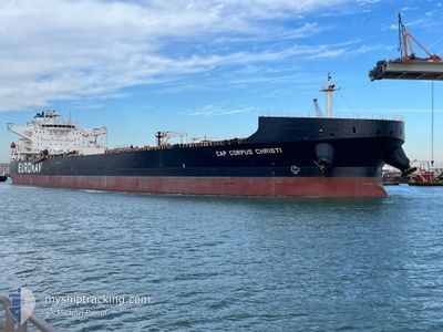
CAP CORPUS CHRISTI
Tanker
Current Trip
| Time Travelled | 29 days |
|---|---|
| Remaining Time | --- |
| Distance Travelled | 6770.73 nm |
| Remaining Distance | 265.38 nm |
| AVG Speed | 10.2 Knots |
| MAX Speed | 17.9 Knots |
| AVG Wind | 11.8 knots |
| MAX Wind | 31 knots |
| MIN Temp | 1.9°C / 35.42°F |
| MAX Temp | 29.3°C / 84.74°F |
| Draught | 10.2 m |
| Position Received | 3 d ago |
Current Position
| Longitude | -79.82084° |
|---|---|
| Latitude | 24.52631° |
| Status | Under way using engine |
| Speed | 9.5 Knots |
| Course | 237.6° |
| Area | North Atlantic Ocean |
| Station | T-AIS |
| Position Received | 3 d ago |
Info
Information
The current position of CAP CORPUS CHRISTI is in North Atlantic Ocean with coordinates 24.52631° / -79.82084° as reported on 2024-05-29 14:43 by AIS to our vessel tracker app. The vessel's current speed is 9.5 Knots and is heading at the port of CORPUS CHRISTI. The estimated time of arrival as calculated by vessel tracking app is 2024-06-07 05:01 LT
The vessel CAP CORPUS CHRISTI (IMO: 9829813, MMSI: 241612000) is a Tanker It's sailing under the flag of [GR] Greece.
In this page you can find informations about the vessels current position, last detected port calls, and current voyage information. If the vessels is not in coverage by AIS you will find the latest position.
The current position of CAP CORPUS CHRISTI is detected by our AIS receivers and we are not responsible for the reliability of the data. The last position was recorded while the vessel was in Coverage by the Ais receivers of our vessel tracking app.
The current draught of CAP CORPUS CHRISTI as reported by AIS is 10.2 meters
Weather
| Temperature | 28.2°C / 82.76°F |
|---|---|
| Wind Speed | 14 knots |
| Direction | 148° SSE |
| Pressure | 1013.6 hPa |
| Humidity | 86.4 % |
| Cloud Coverage | 4 % |
Featured Company
Last Port Calls
| Port | Arrival | Departure | Time In Port |
|---|---|---|---|
| 2024-05-01 11:46 | 2024-05-03 12:26 | 2 d | |
| 2024-04-24 19:40 | 2024-04-28 21:44 | 4 d |
Most Visited Ports (Last year)
| Port | Arrivals | |
|---|---|---|
| 6 | ||
| 2 | ||
| 1 | ||
| 1 | ||
| 1 | ||
| 1 |
Last Trips
| Origin | Departure | Destination | Arrival | Distance | |
|---|---|---|---|---|---|
| 2024-04-28 16:44 | 2024-05-01 06:46 | 263.27 nm | |||
| 2024-03-26 20:56 | 2024-04-24 14:40 | 2990.62 nm |
Events
| Time | Event | Details | Position / Dest | Info |
|---|---|---|---|---|
| 2024-05-29 14:47 | Status Changed | Default Under way using engine |
24.52025 / -79.83164
USCRP
|
Speed: 9.5 kn Course: 237.6° |
| 2024-05-29 14:43 | OUT of Coverage |
24.52631 / -79.82084
North Atlantic Ocean
USCRP
|
Speed: 9.5 kn Course: 237.6° |
|
| 2024-05-29 14:42 | Status Changed | Under way using engine Default |
24.52775 / -79.81839
USCRP
|
Speed: 9 kn Course: 236° |
| 2024-05-29 14:27 | Status Changed | Default Under way using engine |
24.54833 / -79.78167
USCRP
|
Speed: 11.3 kn Course: 238.8° |
| 2024-05-29 14:02 | Status Changed | Under way using engine Default |
24.58932 / -79.70997
USCRP
|
Speed: 12 kn Course: 237° |
| 2024-05-29 13:57 | Status Changed | Default Under way using engine |
24.59833 / -79.69167
USCRP
|
Speed: 12.8 kn Course: 240.8° |
| 2024-05-29 13:53 | Status Changed | Under way using engine Default |
24.60617 / -79.68072
USCRP
|
Speed: 12 kn Course: 205° |
| 2024-05-29 13:48 | IN Coverage |
24.60588 / -79.68129
North Atlantic Ocean
USCRP
|
Speed: 12.8 kn Course: 240.8° |
|
| 2024-05-29 10:03 | Status Changed | Default Under way using engine |
25.18667 / -79.57667
USCRP
|
Speed: 8.2 kn Course: 188.9° |
| 2024-05-29 09:55 | OUT of Coverage |
25.20542 / -79.57505
North Atlantic Ocean
USCRP
|
Speed: 8.2 kn Course: 188.9° |