
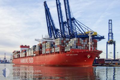
CAP SAN JUAN
Cargo
Current Trip
| Time Travelled | 8 days |
|---|---|
| Remaining Time | --- |
| Distance Travelled | 3319.48 nm |
| Remaining Distance | --- |
| AVG Speed | 17.4 Knots |
| MAX Speed | 20 Knots |
| AVG Wind | 13.6 knots |
| MAX Wind | 25 knots |
| MIN Temp | 13.1°C / 55.58°F |
| MAX Temp | 29.1°C / 84.38°F |
| Draught | 12.8 m |
| Position Received | 3 d ago |
Current Position
| Longitude | -17.25063° |
|---|---|
| Latitude | 10.52173° |
| Status | Under way using engine |
| Speed | 18.2 Knots |
| Course | 143.5° |
| Area | North Atlantic Ocean |
| Station | T-AIS |
| Position Received | 3 d ago |
Info
Information
The current position of CAP SAN JUAN is in North Atlantic Ocean with coordinates 10.52173° / -17.25063° as reported on 2024-05-01 21:34 by AIS to our vessel tracker app. The vessel's current speed is 18.2 Knots and is heading at the port of SALALAH. The estimated time of arrival as calculated by vessel tracking app is 2024-05-19 14:30 LT
The vessel CAP SAN JUAN (IMO: 9717204, MMSI: 538008132) is a Cargo It's sailing under the flag of [MH] Marshall Is.
In this page you can find informations about the vessels current position, last detected port calls, and current voyage information. If the vessels is not in coverage by AIS you will find the latest position.
The current position of CAP SAN JUAN is detected by our AIS receivers and we are not responsible for the reliability of the data. The last position was recorded while the vessel was in Coverage by the Ais receivers of our vessel tracking app.
The current draught of CAP SAN JUAN as reported by AIS is 12.8 meters
Weather
| Temperature | 25.3°C / 77.54°F |
|---|---|
| Wind Speed | 14 knots |
| Direction | 133° SE |
| Pressure | 1012.5 hPa |
| Humidity | 73.9 % |
| Cloud Coverage | 6 % |
Featured Company
Last Port Calls
Most Visited Ports (Last year)
| Port | Arrivals | |
|---|---|---|
| 11 | ||
| 11 | ||
| 9 | ||
| 8 | ||
| 6 | ||
| 6 |
Last Trips
| Origin | Departure | Destination | Arrival | Distance | |
|---|---|---|---|---|---|
| 2024-03-30 17:07 | 2024-04-26 13:32 | 9907.02 nm | |||
| 2024-03-27 11:34 | 2024-03-29 13:39 | 428.91 nm | |||
| 2024-03-23 17:48 | 2024-03-26 05:45 | 981.86 nm | |||
| 2024-03-19 09:49 | 2024-03-21 23:33 | 992.59 nm | |||
| 2024-02-25 08:54 | 2024-03-18 19:23 | 9320.74 nm |
Events
| Time | Event | Details | Position / Dest | Info |
|---|---|---|---|---|
| 2024-05-05 10:56 | START Moving |
-10.02726 / -3.00205
OM SLL
|
Speed: 3.1 kn Course: 171° |
|
| 2024-05-05 10:25 | STOP Moving |
-10.02833 / -2.99333
OM SLL
|
Speed: Course: -1° |
|
| 2024-05-04 04:19 | START Moving |
-3.08853 / -7.84100
OM SLL
|
Speed: 3.9 kn Course: 143° |
|
| 2024-05-04 04:08 | STOP Moving |
-3.08500 / -7.84167
OM SLL
|
Speed: Course: -1° |
|
| 2024-05-01 21:51 | Status Changed | Default Under way using engine |
10.42342 / -17.18373
OM SLL
|
Speed: 18.2 kn Course: 143.5° |
| 2024-05-01 21:34 | OUT of Coverage |
10.52173 / -17.25063
North Atlantic Ocean
OM SLL
|
Speed: 18.2 kn Course: 143.5° |
|
| 2024-05-01 21:03 | Status Changed | Under way using engine Default |
10.65037 / -17.34242
OM SLL
|
Speed: 18.1 kn Course: 147° |
| 2024-05-01 21:03 | IN Coverage |
10.65037 / -17.34242
North Atlantic Ocean
OM SLL
|
Speed: 18.2 kn Course: 147° |
|
| 2024-05-01 18:26 | Status Changed | Default Under way using engine |
11.35895 / -17.54355
OM SLL
|
Speed: 18 kn Course: 172.3° |
| 2024-05-01 18:03 | OUT of Coverage |
11.51227 / -17.56260
North Atlantic Ocean
OM SLL
|
Speed: 18 kn Course: 172.3° |