
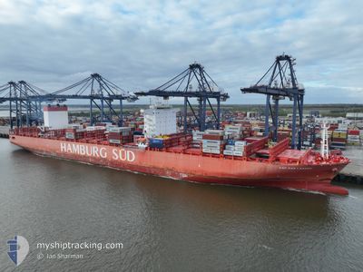
CAP SAN LAZARO
Cargo
Current Trip
| Time Travelled | 13 days |
|---|---|
| Remaining Time | 8 days |
| Distance Travelled | 5559.82 nm |
| Remaining Distance | 3583.58 nm |
| AVG Speed | 16.5 Knots |
| MAX Speed | 19 Knots |
| AVG Wind | 13 knots |
| MAX Wind | 26 knots |
| MIN Temp | 11.4°C / 52.52°F |
| MAX Temp | 29.3°C / 84.74°F |
| Draught | 14.5 m |
| Position Received | 20 h, 33 m ago |
Current Position
| Longitude | 19.19600° |
|---|---|
| Latitude | -34.91742° |
| Status | Under way using engine |
| Speed | 17.4 Knots |
| Course | 98.3° |
| Area | South Atlantic Ocean |
| Station | T-AIS |
| Position Received | 20 h, 33 m ago |
Info
Information
The current position of CAP SAN LAZARO is in South Atlantic Ocean with coordinates -34.91742° / 19.19600° as reported on 2024-05-16 05:53 by AIS to our vessel tracker app. The vessel's current speed is 17.4 Knots and is heading at the port of SALALAH. The estimated time of arrival as calculated by vessel tracking app is 2024-05-25 05:30 LT
The vessel CAP SAN LAZARO (IMO: 9717216, MMSI: 538008134) is a Cargo It's sailing under the flag of [MH] Marshall Is.
In this page you can find informations about the vessels current position, last detected port calls, and current voyage information. If the vessels is not in coverage by AIS you will find the latest position.
The current position of CAP SAN LAZARO is detected by our AIS receivers and we are not responsible for the reliability of the data. The last position was recorded while the vessel was in Coverage by the Ais receivers of our vessel tracking app.
The current draught of CAP SAN LAZARO as reported by AIS is 14.5 meters
Weather
| Temperature | 19.6°C / 67.28°F |
|---|---|
| Wind Speed | 26 knots |
| Direction | 254° WSW |
| Pressure | 1018.4 hPa |
| Humidity | 77.7 % |
| Cloud Coverage | 100 % |
Featured Company
Last Port Calls
| Port | Arrival | Departure | Time In Port |
|---|---|---|---|
| 2024-05-02 12:56 | 2024-05-03 03:18 | 14 h | |
| 2024-04-26 10:22 | 2024-04-27 09:11 | 22 h | |
| 2024-04-24 12:12 | 2024-04-25 11:42 | 23 h | |
| 2024-04-22 04:46 | 2024-04-23 17:45 | 1 d | |
| 2024-04-18 04:45 | 2024-04-18 23:10 | 18 h | |
| 2024-04-10 05:22 | 2024-04-12 20:03 | 2 d | |
| 2024-03-08 06:40 | |||
| 2024-03-01 03:13 | 2024-03-02 09:35 | 1 d |
Most Visited Ports (Last year)
| Port | Arrivals | |
|---|---|---|
| 12 | ||
| 10 | ||
| 9 | ||
| 8 | ||
| 6 | ||
| 6 |
Last Trips
| Origin | Departure | Destination | Arrival | Distance | |
|---|---|---|---|---|---|
| 2024-04-27 11:11 | 2024-05-02 13:56 | 1724.93 nm | |||
| 2024-04-25 12:42 | 2024-04-26 12:22 | 322.27 nm | |||
| 2024-04-23 19:45 | 2024-04-24 13:12 | 130.05 nm | |||
| 2024-04-19 01:10 | 2024-04-22 06:46 | 1411.64 nm | |||
| 2024-04-12 22:03 | 2024-04-18 06:45 | 1534.66 nm | |||
| 2024-03-08 12:10 | 2024-04-10 07:22 | 10894.38 nm | |||
| 2024-02-27 13:34 | 2024-03-01 07:13 | 1009.91 nm |
Events
| Time | Event | Details | Position / Dest | Info |
|---|---|---|---|---|
| 2024-05-16 05:58 | Status Changed | Default Under way using engine |
-34.92300 / 19.22643
SALALAH
|
Speed: 17.4 kn Course: 98.3° |
| 2024-05-16 05:53 | Status Changed | Under way using engine Default |
-34.91742 / 19.19600
SALALAH
|
Speed: 17.3 kn Course: 96° |
| 2024-05-16 05:53 | OUT of Coverage |
-34.91742 / 19.19600
South Atlantic Ocean
SALALAH
|
Speed: 17.4 kn Course: 98.3° |
|
| 2024-05-16 05:40 | Status Changed | Default Under way using engine |
-34.90902 / 19.12517
SALALAH
|
Speed: 17.2 kn Course: 97.8° |
| 2024-05-16 05:29 | Status Changed | Under way using engine Default |
-34.90217 / 19.06258
SALALAH
|
Speed: 17.4 kn Course: 96° |
| 2024-05-16 05:25 | Status Changed | Default Under way using engine |
-34.89848 / 19.03890
SALALAH
|
Speed: 17 kn Course: 103.5° |
| 2024-05-16 04:59 | Status Changed | Under way using engine Default |
-34.84895 / 18.89947
SALALAH
|
Speed: 17.3 kn Course: 122° |
| 2024-05-16 04:54 | Status Changed | Default Under way using engine |
-34.83433 / 18.87268
SALALAH
|
Speed: 17.5 kn Course: 132.1° |
| 2024-05-16 04:49 | Status Changed | Under way using engine Default |
-34.82252 / 18.85355
SALALAH
|
Speed: 17.4 kn Course: 121° |
| 2024-05-16 04:41 | Status Changed | Default Under way using engine |
-34.79833 / 18.81500
SALALAH
|
Speed: 17.2 kn Course: 123.1° |