
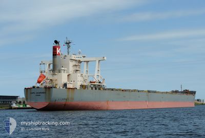
CAPE JACARANDA
Cargo
Current Trip
| Time Travelled | 15 days |
|---|---|
| Remaining Time | 2 days |
| Distance Travelled | 3197.49 nm |
| Remaining Distance | 563.58 nm |
| AVG Speed | 10.1 Knots |
| MAX Speed | 13.6 Knots |
| AVG Wind | 9 knots |
| MAX Wind | 20.6 knots |
| MIN Temp | 20.7°C / 69.26°F |
| MAX Temp | 31°C / 87.8°F |
| Draught | 8.6 m |
| Position Received | 16 h, 49 m ago |
Current Position
| Longitude | 115.62124° |
|---|---|
| Latitude | -8.94746° |
| Status | Under way using engine |
| Speed | 11.7 Knots |
| Course | 200.9° |
| Area | Indian Ocean |
| Station | T-AIS |
| Position Received | 16 h, 49 m ago |
Info
Information
The current position of CAPE JACARANDA is in Indian Ocean with coordinates -8.94746° / 115.62124° as reported on 2024-06-28 07:53 by AIS to our vessel tracker app. The vessel's current speed is 11.7 Knots and is heading at the port of PORT WALCOTT. The estimated time of arrival as calculated by vessel tracking app is 2024-07-01 04:10 LT
The vessel CAPE JACARANDA (IMO: 9446594, MMSI: 355471000) is a Cargo It's sailing under the flag of [PA] Panama.
In this page you can find informations about the vessels current position, last detected port calls, and current voyage information. If the vessels is not in coverage by AIS you will find the latest position.
The current position of CAPE JACARANDA is detected by our AIS receivers and we are not responsible for the reliability of the data. The last position was recorded while the vessel was in Coverage by the Ais receivers of our vessel tracking app.
The current draught of CAPE JACARANDA as reported by AIS is 8.6 meters
Weather
| Temperature | 26.1°C / 78.98°F |
|---|---|
| Wind Speed | 9 knots |
| Direction | 119° ESE |
| Pressure | 1013.5 hPa |
| Humidity | 83.1 % |
| Cloud Coverage | 20 % |
Featured Company
Events
| Time | Event | Details | Position / Dest | Info |
|---|---|---|---|---|
| 2024-06-28 07:56 | Status Changed | Default Under way using engine |
-8.95685 / 115.61835
PORT WALCOTT,AU.
|
Speed: 11.7 kn Course: 200.9° |
| 2024-06-28 07:53 | Change Sea Area | Indonesian part of the Indian Ocean Philippines part of the South China Sea |
-8.94746 / 115.62124
Indian Ocean
PORT WALCOTT,AU.
|
Speed: 11.7 kn Course: 200.9° |
| 2024-06-28 07:53 | Status Changed | Under way using engine Default |
-8.94746 / 115.62124
PORT WALCOTT,AU.
|
Speed: 10.9 kn Course: 203° |
| 2024-06-28 07:53 | OUT of Coverage |
-8.94746 / 115.62124
Indian Ocean
PORT WALCOTT,AU.
|
Speed: 11.7 kn Course: 200.9° |
|
| 2024-06-28 07:38 | IN Coverage |
-8.94746 / 115.62124
Indian Ocean
PORT WALCOTT,AU.
|
Speed: 11.7 kn Course: 200.9° |
|
| 2024-06-22 13:28 | Status Changed | Default Under way using engine |
14.58389 / 119.69710
PORT WALCOTT,AU.
|
Speed: 9.8 kn Course: 172° |
| 2024-06-22 13:06 | Detected in Sea | Philippines part of the South China Sea |
14.64121 / 119.68940
South China Sea
PORT WALCOTT,AU.
|
Speed: 9.8 kn Course: 172° |
| 2024-06-22 13:06 | Status Changed | Under way using engine Default |
14.64121 / 119.68940
PORT WALCOTT,AU.
|
Speed: 9.8 kn Course: 171° |
| 2024-06-22 13:06 | OUT of Coverage |
14.64121 / 119.68940
South China Sea
PORT WALCOTT,AU.
|
Speed: 9.8 kn Course: 172° |
|
| 2024-06-22 12:58 | IN Coverage |
14.64121 / 119.68940
South China Sea
PORT WALCOTT,AU.
|
Speed: 9.8 kn Course: 172° |