
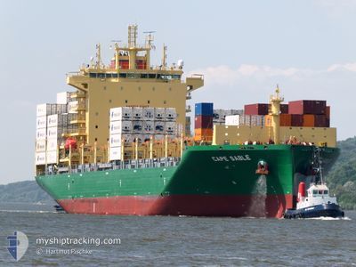
CAPE SABLE
Cargo
Current Trip
| Time Travelled | 1 day |
|---|---|
| Remaining Time | 18 h, 36 mins |
| Distance Travelled | 329.25 nm |
| Remaining Distance | 202.37 nm |
| AVG Speed | 11.1 Knots |
| MAX Speed | 13.2 Knots |
| AVG Wind | 12.4 knots |
| MAX Wind | 21 knots |
| MIN Temp | 27.4°C / 81.32°F |
| MAX Temp | 29°C / 84.2°F |
| Draught | 7.6 m |
| Position Received | 23 h, 32 m ago |
Current Position
| Longitude | -75.24005° |
|---|---|
| Latitude | 11.16447° |
| Status | Under way using engine |
| Speed | 12.7 Knots |
| Course | 261.7° |
| Area | Caribbean Sea |
| Station | T-AIS |
| Position Received | 23 h, 32 m ago |
Info
Information
The current position of CAPE SABLE is in Caribbean Sea with coordinates 11.16447° / -75.24005° as reported on 2024-06-15 06:33 by AIS to our vessel tracker app. The vessel's current speed is 12.7 Knots and is heading at the port of LIMON. The estimated time of arrival as calculated by vessel tracking app is 2024-06-17 00:42 LT
The vessel CAPE SABLE (IMO: 9950131, MMSI: 219032844) is a Cargo It's sailing under the flag of [DK] Denmark.
In this page you can find informations about the vessels current position, last detected port calls, and current voyage information. If the vessels is not in coverage by AIS you will find the latest position.
The current position of CAPE SABLE is detected by our AIS receivers and we are not responsible for the reliability of the data. The last position was recorded while the vessel was in Coverage by the Ais receivers of our vessel tracking app.
The current draught of CAPE SABLE as reported by AIS is 7.6 meters
Weather
| Temperature | 28°C / 82.4°F |
|---|---|
| Wind Speed | 13 knots |
| Direction | 194° SSW |
| Pressure | 1009.7 hPa |
| Humidity | 81.2 % |
| Cloud Coverage | 100 % |
Featured Company
Last Port Calls
| Port | Arrival | Departure | Time In Port |
|---|---|---|---|
| 2024-06-14 15:58 | 2024-06-15 01:43 | 9 h | |
| 2024-06-13 18:11 | 2024-06-14 03:01 | 8 h | |
| 2024-06-10 14:59 | 2024-06-11 19:43 | 1 d | |
| 2024-06-05 08:37 | 2024-06-06 05:20 | 20 h | |
| 2024-06-01 09:28 | 2024-06-01 22:10 | 12 h | |
| 2024-05-20 18:33 | 2024-05-21 14:39 | 20 h | |
| 2024-05-19 10:32 | 2024-05-20 03:07 | 16 h | |
| 2024-05-17 11:38 | 2024-05-18 05:37 | 17 h | |
| 2024-05-15 16:16 | 2024-05-16 05:24 | 13 h | |
| 2024-05-14 04:41 | 2024-05-15 01:45 | 21 h |
Most Visited Ports (Last year)
| Port | Arrivals | |
|---|---|---|
| 4 | ||
| 3 | ||
| 2 | ||
| 2 | ||
| 2 | ||
| 2 |
Last Trips
| Origin | Departure | Destination | Arrival | Distance | |
|---|---|---|---|---|---|
| 2024-06-13 22:01 | 2024-06-14 10:58 | 133.60 nm | |||
| 2024-06-11 14:43 | 2024-06-13 13:11 | 495.04 nm | |||
| 2024-06-06 01:20 | 2024-06-10 09:59 | 1321.39 nm | |||
| 2024-06-01 19:10 | 2024-06-05 04:37 | 819.09 nm | |||
| 2024-05-21 16:39 | 2024-06-01 06:28 | 3178.56 nm | |||
| 2024-05-20 05:07 | 2024-05-20 20:33 | 139.69 nm | |||
| 2024-05-18 07:37 | 2024-05-19 12:32 | 326.90 nm | |||
| 2024-05-16 06:24 | 2024-05-17 13:38 | 437.69 nm | |||
| 2024-05-15 03:45 | 2024-05-15 17:16 | 156.87 nm | |||
| 2024-05-03 06:44 | 2024-05-14 06:41 | 4053.12 nm |
Events
| Time | Event | Details | Position / Dest | Info |
|---|---|---|---|---|
| 2024-06-15 06:37 | Status Changed | Default Under way using engine |
11.16167 / -75.25500
CRLIO
|
Speed: 12.7 kn Course: 261.7° |
| 2024-06-15 06:33 | OUT of Coverage |
11.16447 / -75.24005
Caribbean Sea
CRLIO
|
Speed: 12.7 kn Course: 261.7° |
|
| 2024-06-15 04:33 | Status Changed | Under way using engine Default |
11.22738 / -74.81393
CRLIO
|
Speed: 12.4 kn Course: 268° |
| 2024-06-15 04:31 | Status Changed | Default Under way using engine |
11.22759 / -74.80514
CRLIO
|
Speed: 12.6 kn Course: 269.8° |
| 2024-06-15 03:11 | Destination Changed | CRLIO COSMR |
11.23487 / -74.52397
CRLIO
|
Speed: 12.4 kn Course: 267.8° |
| 2024-06-15 03:11 | ETA Changed | 2024/06/16 17:00 2024/06/14 15:00 |
11.23487 / -74.52397
CRLIO
|
Speed: 12.4 kn Course: 267.8° |
| 2024-06-15 02:57 | Status Changed | Under way using engine Default |
11.23635 / -74.47408
COSMR
|
Speed: 12 kn Course: 268° |
| 2024-06-15 02:57 | IN Coverage |
11.23635 / -74.47408
Caribbean Sea
|
Speed: 12.6 kn Course: 267.6° |
|
| 2024-06-15 01:43 | START Moving | 0.23 nm, North West of SANTA MARTA |
11.24667 / -74.22334
COSMR
|
Speed: 5 kn Course: -1° |
| 2024-06-15 01:43 | PORT DEPARTURE |
|
11.24667 / -74.22334
COSMR
|
Speed: 1.1 kn Course: 272° |