
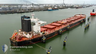
CAPE SANDRA
Bulk Carrier
Current Trip
| Time Travelled | 14 days |
|---|---|
| Remaining Time | --- |
| Distance Travelled | 2470.00 nm |
| Remaining Distance | --- |
| AVG Speed | 10.6 Knots |
| MAX Speed | 10.6 Knots |
| AVG Wind | 12.6 knots |
| MAX Wind | 26.8 knots |
| MIN Temp | 11°C / 51.8°F |
| MAX Temp | 23.1°C / 73.58°F |
| Draught | 9.2 m |
| Position Received | 17 h, 57 m ago |
Current Position
| Longitude | -8.78518° |
|---|---|
| Latitude | 33.85955° |
| Status | Under way using engine |
| Speed | 2 Knots |
| Course | 271° |
| Area | North Atlantic Ocean |
| Station | T-AIS |
| Position Received | 17 h, 57 m ago |
Info
Information
The current position of CAPE SANDRA is in North Atlantic Ocean with coordinates 33.85955° / -8.78518° as reported on 2024-05-23 03:21 by AIS to our vessel tracker app. The vessel's current speed is 2 Knots and is heading at the port of JARDIM CAMBURI. The estimated time of arrival as calculated by vessel tracking app is 2024-06-01 21:00 LT
The vessel CAPE SANDRA (IMO: 9446908, MMSI: 538004220) is a Bulk Carrier that was built in 2011 ( 13 years old ). It's sailing under the flag of [MH] Marshall Is.
In this page you can find informations about the vessels current position, last detected port calls, and current voyage information. If the vessels is not in coverage by AIS you will find the latest position.
The current position of CAPE SANDRA is detected by our AIS receivers and we are not responsible for the reliability of the data. The last position was recorded while the vessel was in Coverage by the Ais receivers of our vessel tracking app.
The current draught of CAPE SANDRA as reported by AIS is 9.2 meters
Weather
| Temperature | 18°C / 64.4°F |
|---|---|
| Wind Speed | 16 knots |
| Direction | 354° N |
| Pressure | 1015.9 hPa |
| Humidity | 70.8 % |
| Cloud Coverage | --- |
Featured Company
Last Port Calls
| Port | Arrival | Departure | Time In Port |
|---|---|---|---|
| 2024-05-05 16:45 | 2024-05-09 17:25 | 4 d | |
| 2024-04-05 06:10 | 2024-04-06 15:03 | 1 d | |
| 2024-03-03 18:53 | 2024-03-07 21:03 | 4 d |
Most Visited Ports (Last year)
| Port | Arrivals | |
|---|---|---|
| 2 | ||
| 2 | ||
| 1 | ||
| 1 | ||
| 1 | ||
| 1 |
Events
| Time | Event | Details | Position / Dest | Info |
|---|---|---|---|---|
| 2024-05-23 03:21 | Status Changed | Default Under way using engine |
33.85948 / -8.78527
TUBARAO
|
Speed: 2 kn Course: 271° |
| 2024-05-23 03:21 | OUT of Coverage |
33.85955 / -8.78518
North Atlantic Ocean
TUBARAO
|
Speed: 2 kn Course: 219° |
|
| 2024-05-23 03:11 | Status Changed | Under way using engine Default |
33.86445 / -8.78087
TUBARAO
|
Speed: 2.1 kn Course: 270° |
| 2024-05-23 03:01 | Status Changed | Default Under way using engine |
33.86892 / -8.77717
TUBARAO
|
Speed: 2.1 kn Course: 268° |
| 2024-05-23 02:57 | Status Changed | Under way using engine Default |
33.87132 / -8.77517
TUBARAO
|
Speed: 2.2 kn Course: 266° |
| 2024-05-23 02:45 | Status Changed | Default Under way using engine |
33.87718 / -8.77030
TUBARAO
|
Speed: 2.1 kn Course: 269° |
| 2024-05-23 02:42 | Status Changed | Under way using engine Default |
33.87885 / -8.76878
TUBARAO
|
Speed: 2.1 kn Course: 266° |
| 2024-05-23 01:56 | Status Changed | Default Under way using engine |
33.89925 / -8.74727
TUBARAO
|
Speed: 2 kn Course: 273° |
| 2024-05-23 01:44 | Status Changed | Under way using engine Default |
33.90473 / -8.74178
TUBARAO
|
Speed: 2.2 kn Course: 266° |
| 2024-05-23 01:25 | Status Changed | Default Under way using engine |
33.91402 / -8.73235
TUBARAO
|
Speed: 2.1 kn Course: 272° |