
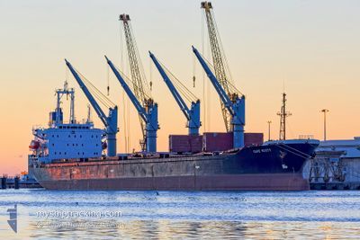
CAPE SCOTT
Bulk Carrier
Current Trip
| Time Travelled | 6 h, 36 mins |
|---|---|
| Remaining Time | --- |
| Distance Travelled | 9.00 nm |
| Remaining Distance | --- |
| AVG Speed | 5.8 Knots |
| MAX Speed | 10.3 Knots |
| AVG Wind | 2.2 knots |
| MAX Wind | 3.4 knots |
| MIN Temp | 15.7°C / 60.26°F |
| MAX Temp | 17.2°C / 62.96°F |
| Draught | 10 m |
| Position Received | Now |
Current Position
| Longitude | 28.84464° |
|---|---|
| Latitude | 40.92195° |
| Status | Under way using engine |
| Speed | 10.7 Knots |
| Course | 244.5° |
| Area | Sea of Marmara |
| Station | T-AIS |
| Position Received | Now |
Info
Information
The current position of CAPE SCOTT is in Sea of Marmara with coordinates 40.92195° / 28.84464° as reported on 2024-05-29 02:22 by AIS to our vessel tracker app. The vessel's current speed is 10.7 Knots and is heading at the port of TARRAGONA. The estimated time of arrival as calculated by vessel tracking app is 2024-06-03 18:00 LT
The vessel CAPE SCOTT (IMO: 9159737, MMSI: 312417000) is a Bulk Carrier that was built in 1997 ( 27 years old ). It's sailing under the flag of [BZ] Belize.
In this page you can find informations about the vessels current position, last detected port calls, and current voyage information. If the vessels is not in coverage by AIS you will find the latest position.
The current position of CAPE SCOTT is detected by our AIS receivers and we are not responsible for the reliability of the data. The last position was recorded while the vessel was in Coverage by the Ais receivers of our vessel tracking app.
The current draught of CAPE SCOTT as reported by AIS is 10 meters
Weather
| Temperature | 15.7°C / 60.26°F |
|---|---|
| Wind Speed | 2 knots |
| Direction | 185° S |
| Pressure | 1013.4 hPa |
| Humidity | 81.1 % |
| Cloud Coverage | --- |
Featured Company
Last Port Calls
| Port | Arrival | Departure | Time In Port |
|---|---|---|---|
| 2024-05-28 18:24 | 2024-05-28 19:46 | 1 h | |
| 2024-05-24 14:36 | 2024-05-26 05:38 | 1 d | |
| 2024-05-09 10:39 | 2024-05-15 04:44 | 5 d | |
| 2024-04-25 05:50 | 2024-04-25 13:15 | 7 h | |
| 2024-04-21 20:07 | 2024-04-21 21:33 | 1 h | |
| 2024-04-17 14:56 | 2024-04-20 06:49 | 2 d | |
| 2024-04-04 04:29 | 2024-04-04 13:55 | 9 h | |
| 2024-03-22 08:32 | 2024-03-30 05:03 | 7 d | |
| 2024-03-11 03:54 | 2024-03-11 13:25 | 9 h |
Most Visited Ports (Last year)
| Port | Arrivals | |
|---|---|---|
| 6 | ||
| 6 | ||
| 2 | ||
| 2 | ||
| 2 | ||
| 1 |
Last Trips
| Origin | Departure | Destination | Arrival | Distance | |
|---|---|---|---|---|---|
| 2024-05-26 08:38 | 2024-05-28 21:24 | 345.42 nm | |||
| 2024-05-15 06:44 | 2024-05-24 17:36 | 1685.82 nm | |||
| 2024-04-25 15:15 | 2024-05-09 12:39 | 32.15 nm | |||
| 2024-04-22 00:33 | 2024-04-25 07:50 | 751.16 nm | |||
| 2024-04-20 09:49 | 2024-04-21 23:07 | 341.42 nm | |||
| 2024-03-30 08:03 | 2024-04-17 17:56 | 3231.45 nm | |||
| 2024-03-30 08:03 | 2024-04-04 06:29 | 1291.17 nm | |||
| 2024-02-27 20:19 | 2024-03-22 11:32 | 2692.09 nm | |||
| 2024-02-27 20:19 | 2024-03-11 05:54 | 1341.01 nm |
Events
| Time | Event | Details | Position / Dest | Info |
|---|---|---|---|---|
| 2024-05-29 02:01 | START Moving | 1.35 nm, South of BAKIRKOY |
40.95111 / 28.88464
ES_TAR
|
Speed: 3.5 kn Course: 178° |
| 2024-05-29 01:50 | Destination Changed | ES_TAR ISTANBUL |
40.95444 / 28.88373
ES_TAR
|
Speed: 0.1 kn Course: 196° |
| 2024-05-29 01:50 | ETA Changed | 2024/06/03 18:00 2024/05/27 20:00 |
40.95444 / 28.88373
ES_TAR
|
Speed: 0.1 kn Course: 196° |
| 2024-05-29 01:50 | Status Changed | Under way using engine At anchor |
40.95444 / 28.88373
ISTANBUL
|
Speed: 0.1 kn Course: 201° |
| 2024-05-28 21:11 | Status Changed | At anchor Under way using engine |
40.95367 / 28.88491
ISTANBUL
|
Speed: Course: 240° |
| 2024-05-28 20:50 | STOP Moving | 1.21 nm, South of BAKIRKOY |
40.95347 / 28.88426
ISTANBUL
|
Speed: 0.2 kn Course: 242° |
| 2024-05-28 19:46 | PORT DEPARTURE |
|
41.00059 / 28.99176
ISTANBUL
|
Speed: 11.3 kn Course: 182° |
| 2024-05-28 18:24 | PORT ARRIVAL |
|
41.20254 / 29.10926
[TR] ISTANBUL
|
Speed: 9.2 kn Course: 211° |
| 2024-05-28 18:11 | Change Sea Area | Turkish part of the Sea of Marmara Turkish part of the Black Sea |
41.23067 / 29.12636
Sea of Marmara
|
Speed: 8.2 kn Course: 188.6° |
| 2024-05-28 16:57 | START Moving | 4.91 nm, North West of RUMELI FENERI |
41.29233 / 29.04073
ISTANBUL
|
Speed: 3.1 kn Course: 45° |