
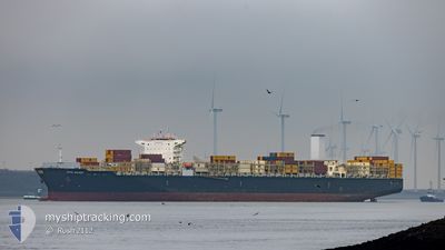
CAPE SOUNIO
Cargo
Current Trip
| Time Travelled | 3 days |
|---|---|
| Remaining Time | 1 day |
| Distance Travelled | 1709.39 nm |
| Remaining Distance | 489.10 nm |
| AVG Speed | 16.7 Knots |
| MAX Speed | 22 Knots |
| AVG Wind | 6.8 knots |
| MAX Wind | 12.4 knots |
| MIN Temp | 24.9°C / 76.82°F |
| MAX Temp | 30.3°C / 86.54°F |
| Draught | 11.6 m |
| Position Received | 2 h, 56 m ago |
Current Position
| Longitude | 118.96878° |
|---|---|
| Latitude | 24.03785° |
| Status | Under way using engine |
| Speed | 18.1 Knots |
| Course | 42.8° |
| Area | South China Sea |
| Station | T-AIS |
| Position Received | 2 h, 56 m ago |
Info
Information
The current position of CAPE SOUNIO is in South China Sea with coordinates 24.03785° / 118.96878° as reported on 2024-06-08 17:50 by AIS to our vessel tracker app. The vessel's current speed is 18.1 Knots and is heading at the port of SHANGHAI. The estimated time of arrival as calculated by vessel tracking app is 2024-06-09 22:55 LT
The vessel CAPE SOUNIO (IMO: 9727625, MMSI: 248089000) is a Cargo It's sailing under the flag of [MT] Malta.
In this page you can find informations about the vessels current position, last detected port calls, and current voyage information. If the vessels is not in coverage by AIS you will find the latest position.
The current position of CAPE SOUNIO is detected by our AIS receivers and we are not responsible for the reliability of the data. The last position was recorded while the vessel was in Coverage by the Ais receivers of our vessel tracking app.
The current draught of CAPE SOUNIO as reported by AIS is 11.6 meters
Weather
| Temperature | 25.2°C / 77.36°F |
|---|---|
| Wind Speed | 1 knots |
| Direction | 276° W |
| Pressure | 1007.9 hPa |
| Humidity | 85.9 % |
| Cloud Coverage | 26 % |
Featured Company
Last Port Calls
| Port | Arrival | Departure | Time In Port |
|---|---|---|---|
| 2024-06-04 00:48 | 2024-06-05 04:25 | 1 d | |
| 2024-06-02 02:30 | 2024-06-03 22:43 | 1 d | |
| 2024-05-05 22:03 | 2024-05-05 22:54 | 51 m | |
| 2024-05-02 20:51 | 2024-05-03 21:18 | 1 d | |
| 2024-05-02 01:10 | 2024-05-02 10:40 | 9 h | |
| 2024-04-23 10:31 | 2024-04-25 04:51 | 1 d | |
| 2024-04-11 18:34 | 2024-04-12 14:23 | 19 h | |
| 2024-04-08 20:30 | 2024-04-08 20:46 | 15 m |
Last Trips
| Origin | Departure | Destination | Arrival | Distance | |
|---|---|---|---|---|---|
| 2024-06-04 06:43 | 2024-06-04 08:48 | 10.63 nm | |||
| 2024-05-05 19:54 | 2024-06-02 10:30 | 9147.64 nm | |||
| 2024-05-03 18:18 | 2024-05-05 19:03 | 221.39 nm | |||
| 2024-05-02 07:40 | 2024-05-02 17:51 | 108.04 nm | |||
| 2024-04-25 01:51 | 2024-05-01 22:10 | 916.57 nm | |||
| 2024-04-12 11:23 | 2024-04-23 07:31 | 1494.56 nm | |||
| 2024-04-08 17:46 | 2024-04-11 15:34 | 188.95 nm | |||
| 2024-03-19 13:56 | 2024-04-08 17:30 | 9234.66 nm |
Events
| Time | Event | Details | Position / Dest | Info |
|---|---|---|---|---|
| 2024-06-08 17:57 | Status Changed | Default Under way using engine |
24.06205 / 118.99463
CHSHA
|
Speed: 18.1 kn Course: 42.8° |
| 2024-06-08 17:50 | OUT of Coverage |
24.03785 / 118.96878
South China Sea
CHSHA
|
Speed: 18.1 kn Course: 42.8° |
|
| 2024-06-08 17:45 | Status Changed | Under way using engine Default |
24.01711 / 118.94788
CHSHA
|
Speed: 18.1 kn Course: 43° |
| 2024-06-08 17:33 | IN Coverage |
24.01782 / 118.94864
South China Sea
CHSHA
|
Speed: 18.1 kn Course: 43.5° |
|
| 2024-06-08 16:05 | Status Changed | Default Under way using engine |
23.70001 / 118.52462
CHSHA
|
Speed: 19.2 kn Course: 70.2° |
| 2024-06-08 16:00 | OUT of Coverage |
23.69130 / 118.49845
South China Sea
CHSHA
|
Speed: 19.2 kn Course: 70.2° |
|
| 2024-06-08 14:14 | Status Changed | Under way using engine Default |
23.41706 / 117.96229
CHSHA
|
Speed: 20.6 kn Course: 47° |
| 2024-06-08 14:13 | Status Changed | Default Under way using engine |
23.41402 / 117.95875
CHSHA
|
Speed: 20.5 kn Course: 45.1° |
| 2024-06-08 13:58 | Change Sea Area | Chinese part of the South China Sea Malaysian part of the South China Sea |
23.35191 / 117.89056
South China Sea
CHSHA
|
Speed: 20.6 kn Course: 41.6° |
| 2024-06-08 13:57 | IN Coverage |
23.35191 / 117.89056
South China Sea
CHSHA
|
Speed: 20.6 kn Course: 41.6° |