
CAPT EUGENE
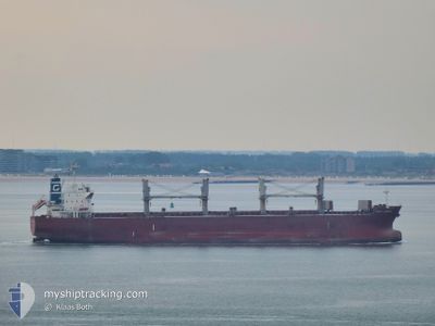
Bulk Carrier
Current Trip
| Time Travelled | 2 days |
|---|---|
| Remaining Time | --- |
| Distance Travelled | 676.70 nm |
| Remaining Distance | --- |
| AVG Speed | 12.3 Knots |
| MAX Speed | 12.3 Knots |
| AVG Wind | 9.8 knots |
| MAX Wind | 14.8 knots |
| MIN Temp | 23°C / 73.4°F |
| MAX Temp | 27.3°C / 81.14°F |
| Draught | 11.6 m |
| Position Received | 15 h, 41 m ago |
Current Position
| Longitude | 22.07644° |
|---|---|
| Latitude | 35.28085° |
| Status | Under way using engine |
| Speed | 12.3 Knots |
| Course | 280.2° |
| Area | Mediterranean Sea - Eastern Basin |
| Station | T-AIS |
| Position Received | 15 h, 41 m ago |
Info
Information
The current position of CAPT EUGENE is in Mediterranean Sea - Eastern Basin with coordinates 35.28085° / 22.07644° as reported on 2024-06-06 08:04 by AIS to our vessel tracker app. The vessel's current speed is 12.3 Knots and is heading at the port of GIBRALTAR. The estimated time of arrival as calculated by vessel tracking app is 2024-06-11 12:30 LT
The vessel CAPT EUGENE (IMO: 9478767, MMSI: 352644000) is a Bulk Carrier that was built in 2010 ( 14 years old ). It's sailing under the flag of [PA] Panama.
In this page you can find informations about the vessels current position, last detected port calls, and current voyage information. If the vessels is not in coverage by AIS you will find the latest position.
The current position of CAPT EUGENE is detected by our AIS receivers and we are not responsible for the reliability of the data. The last position was recorded while the vessel was in Coverage by the Ais receivers of our vessel tracking app.
The current draught of CAPT EUGENE as reported by AIS is 11.6 meters
Weather
| Temperature | 23.6°C / 74.48°F |
|---|---|
| Wind Speed | 7 knots |
| Direction | 189° S |
| Pressure | 1011.3 hPa |
| Humidity | 84.8 % |
| Cloud Coverage | 14 % |
Featured Company
Events
| Time | Event | Details | Position / Dest | Info |
|---|---|---|---|---|
| 2024-06-06 08:13 | Status Changed | Default Under way using engine |
35.28500 / 22.03833
GI GIB
|
Speed: 12.3 kn Course: 280.2° |
| 2024-06-06 08:04 | OUT of Coverage |
35.28085 / 22.07644
Mediterranean Sea - Eastern Basin
GI GIB
|
Speed: 12.3 kn Course: 280.2° |
|
| 2024-06-06 07:59 | Status Changed | Under way using engine Default |
35.27829 / 22.09449
GI GIB
|
Speed: 12.4 kn Course: 281° |
| 2024-06-06 07:44 | Status Changed | Default Under way using engine |
35.26766 / 22.15872
GI GIB
|
Speed: 12.3 kn Course: 280.2° |
| 2024-06-06 07:43 | Status Changed | Under way using engine Default |
35.26697 / 22.16348
GI GIB
|
Speed: 12.3 kn Course: 280° |
| 2024-06-06 07:36 | Status Changed | Default Under way using engine |
35.26246 / 22.19156
GI GIB
|
Speed: 12.4 kn Course: 280.5° |
| 2024-06-06 04:49 | IN Coverage |
35.16034 / 22.87224
Mediterranean Sea - Eastern Basin
GI GIB
|
Speed: 12.3 kn Course: 280.3° |
|
| 2024-06-06 03:44 | OUT of Coverage |
35.12102 / 23.14317
Mediterranean Sea - Eastern Basin
GI GIB
|
Speed: 12.1 kn Course: 279.3° |
|
| 2024-06-06 02:48 | IN Coverage |
35.09182 / 23.36323
Mediterranean Sea - Eastern Basin
GI GIB
|
Speed: 12.4 kn Course: 280.4° |
|
| 2024-06-05 16:49 | OUT of Coverage |
34.68230 / 25.62139
Mediterranean Sea - Eastern Basin
GI GIB
|
Speed: 12.4 kn Course: 291.2° |