
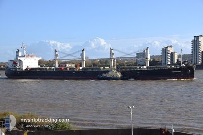
CAPTAINYANNIS L
Bulk Carrier
Current Trip
NOLA
| Time Travelled | 6 days |
|---|---|
| Remaining Time | --- |
| Distance Travelled | 415.44 nm |
| Remaining Distance | --- |
| AVG Speed | 9.5 Knots |
| MAX Speed | 14.2 Knots |
| AVG Wind | 12.7 knots |
| MAX Wind | 20.9 knots |
| MIN Temp | 23°C / 73.4°F |
| MAX Temp | 29.1°C / 84.38°F |
| Draught | 6 m |
| Position Received | 6 d ago |
Current Position
| Longitude | -90.00461° |
|---|---|
| Latitude | 29.80954° |
| Status | Under way using engine |
| Speed | 14.1 Knots |
| Course | 190° |
| Area | North Atlantic Ocean |
| Station | T-AIS |
| Position Received | 6 d ago |
Info
Information
The current position of CAPTAINYANNIS L is in North Atlantic Ocean with coordinates 29.80954° / -90.00461° as reported on 2024-05-07 10:57 by AIS to our vessel tracker app. The vessel's current speed is 14.1 Knots
The vessel CAPTAINYANNIS L (IMO: 9343546, MMSI: 538007864) is a Bulk Carrier that was built in 2008 ( 16 years old ). It's sailing under the flag of [MH] Marshall Is.
In this page you can find informations about the vessels current position, last detected port calls, and current voyage information. If the vessels is not in coverage by AIS you will find the latest position.
The current position of CAPTAINYANNIS L is detected by our AIS receivers and we are not responsible for the reliability of the data. The last position was recorded while the vessel was in Coverage by the Ais receivers of our vessel tracking app.
The current draught of CAPTAINYANNIS L as reported by AIS is 6 meters
Weather
| Temperature | 26°C / 78.8°F |
|---|---|
| Wind Speed | 11 knots |
| Direction | 220° SW |
| Pressure | 1009.8 hPa |
| Humidity | 91.8 % |
| Cloud Coverage | 97 % |
Featured Company
Last Port Calls
| Port | Arrival | Departure | Time In Port |
|---|---|---|---|
| 2024-04-30 05:54 | 2024-05-07 11:14 | 7 d | |
| 2024-04-03 13:29 | 2024-04-06 13:45 | 3 d | |
| 2024-03-20 21:52 | 2024-04-01 16:41 | 11 d | |
| 2024-03-04 00:49 |
Events
| Time | Event | Details | Position / Dest | Info |
|---|---|---|---|---|
| 2024-05-11 18:06 | STOP Moving | 19.48 nm, South of PILOTTOWN |
28.86357 / -89.34577
NOLA
|
Speed: 0.2 kn Course: 88° |
| 2024-05-11 11:32 | START Moving |
28.12333 / -89.66167
NOLA
|
Speed: 5 kn Course: 334° |
|
| 2024-05-10 12:41 | STOP Moving |
27.77833 / -89.47667
NOLA
|
Speed: Course: -1° |
|
| 2024-05-07 11:14 | PORT DEPARTURE |
|
29.74948 / -90.01918
NOLA
|
Speed: 13.3 kn Course: 169° |
| 2024-05-07 11:02 | Status Changed | Default Under way using engine |
29.79197 / -90.01128
[US] NEW ORLEANS
|
Speed: 14.1 kn Course: 190° |
| 2024-05-07 10:57 | OUT of Coverage |
29.80954 / -90.00461
North Atlantic Ocean
|
Speed: 14.1 kn Course: 193° |
|
| 2024-05-07 10:55 | Status Changed | Under way using engine Default |
29.81865 / -90.00205
[US] NEW ORLEANS
|
Speed: 13.9 kn Course: 195° |
| 2024-05-07 10:55 | Status Changed | Default Under way using engine |
29.82120 / -90.00098
[US] NEW ORLEANS
|
Speed: 13.9 kn Course: 195° |
| 2024-05-07 10:47 | Status Changed | Under way using engine Default |
29.84380 / -89.98347
[US] NEW ORLEANS
|
Speed: 13.7 kn Course: 214° |
| 2024-05-07 10:46 | Status Changed | Default Under way using engine |
29.84697 / -89.98106
[US] NEW ORLEANS
|
Speed: 12.9 kn Course: 180° |