
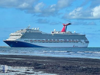
CARNIVAL LIBERTY
Passengers Ship
Current Trip
USNOLA>HNRTB
| Time Travelled | 6 h, 39 mins |
|---|---|
| Remaining Time | --- |
| Distance Travelled | 63.64 nm |
| Remaining Distance | --- |
| AVG Speed | 9.9 Knots |
| MAX Speed | 11 Knots |
| AVG Wind | 12.9 knots |
| MAX Wind | 16 knots |
| MIN Temp | 28.2°C / 82.76°F |
| MAX Temp | 28.7°C / 83.66°F |
| Draught | 8.3 m |
| Position Received | 2 d ago |
Current Position
| Longitude | -88.94009° |
|---|---|
| Latitude | 27.96884° |
| Status | Under way using engine |
| Speed | 18.1 Knots |
| Course | 152.8° |
| Area | Gulf of Mexico |
| Station | T-AIS |
| Position Received | 2 d ago |
Info
Information
The current position of CARNIVAL LIBERTY is in Gulf of Mexico with coordinates 27.96884° / -88.94009° as reported on 2024-05-20 07:20 by AIS to our vessel tracker app. The vessel's current speed is 18.1 Knots
The vessel CARNIVAL LIBERTY (IMO: 9278181, MMSI: 371083000) is a Passengers Ship that was built in 2005 ( 19 years old ). It's sailing under the flag of [PA] Panama.
In this page you can find informations about the vessels current position, last detected port calls, and current voyage information. If the vessels is not in coverage by AIS you will find the latest position.
The current position of CARNIVAL LIBERTY is detected by our AIS receivers and we are not responsible for the reliability of the data. The last position was recorded while the vessel was in Coverage by the Ais receivers of our vessel tracking app.
The current draught of CARNIVAL LIBERTY as reported by AIS is 8.3 meters
Weather
| Temperature | 28.5°C / 83.3°F |
|---|---|
| Wind Speed | 16 knots |
| Direction | 96° E |
| Pressure | 1011.4 hPa |
| Humidity | 82.9 % |
| Cloud Coverage | --- |
Featured Company
Last Port Calls
| Port | Arrival | Departure | Time In Port |
|---|---|---|---|
| 2024-05-22 12:07 | 2024-05-22 23:10 | 11 h | |
| 2024-05-19 08:10 | 2024-05-19 22:26 | 14 h | |
| 2024-05-17 14:20 | 2024-05-17 22:54 | 8 h | |
| 2024-05-15 12:00 | 2024-05-15 22:04 | 10 h | |
| 2024-05-12 08:00 | 2024-05-12 23:05 | 15 h | |
| 2024-05-10 12:15 | 2024-05-10 21:12 | 8 h | |
| 2024-05-09 12:46 | 2024-05-09 22:38 | 9 h | |
| 2024-05-08 17:14 | 2024-05-09 01:09 | 7 h | |
| 2024-05-06 07:55 | 2024-05-06 22:23 | 14 h | |
| 2024-05-03 09:52 | 2024-05-03 17:22 | 7 h |
Most Visited Ports (Last year)
| Port | Arrivals | |
|---|---|---|
| 99 | ||
| 71 | ||
| 35 | ||
| 3 | ||
| 2 | ||
| 1 |
Last Trips
| Origin | Departure | Destination | Arrival | Distance | |
|---|---|---|---|---|---|
| 2024-05-19 17:26 | 2024-05-22 06:07 | 892.18 nm | |||
| 2024-05-17 17:54 | 2024-05-19 03:10 | 621.31 nm | |||
| 2024-05-15 17:04 | 2024-05-17 09:20 | 548.65 nm | |||
| 2024-05-12 18:05 | 2024-05-15 07:00 | 1023.25 nm | |||
| 2024-05-10 16:12 | 2024-05-12 03:00 | 622.30 nm | |||
| 2024-05-09 16:38 | 2024-05-10 07:15 | 221.40 nm | |||
| 2024-05-08 20:09 | 2024-05-09 06:46 | 145.73 nm | |||
| 2024-05-06 17:23 | 2024-05-08 12:14 | 736.00 nm | |||
| 2024-05-03 13:22 | 2024-05-06 02:55 | 913.56 nm | |||
| 2024-05-01 16:23 | 2024-05-03 05:52 | 370.54 nm |
Events
| Time | Event | Details | Position / Dest | Info |
|---|---|---|---|---|
| 2024-05-22 23:10 | PORT DEPARTURE |
|
16.30833 / -86.49500
USNOLA>HNRTB
|
Speed: 5 kn Course: -1° |
| 2024-05-22 23:01 | START Moving |
16.32500 / -86.49834
[HN] ROATAN
|
Speed: 5 kn Course: -1° |
|
| 2024-05-22 12:29 | STOP Moving |
16.32833 / -86.49834
[HN] ROATAN
|
Speed: Course: -1° |
|
| 2024-05-22 12:07 | PORT ARRIVAL |
|
16.31749 / -86.49950
[HN] ROATAN
|
Speed: 4 kn Course: -1° |
| 2024-05-20 07:26 | Status Changed | Default Under way using engine |
27.94143 / -88.92436
USNOLA>HNRTB
|
Speed: 18.1 kn Course: 152.8° |
| 2024-05-20 07:20 | OUT of Coverage |
27.96884 / -88.94009
Gulf of Mexico
USNOLA>HNRTB
|
Speed: 18.1 kn Course: 152.8° |
|
| 2024-05-20 07:16 | Status Changed | Under way using engine Default |
27.98817 / -88.95118
USNOLA>HNRTB
|
Speed: 18.1 kn Course: 154° |
| 2024-05-20 07:06 | Status Changed | Default Under way using engine |
28.03761 / -88.97847
USNOLA>HNRTB
|
Speed: 18 kn Course: 154.3° |
| 2024-05-20 06:29 | Status Changed | Under way using engine Default |
28.20016 / -89.06496
USNOLA>HNRTB
|
Speed: 17.7 kn Course: 155° |
| 2024-05-20 06:07 | Status Changed | Default Under way using engine |
28.30636 / -89.11781
USNOLA>HNRTB
|
Speed: 17.2 kn Course: 157.3° |