
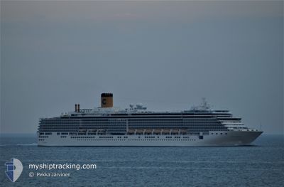
CARNIVAL LUMINOSA
Passengers Ship
Current Trip
| Trip Time | 1 day |
|---|---|
| Trip Distance | 596.70 nm |
| AVG Speed | 18.9 Knots |
| MAX Speed | 23.7 Knots |
| Draught | 8.2 m |
| AVG Wind | 8.9 knots |
| MAX Wind | 18 knots |
| MIN Temp | 11.4°C / 52.52°F |
| MAX Temp | 18.6°C / 65.48°F |
| Position Received | 2 m ago |
Current Position
| Longitude | -123.38893° |
|---|---|
| Latitude | 48.41709° |
| Status | Moored |
| Speed | |
| Course | 85° |
| Area | The Coastal Waters of Southeast Alaska and British Columbia |
| Station | T-AIS |
| Position Received | 2 m ago |
Info
Information
The current position of CARNIVAL LUMINOSA is in The Coastal Waters of Southeast Alaska and British Columbia with coordinates 48.41709° / -123.38893° as reported on 2024-06-27 04:07 by AIS to our vessel tracker app. The vessel's current speed is 0 Knots and is currently inside the port of VICTORIA.
The vessel CARNIVAL LUMINOSA (IMO: 9398905, MMSI: 311001201) is a Passengers Ship that was built in 2009 ( 15 years old ). It's sailing under the flag of [BS] Bahamas.
In this page you can find informations about the vessels current position, last detected port calls, and current voyage information. If the vessels is not in coverage by AIS you will find the latest position.
The current position of CARNIVAL LUMINOSA is detected by our AIS receivers and we are not responsible for the reliability of the data. The last position was recorded while the vessel was in Coverage by the Ais receivers of our vessel tracking app.
The current draught of CARNIVAL LUMINOSA as reported by AIS is 8.2 meters
Weather
| Temperature | 13.2°C / 55.76°F |
|---|---|
| Wind Speed | 5 knots |
| Direction | 265° W |
| Pressure | 1013.8 hPa |
| Humidity | 76.8 % |
| Cloud Coverage | 75 % |
Featured Company
Last Port Calls
| Port | Arrival | Departure | Time In Port |
|---|---|---|---|
| 2024-06-27 02:14 | |||
| 2024-06-25 13:37 | 2024-06-25 21:11 | 7 h | |
| 2024-06-23 14:15 | 2024-06-24 04:03 | 13 h | |
| 2024-06-22 19:31 | 2024-06-23 06:11 | 10 h | |
| 2024-06-20 12:41 | 2024-06-20 23:09 | 10 h | |
| 2024-06-20 02:23 | 2024-06-20 06:59 | 4 h | |
| 2024-06-18 13:43 | 2024-06-18 21:23 | 7 h | |
| 2024-06-16 13:23 | 2024-06-17 04:07 | 14 h | |
| 2024-06-15 19:35 | 2024-06-16 06:19 | 10 h | |
| 2024-06-13 12:39 | 2024-06-13 23:13 | 10 h |
Last Trips
| Origin | Departure | Destination | Arrival | Distance | |
|---|---|---|---|---|---|
| 2024-06-25 13:11 | 2024-06-26 19:14 | 596.70 nm | |||
| 2024-06-23 20:03 | 2024-06-25 05:37 | 421.13 nm | |||
| 2024-06-22 22:11 | 2024-06-23 06:15 | 98.66 nm | |||
| 2024-06-20 16:09 | 2024-06-22 11:31 | 887.71 nm | |||
| 2024-06-19 23:59 | 2024-06-20 05:41 | 83.09 nm | |||
| 2024-06-18 13:23 | 2024-06-19 19:23 | 596.72 nm | |||
| 2024-06-16 20:07 | 2024-06-18 05:43 | 421.67 nm | |||
| 2024-06-15 22:19 | 2024-06-16 05:23 | 98.34 nm | |||
| 2024-06-13 16:13 | 2024-06-15 11:35 | 888.77 nm | |||
| 2024-06-13 00:01 | 2024-06-13 05:39 | 83.46 nm |
Events
| Time | Event | Details | Position / Dest | Info |
|---|---|---|---|---|
| 2024-06-27 03:09 | Destination Changed | US SEA US VIC |
48.41709 / -123.38894
[CA] VICTORIA
|
Speed: Course: 85° |
| 2024-06-27 03:09 | ETA Changed | 2024/06/27 15:00 2024/06/27 01:48 |
48.41709 / -123.38894
[CA] VICTORIA
|
Speed: Course: 85° |
| 2024-06-27 02:31 | STOP Moving |
48.41711 / -123.38901
[CA] VICTORIA
|
Speed: 0.1 kn Course: 86° |
|
| 2024-06-27 02:20 | Status Changed | Moored Under way using engine |
48.41710 / -123.39159
[CA] VICTORIA
|
Speed: 1.1 kn Course: 80° |
| 2024-06-27 02:14 | PORT ARRIVAL |
|
48.41655 / -123.39455
[CA] VICTORIA
|
Speed: 2 kn Course: 60° |
| 2024-06-27 00:59 | Change Sea Area | Canadian part of the The Coastal Waters of Southeast Alaska and British Columbia United States part of the The Coastal Waters of Southeast Alaska and British Columbia |
48.22823 / -123.57249
The Coastal Waters of Southeast Alaska and British Columbia
US VIC
|
Speed: 14.5 kn Course: 91.1° |
| 2024-06-27 00:43 | Draught Changed | 8.2 8 |
48.22739 / -123.69128
US VIC
|
Speed: 17.8 kn Course: 88.8° |
| 2024-06-27 00:43 | ETA Changed | 2024/06/27 01:48 |
48.22739 / -123.69128
US VIC
|
Speed: 17.8 kn Course: 88.8° |
| 2024-06-27 00:37 | Draught Changed | 8 8.2 |
48.22686 / -123.73476
US VIC
|
Speed: 17.8 kn Course: 89.2° |
| 2024-06-26 22:29 | Status Changed | Under way using engine Default |
48.45348 / -124.65905
US VIC
|
Speed: 14 kn Course: 116° |