
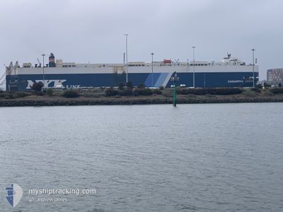
CASSIOPEIA LEADER
Vehicles Carrier
Current Trip
| Time Travelled | 10 days |
|---|---|
| Remaining Time | 1 day |
| Distance Travelled | 3447.28 nm |
| Remaining Distance | 1037.81 nm |
| AVG Speed | 15.2 Knots |
| MAX Speed | 19.3 Knots |
| AVG Wind | 9.7 knots |
| MAX Wind | 20.8 knots |
| MIN Temp | 12.9°C / 55.22°F |
| MAX Temp | 30.3°C / 86.54°F |
| Draught | 7.8 m |
| Position Received | 2 d ago |
Current Position
| Longitude | -79.46201° |
|---|---|
| Latitude | 8.78134° |
| Status | Under way using engine |
| Speed | 17 Knots |
| Course | 178° |
| Area | North Pacific Ocean |
| Station | T-AIS |
| Position Received | 2 d ago |
Info
Information
The current position of CASSIOPEIA LEADER is in North Pacific Ocean with coordinates 8.78134° / -79.46201° as reported on 2024-06-05 20:39 by AIS to our vessel tracker app. The vessel's current speed is 17 Knots and is heading at the port of CRISTOBAL. The estimated time of arrival as calculated by vessel tracking app is 2024-06-10 14:51 LT
The vessel CASSIOPEIA LEADER (IMO: 9182277, MMSI: 431013000) is a Vehicles Carrier that was built in 1999 ( 25 years old ). It's sailing under the flag of [JP] Japan.
In this page you can find informations about the vessels current position, last detected port calls, and current voyage information. If the vessels is not in coverage by AIS you will find the latest position.
The current position of CASSIOPEIA LEADER is detected by our AIS receivers and we are not responsible for the reliability of the data. The last position was recorded while the vessel was in Coverage by the Ais receivers of our vessel tracking app.
The current draught of CASSIOPEIA LEADER as reported by AIS is 7.8 meters
Weather
| Temperature | 27.8°C / 82.04°F |
|---|---|
| Wind Speed | 9 knots |
| Direction | 22° NNE |
| Pressure | 1012.3 hPa |
| Humidity | 79.3 % |
| Cloud Coverage | 100 % |
Featured Company
Last Port Calls
| Port | Arrival | Departure | Time In Port |
|---|---|---|---|
| 2024-05-29 09:03 | 2024-05-29 16:52 | 7 h | |
| 2024-05-28 10:39 | 2024-05-28 19:55 | 9 h | |
| 2024-05-25 23:50 | 2024-05-26 17:29 | 17 h | |
| 2024-05-23 02:14 | 2024-05-23 17:34 | 15 h | |
| 2024-05-18 06:02 | 2024-05-18 06:14 | 12 m | |
| 2024-05-18 05:57 | |||
| 2024-05-18 05:45 | |||
| 2024-05-18 05:09 | |||
| 2024-05-18 04:57 | |||
| 2024-05-18 03:21 |
Most Visited Ports (Last year)
| Port | Arrivals | |
|---|---|---|
| 87 | ||
| 86 | ||
| 3 | ||
| 3 | ||
| 3 | ||
| 2 |
Last Trips
| Origin | Departure | Destination | Arrival | Distance | |
|---|---|---|---|---|---|
| 2024-05-28 15:55 | 2024-05-29 05:03 | 122.91 nm | |||
| 2024-05-26 13:29 | 2024-05-28 06:39 | 390.54 nm | |||
| 2024-05-23 13:34 | 2024-05-25 19:50 | 708.97 nm | |||
| 2024-05-18 01:14 | 2024-05-22 22:14 | 1557.45 nm | |||
| 2024-04-24 14:20 | 2024-05-18 01:02 | 8056.79 nm | |||
| 2024-04-24 14:20 | 2024-05-18 00:57 | 8056.69 nm | |||
| 2024-04-24 14:20 | 2024-05-18 00:45 | 8056.59 nm | |||
| 2024-04-24 14:20 | 2024-05-18 00:09 | 8056.49 nm | |||
| 2024-04-24 14:20 | 2024-05-17 23:57 | 8056.27 nm | |||
| 2024-04-24 14:20 | 2024-05-17 22:21 | 8056.16 nm |
Events
| Time | Event | Details | Position / Dest | Info |
|---|---|---|---|---|
| 2024-06-05 20:44 | Status Changed | Default Under way using engine |
8.75539 / -79.46051
PA CTB
|
Speed: 17 kn Course: 178° |
| 2024-06-05 20:39 | OUT of Coverage |
8.78134 / -79.46201
North Pacific Ocean
|
Speed: 17 kn Course: 178° |
|
| 2024-06-05 20:09 | Change Sea Area | Panamanian part of the North Pacific Ocean Panamanian part of the Caribbean Sea |
8.88764 / -79.52118
North Pacific Ocean
|
Speed: 12 kn Course: 142° |
| 2024-06-05 19:55 | Status Changed | Under way using engine Default |
8.91555 / -79.54354
PA CTB
|
Speed: Course: 135° |
| 2024-06-05 19:55 | START Moving | 2.81 nm, South East of BALBOA |
8.91555 / -79.54354
PA CTB
|
Speed: 10.7 kn Course: 141.4° |
| 2024-06-05 19:55 | IN Coverage |
8.91394 / -79.54228
Caribbean Sea
|
Speed: 10 kn Course: 141° |
|
| 2024-06-05 19:01 | Status Changed | Default Under way using engine |
8.99547 / -79.59013
PA CTB
|
Speed: Course: 135° |
| 2024-06-05 18:53 | Status Changed | Under way using engine Default |
8.99545 / -79.59014
PA CTB
|
Speed: Course: 135° |
| 2024-06-05 18:53 | OUT of Coverage |
8.99545 / -79.59014
Caribbean Sea
|
Speed: Course: 134° |
|
| 2024-06-05 18:38 | Status Changed | Default Under way using engine |
8.99767 / -79.59229
PA CTB
|
Speed: 1 kn Course: 134° |