
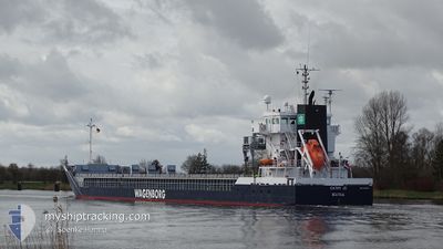
CATHY JO
General Cargo
Current Trip
| Time Travelled | 2 days |
|---|---|
| Remaining Time | --- |
| Distance Travelled | 561.85 nm |
| Remaining Distance | --- |
| AVG Speed | 10.9 Knots |
| MAX Speed | 13.1 Knots |
| AVG Wind | 11 knots |
| MAX Wind | 21.2 knots |
| MIN Temp | 20.8°C / 69.44°F |
| MAX Temp | 23.3°C / 73.94°F |
| Draught | 6.3 m |
| Position Received | 4 h, 14 m ago |
Current Position
| Longitude | 5.04889° |
|---|---|
| Latitude | 39.74047° |
| Status | Under way using engine |
| Speed | 9.6 Knots |
| Course | 58.2° |
| Area | Mediterranean Sea - Western Basin |
| Station | T-AIS |
| Position Received | 4 h, 14 m ago |
Info
Information
The current position of CATHY JO is in Mediterranean Sea - Western Basin with coordinates 39.74047° / 5.04889° as reported on 2024-06-29 15:56 by AIS to our vessel tracker app. The vessel's current speed is 9.6 Knots and is heading at the port of PIOMBINO. The estimated time of arrival as calculated by vessel tracking app is 2024-07-01 04:00 LT
The vessel CATHY JO (IMO: 9419278, MMSI: 246996000) is a General Cargo that was built in 2008 ( 16 years old ). It's sailing under the flag of [NL] Netherlands.
In this page you can find informations about the vessels current position, last detected port calls, and current voyage information. If the vessels is not in coverage by AIS you will find the latest position.
The current position of CATHY JO is detected by our AIS receivers and we are not responsible for the reliability of the data. The last position was recorded while the vessel was in Coverage by the Ais receivers of our vessel tracking app.
The current draught of CATHY JO as reported by AIS is 6.3 meters
Weather
| Temperature | 22.8°C / 73.04°F |
|---|---|
| Wind Speed | 16 knots |
| Direction | 224° SW |
| Pressure | 1013.4 hPa |
| Humidity | 87.7 % |
| Cloud Coverage | 4 % |
Featured Company
Last Port Calls
| Port | Arrival | Departure | Time In Port |
|---|---|---|---|
| 2024-06-27 06:34 | 2024-06-27 11:22 | 4 h | |
| 2024-06-04 23:41 | 2024-06-07 18:11 | 2 d | |
| 2024-05-23 17:38 | 2024-05-24 16:46 | 23 h | |
| 2024-05-20 08:23 | 2024-05-21 09:23 | 1 d | |
| 2024-05-11 13:48 | 2024-05-17 21:51 | 6 d | |
| 2024-05-05 17:42 | 2024-05-08 21:46 | 3 d | |
| 2024-04-29 13:48 | 2024-05-02 15:39 | 3 d | |
| 2024-04-28 13:12 | 2024-04-29 04:36 | 15 h | |
| 2024-04-28 12:34 | 2024-04-28 12:50 | 15 m | |
| 2024-04-28 10:54 | 2024-04-28 10:59 | 5 m |
Most Visited Ports (Last year)
| Port | Arrivals | |
|---|---|---|
| 5 | ||
| 4 | ||
| 3 | ||
| 2 | ||
| 2 | ||
| 2 |
Last Trips
| Origin | Departure | Destination | Arrival | Distance | |
|---|---|---|---|---|---|
| 2024-06-07 20:11 | 2024-06-27 07:34 | 2208.43 nm | |||
| 2024-05-24 19:46 | 2024-06-05 01:41 | 1848.74 nm | |||
| 2024-05-21 11:23 | 2024-05-23 20:38 | 606.99 nm | |||
| 2024-05-17 23:51 | 2024-05-20 10:23 | 656.72 nm | |||
| 2024-05-08 23:46 | 2024-05-11 15:48 | 658.70 nm | |||
| 2024-05-02 17:39 | 2024-05-05 19:42 | 773.47 nm | |||
| 2024-04-29 06:36 | 2024-04-29 15:48 | 90.12 nm | |||
| 2024-04-28 14:50 | 2024-04-28 15:12 | 0.18 nm | |||
| 2024-04-28 12:59 | 2024-04-28 14:34 | 1.94 nm | |||
| 2024-04-23 00:56 | 2024-04-28 12:54 | 1315.31 nm |
Events
| Time | Event | Details | Position / Dest | Info |
|---|---|---|---|---|
| 2024-06-29 16:07 | Status Changed | Default Under way using engine |
39.75636 / 5.08284
ITPIO
|
Speed: 9.6 kn Course: 58.2° |
| 2024-06-29 15:56 | OUT of Coverage |
39.74047 / 5.04889
Mediterranean Sea - Western Basin
ITPIO
|
Speed: 9.6 kn Course: 58.2° |
|
| 2024-06-29 15:53 | Status Changed | Under way using engine Default |
39.73629 / 5.03998
ITPIO
|
Speed: 9.6 kn Course: 59° |
| 2024-06-29 15:53 | IN Coverage |
39.73883 / 5.04544
Mediterranean Sea - Western Basin
ITPIO
|
Speed: 9.6 kn Course: 59.8° |
|
| 2024-06-29 06:01 | Status Changed | Default Under way using engine |
38.87042 / 3.14741
ITPIO
|
Speed: 10.2 kn Course: 59.2° |
| 2024-06-29 05:57 | OUT of Coverage |
38.86459 / 3.13484
Mediterranean Sea - Western Basin
ITPIO
|
Speed: 10.2 kn Course: 59.2° |
|
| 2024-06-29 05:52 | Status Changed | Under way using engine Default |
38.85656 / 3.11742
ITPIO
|
Speed: 10.3 kn Course: 60° |
| 2024-06-29 05:25 | Status Changed | Default Under way using engine |
38.81863 / 3.03368
ITPIO
|
Speed: 10.2 kn Course: 59.9° |
| 2024-06-29 05:22 | Status Changed | Under way using engine Default |
38.81385 / 3.02307
ITPIO
|
Speed: 10.2 kn Course: 59° |
| 2024-06-29 04:53 | Status Changed | Default Under way using engine |
38.77074 / 2.93349
ITPIO
|
Speed: 10.4 kn Course: 58.5° |