
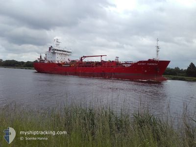
CATHY THERESA
Oil/Chemical Tanker
Current Trip
| Time Travelled | 5 days |
|---|---|
| Remaining Time | 1 day |
| Distance Travelled | 1613.29 nm |
| Remaining Distance | 509.25 nm |
| AVG Speed | 11.6 Knots |
| MAX Speed | 14.9 Knots |
| AVG Wind | 16 knots |
| MAX Wind | 22.9 knots |
| MIN Temp | 12.4°C / 54.32°F |
| MAX Temp | 20.4°C / 68.72°F |
| Draught | 6.9 m |
| Position Received | 3 h, 53 m ago |
Current Position
| Longitude | 0.35785° |
|---|---|
| Latitude | 38.45987° |
| Status | Under way using engine |
| Speed | 11.5 Knots |
| Course | 37.1° |
| Area | Mediterranean Sea - Western Basin |
| Station | T-AIS |
| Position Received | 3 h, 53 m ago |
Info
Information
The current position of CATHY THERESA is in Mediterranean Sea - Western Basin with coordinates 38.45987° / 0.35785° as reported on 2024-06-01 13:43 by AIS to our vessel tracker app. The vessel's current speed is 11.5 Knots and is heading at the port of VADO LIGURE. The estimated time of arrival as calculated by vessel tracking app is 2024-06-03 11:02 LT
The vessel CATHY THERESA (IMO: 9478315, MMSI: 219374000) is a Oil/Chemical Tanker that was built in 2011 ( 13 years old ). It's sailing under the flag of [DK] Denmark.
In this page you can find informations about the vessels current position, last detected port calls, and current voyage information. If the vessels is not in coverage by AIS you will find the latest position.
The current position of CATHY THERESA is detected by our AIS receivers and we are not responsible for the reliability of the data. The last position was recorded while the vessel was in Coverage by the Ais receivers of our vessel tracking app.
The current draught of CATHY THERESA as reported by AIS is 6.9 meters
Weather
| Temperature | 20.5°C / 68.9°F |
|---|---|
| Wind Speed | 13 knots |
| Direction | 119° ESE |
| Pressure | 1016 hPa |
| Humidity | 68.4 % |
| Cloud Coverage | 36 % |
Featured Company
Last Port Calls
| Port | Arrival | Departure | Time In Port |
|---|---|---|---|
| 2024-05-25 09:13 | 2024-05-26 19:37 | 1 d | |
| 2024-05-24 01:25 | 2024-05-24 17:50 | 16 h | |
| 2024-05-21 20:27 | 2024-05-23 09:01 | 1 d | |
| 2024-05-20 08:46 | 2024-05-21 16:19 | 1 d | |
| 2024-05-19 08:53 | 2024-05-20 08:20 | 23 h | |
| 2024-05-15 23:22 | 2024-05-17 19:22 | 1 d | |
| 2024-05-12 21:42 | 2024-05-14 08:30 | 1 d | |
| 2024-05-10 15:26 | 2024-05-11 14:08 | 22 h | |
| 2024-05-03 15:19 | 2024-05-03 22:47 | 7 h | |
| 2024-04-21 14:32 | 2024-04-23 15:07 | 2 d |
Most Visited Ports (Last year)
| Port | Arrivals | |
|---|---|---|
| 5 | ||
| 5 | ||
| 4 | ||
| 3 | ||
| 3 | ||
| 3 |
Last Trips
| Origin | Departure | Destination | Arrival | Distance | |
|---|---|---|---|---|---|
| 2024-05-24 19:50 | 2024-05-25 10:13 | 110.04 nm | |||
| 2024-05-23 11:01 | 2024-05-24 03:25 | 51.18 nm | |||
| 2024-05-21 18:19 | 2024-05-21 22:27 | 45.99 nm | |||
| 2024-05-20 10:20 | 2024-05-20 10:46 | 3.13 nm | |||
| 2024-05-17 21:22 | 2024-05-19 10:53 | 380.67 nm | |||
| 2024-05-14 10:30 | 2024-05-16 01:22 | 314.97 nm | |||
| 2024-05-11 16:08 | 2024-05-12 23:42 | 274.90 nm | |||
| 2024-05-03 23:47 | 2024-05-10 17:26 | 1780.91 nm | |||
| 2024-04-23 15:07 | 2024-05-03 16:19 | 2488.00 nm | |||
| 2024-04-14 20:44 | 2024-04-21 14:32 | 1728.64 nm |
Events
| Time | Event | Details | Position / Dest | Info |
|---|---|---|---|---|
| 2024-06-01 13:46 | Status Changed | Default Under way using engine |
38.46722 / .36490
GBFAW>ITVDL
|
Speed: 11.5 kn Course: 37.1° |
| 2024-06-01 13:43 | OUT of Coverage |
38.45987 / .35785
Mediterranean Sea - Western Basin
GBFAW>ITVDL
|
Speed: 11.5 kn Course: 37.1° |
|
| 2024-06-01 13:43 | Status Changed | Under way using engine Default |
38.45900 / .35708
GBFAW>ITVDL
|
Speed: 11.5 kn Course: 36° |
| 2024-06-01 13:26 | IN Coverage |
38.45987 / .35785
Mediterranean Sea - Western Basin
GBFAW>ITVDL
|
Speed: 11.5 kn Course: 37.1° |
|
| 2024-06-01 12:10 | Status Changed | Default Under way using engine |
38.22317 / .12893
GBFAW>ITVDL
|
Speed: 11.2 kn Course: 38.7° |
| 2024-06-01 12:06 | Status Changed | Under way using engine Default |
38.21332 / .11922
GBFAW>ITVDL
|
Speed: 11.2 kn Course: 38° |
| 2024-06-01 12:06 | OUT of Coverage |
38.21332 / .11922
Mediterranean Sea - Western Basin
GBFAW>ITVDL
|
Speed: 11.2 kn Course: 38.7° |
|
| 2024-06-01 12:02 | Status Changed | Default Under way using engine |
38.20283 / .10885
GBFAW>ITVDL
|
Speed: 11.2 kn Course: 36.8° |
| 2024-06-01 11:56 | Status Changed | Under way using engine Default |
38.18750 / .09396
GBFAW>ITVDL
|
Speed: 11.2 kn Course: 38° |
| 2024-06-01 11:50 | Status Changed | Default Under way using engine |
38.17284 / .07969
GBFAW>ITVDL
|
Speed: 11.7 kn Course: 37.7° |