
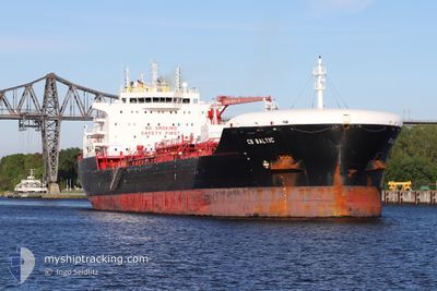
CB BALTIC
Tanker
Current Trip
| Time Travelled | 17 h, 50 mins |
|---|---|
| Remaining Time | --- |
| Distance Travelled | 201.36 nm |
| Remaining Distance | --- |
| AVG Speed | 12.5 Knots |
| MAX Speed | 13 Knots |
| AVG Wind | 11.9 knots |
| MAX Wind | 13.8 knots |
| MIN Temp | 22.4°C / 72.32°F |
| MAX Temp | 22.9°C / 73.22°F |
| Draught | 9.6 m |
| Position Received | 38 m ago |
Current Position
| Longitude | 19.40909° |
|---|---|
| Latitude | 33.11175° |
| Status | Under way using engine |
| Speed | 12 Knots |
| Course | 81° |
| Area | Mediterranean Sea - Eastern Basin |
| Station | T-AIS |
| Position Received | 38 m ago |
Info
Information
The current position of CB BALTIC is in Mediterranean Sea - Eastern Basin with coordinates 33.11175° / 19.40909° as reported on 2024-06-07 11:17 by AIS to our vessel tracker app. The vessel's current speed is 12 Knots
The vessel CB BALTIC (IMO: 9851701, MMSI: 255806263) is a Tanker It's sailing under the flag of [PT] Portugal.
In this page you can find informations about the vessels current position, last detected port calls, and current voyage information. If the vessels is not in coverage by AIS you will find the latest position.
The current position of CB BALTIC is detected by our AIS receivers and we are not responsible for the reliability of the data. The last position was recorded while the vessel was in Coverage by the Ais receivers of our vessel tracking app.
The current draught of CB BALTIC as reported by AIS is 9.6 meters
Weather
| Temperature | 22.8°C / 73.04°F |
|---|---|
| Wind Speed | 13 knots |
| Direction | 321° NW |
| Pressure | 1016.9 hPa |
| Humidity | 82.2 % |
| Cloud Coverage | --- |
Featured Company
Last Port Calls
| Port | Arrival | Departure | Time In Port |
|---|---|---|---|
| 2024-06-03 11:46 | 2024-06-06 18:05 | 3 d | |
| 2024-05-13 00:07 | 2024-05-17 15:01 | 4 d | |
| 2024-05-11 11:41 | 2024-05-11 12:38 | 57 m | |
| 2024-05-08 16:53 | 2024-05-11 04:21 | 2 d | |
| 2024-05-03 04:10 | 2024-05-05 20:44 | 2 d | |
| 2024-04-21 00:52 | 2024-04-23 08:31 | 2 d | |
| 2024-04-05 09:54 | 2024-04-07 04:01 | 1 d |
Last Trips
| Origin | Departure | Destination | Arrival | Distance | |
|---|---|---|---|---|---|
| 2024-05-17 17:01 | 2024-06-03 13:46 | 2748.72 nm | |||
| 2024-05-11 14:38 | 2024-05-13 02:07 | 315.81 nm | |||
| 2024-05-11 06:21 | 2024-05-11 13:41 | 82.24 nm | |||
| 2024-05-05 22:44 | 2024-05-08 18:53 | 827.41 nm | |||
| 2024-04-23 10:31 | 2024-05-03 06:10 | 142.74 nm | |||
| 2024-04-07 07:01 | 2024-04-21 02:52 | 3497.24 nm | |||
| 2024-03-26 17:29 | 2024-04-05 12:54 | 2150.55 nm |
Events
| Time | Event | Details | Position / Dest | Info |
|---|---|---|---|---|
| 2024-06-07 11:24 | Status Changed | Default Under way using engine |
33.11593 / 19.44044
LY MRA
|
Speed: 12 kn Course: 81° |
| 2024-06-07 11:17 | Status Changed | Under way using engine Default |
33.11175 / 19.40909
LY MRA
|
Speed: 12.9 kn Course: 82° |
| 2024-06-07 11:17 | IN Coverage |
33.11175 / 19.40909
Mediterranean Sea - Eastern Basin
|
Speed: 12 kn Course: 81° |
|
| 2024-06-06 20:22 | OUT of Coverage |
32.44721 / 15.78294
Mediterranean Sea - Eastern Basin
|
Speed: 12.6 kn Course: 76.5° |
|
| 2024-06-06 19:43 | IN Coverage |
32.41742 / 15.62444
Mediterranean Sea - Eastern Basin
|
Speed: 12.9 kn Course: 77.2° |
|
| 2024-06-06 18:05 | PORT DEPARTURE |
|
32.41742 / 15.62444
LY MRA
|
Speed: Course: -1° |
| 2024-06-03 12:01 | STOP Moving |
32.36833 / 15.21500
[LY] MISURATA
|
Speed: Course: -1° |
|
| 2024-06-03 11:46 | PORT ARRIVAL |
|
32.37153 / 15.22673
[LY] MISURATA
|
Speed: 4 kn Course: -1° |
| 2024-06-03 11:04 | START Moving | 4.03 nm, North East of MISURATA |
32.39333 / 15.30500
LY MRA
|
Speed: 6 kn Course: 243° |
| 2024-06-02 14:29 | OUT of Coverage |
32.39399 / 15.31211
Mediterranean Sea - Eastern Basin
|
Speed: Course: 186.4° |