
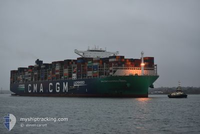
CC CHAMPS ELYSEES
Cargo A
Current Trip
| Time Travelled | 4 days |
|---|---|
| Remaining Time | --- |
| Distance Travelled | 2042.39 nm |
| Remaining Distance | --- |
| AVG Speed | 20.1 Knots |
| MAX Speed | 22.1 Knots |
| AVG Wind | 13.6 knots |
| MAX Wind | 27.9 knots |
| MIN Temp | 19°C / 66.2°F |
| MAX Temp | 27.8°C / 82.04°F |
| Draught | 11.7 m |
| Position Received | 2 d ago |
Current Position
| Longitude | -14.73810° |
|---|---|
| Latitude | 26.64023° |
| Status | Under way using engine |
| Speed | 20.8 Knots |
| Course | 213.7° |
| Area | North Atlantic Ocean |
| Station | T-AIS |
| Position Received | 2 d ago |
Info
Information
The current position of CC CHAMPS ELYSEES is in North Atlantic Ocean with coordinates 26.64023° / -14.73810° as reported on 2024-06-03 01:34 by AIS to our vessel tracker app. The vessel's current speed is 20.8 Knots and is heading at the port of PORT KLANG. The estimated time of arrival as calculated by vessel tracking app is 2024-06-23 16:00 LT
The vessel CC CHAMPS ELYSEES (IMO: 9839131, MMSI: 228386800) is a Cargo A It's sailing under the flag of [FR] France.
In this page you can find informations about the vessels current position, last detected port calls, and current voyage information. If the vessels is not in coverage by AIS you will find the latest position.
The current position of CC CHAMPS ELYSEES is detected by our AIS receivers and we are not responsible for the reliability of the data. The last position was recorded while the vessel was in Coverage by the Ais receivers of our vessel tracking app.
The current draught of CC CHAMPS ELYSEES as reported by AIS is 11.7 meters
Weather
| Temperature | 27.4°C / 81.32°F |
|---|---|
| Wind Speed | 6 knots |
| Direction | 203° SSW |
| Pressure | 1013 hPa |
| Humidity | 81.2 % |
| Cloud Coverage | 100 % |
Featured Company
Last Port Calls
| Port | Arrival | Departure | Time In Port |
|---|---|---|---|
| 2024-05-30 22:18 | 2024-06-01 12:25 | 1 d | |
| 2024-05-23 23:46 | 2024-05-27 00:30 | 3 d | |
| 2024-05-19 18:49 | 2024-05-21 22:06 | 2 d | |
| 2024-05-14 06:39 | 2024-05-16 22:50 | 2 d | |
| 2024-05-09 22:37 | 2024-05-11 03:29 | 1 d | |
| 2024-05-07 12:38 | 2024-05-08 00:14 | 11 h | |
| 2024-04-11 17:59 | 2024-04-13 04:47 | 1 d | |
| 2024-04-04 20:16 | 2024-04-06 01:32 | 1 d |
Most Visited Ports (Last year)
| Port | Arrivals | |
|---|---|---|
| 6 | ||
| 5 | ||
| 4 | ||
| 4 | ||
| 4 | ||
| 4 |
Last Trips
| Origin | Departure | Destination | Arrival | Distance | |
|---|---|---|---|---|---|
| 2024-05-27 02:30 | 2024-05-31 00:18 | 1476.56 nm | |||
| 2024-05-21 23:06 | 2024-05-24 01:46 | 308.04 nm | |||
| 2024-05-17 00:50 | 2024-05-19 19:49 | 321.93 nm | |||
| 2024-05-11 05:29 | 2024-05-14 08:39 | 1409.60 nm | |||
| 2024-05-08 01:14 | 2024-05-10 00:37 | 168.58 nm | |||
| 2024-04-13 12:47 | 2024-05-07 13:38 | 10761.23 nm | |||
| 2024-04-06 09:32 | 2024-04-12 01:59 | 1472.99 nm | |||
| 2024-03-30 22:02 | 2024-04-05 04:16 | 905.43 nm |
Events
| Time | Event | Details | Position / Dest | Info |
|---|---|---|---|---|
| 2024-06-03 01:40 | Status Changed | Default Under way using engine |
26.61135 / -14.75941
PORT KLANG (MYPKG)
|
Speed: 20.8 kn Course: 213.7° |
| 2024-06-03 01:34 | OUT of Coverage |
26.64023 / -14.73810
North Atlantic Ocean
PORT KLANG (MYPKG)
|
Speed: 20.8 kn Course: 213.7° |
|
| 2024-06-03 01:09 | Status Changed | Under way using engine Default |
26.75843 / -14.64801
PORT KLANG (MYPKG)
|
Speed: 21.1 kn Course: 216° |
| 2024-06-03 00:52 | Status Changed | Default Under way using engine |
26.83987 / -14.58440
PORT KLANG (MYPKG)
|
Speed: 20.9 kn Course: 215.1° |
| 2024-06-03 00:10 | Status Changed | Under way using engine Default |
27.04367 / -14.42295
PORT KLANG (MYPKG)
|
Speed: 21.6 kn Course: 215° |
| 2024-06-03 00:08 | Status Changed | Default Under way using engine |
27.05256 / -14.41596
PORT KLANG (MYPKG)
|
Speed: 21.6 kn Course: 215.2° |
| 2024-06-02 23:07 | Change Sea Area | Western Saharan part of the North Atlantic Ocean Spanish (Canary Islands) part of the North Atlantic Ocean |
27.35037 / -14.17834
North Atlantic Ocean
PORT KLANG (MYPKG)
|
Speed: 21.7 kn Course: 215.6° |
| 2024-06-02 15:39 | Status Changed | Under way using engine Default |
29.62729 / -12.62259
PORT KLANG (MYPKG)
|
Speed: 21.4 kn Course: 211° |
| 2024-06-02 15:36 | Status Changed | Default Under way using engine |
29.64054 / -12.61363
PORT KLANG (MYPKG)
|
Speed: 21.5 kn Course: 210.4° |
| 2024-06-02 12:46 | Status Changed | Under way using engine Default |
30.52277 / -12.06126
PORT KLANG (MYPKG)
|
Speed: 21 kn Course: 208° |