
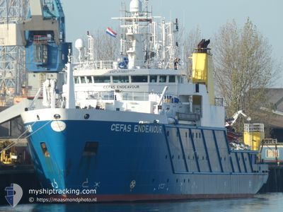
CEFAS ENDEAVOUR
Fishery Research Vessel
Current Trip
SURVEY GROUND
| Time Travelled | 15 h, 7 mins |
|---|---|
| Remaining Time | --- |
| Distance Travelled | 170.99 nm |
| Remaining Distance | --- |
| AVG Speed | 10.4 Knots |
| MAX Speed | 13 Knots |
| AVG Wind | 4 knots |
| MAX Wind | 8.2 knots |
| MIN Temp | 9.8°C / 49.64°F |
| MAX Temp | 12.9°C / 55.22°F |
| Draught | 5.2 m |
| Position Received | Now |
Current Position
| Longitude | -0.81756° |
|---|---|
| Latitude | 54.78270° |
| Status | Under way using engine |
| Speed | 0.7 Knots |
| Course | 146° |
| Area | North Sea |
| Station | T-AIS |
| Position Received | Now |
Info
Information
The current position of CEFAS ENDEAVOUR is in North Sea with coordinates 54.78270° / -0.81756° as reported on 2024-05-17 04:17 by AIS to our vessel tracker app. The vessel's current speed is 0.7 Knots
The vessel CEFAS ENDEAVOUR (IMO: 9251107, MMSI: 235005270) is a Fishery Research Vessel that was built in 2003 ( 21 years old ). It's sailing under the flag of [GB] United Kingdom.
In this page you can find informations about the vessels current position, last detected port calls, and current voyage information. If the vessels is not in coverage by AIS you will find the latest position.
The current position of CEFAS ENDEAVOUR is detected by our AIS receivers and we are not responsible for the reliability of the data. The last position was recorded while the vessel was in Coverage by the Ais receivers of our vessel tracking app.
The current draught of CEFAS ENDEAVOUR as reported by AIS is 5.2 meters
Weather
| Temperature | 10°C / 50°F |
|---|---|
| Wind Speed | 4 knots |
| Direction | 45° NE |
| Pressure | 1008 hPa |
| Humidity | 98.7 % |
| Cloud Coverage | 100 % |
Featured Company
Last Port Calls
| Port | Arrival | Departure | Time In Port |
|---|---|---|---|
| 2024-05-14 13:46 | 2024-05-16 13:10 | 1 d | |
| 2024-05-04 16:51 | 2024-05-14 12:48 | 9 d | |
| 2024-04-28 23:17 | 2024-05-02 03:47 | 3 d | |
| 2024-04-15 10:53 | 2024-04-20 20:08 | 5 d | |
| 2024-03-30 08:06 | 2024-04-09 14:04 | 10 d | |
| 2024-03-17 18:25 | 2024-03-19 16:54 | 1 d | |
| 2024-03-09 06:32 | 2024-03-09 12:52 | 6 h | |
| 2024-03-04 00:29 |
Last Trips
| Origin | Departure | Destination | Arrival | Distance | |
|---|---|---|---|---|---|
| 2024-05-14 13:48 | 2024-05-14 14:46 | 4.44 nm | |||
| 2024-05-02 04:47 | 2024-05-04 17:51 | 426.43 nm | |||
| 2024-04-20 21:08 | 2024-04-29 00:17 | 936.24 nm | |||
| 2024-04-09 15:04 | 2024-04-15 11:53 | 882.27 nm | |||
| 2024-03-19 16:54 | 2024-03-30 08:06 | 1416.27 nm | |||
| 2024-03-09 12:52 | 2024-03-17 18:25 | 886.30 nm | |||
| 2024-03-04 00:29 | 2024-03-09 06:32 | 664.58 nm |
Events
| Time | Event | Details | Position / Dest | Info |
|---|---|---|---|---|
| 2024-05-17 04:00 | STOP Moving | 13.58 nm, North of PORT MULGRAVE |
54.78516 / -.82049
SURVEY GROUND
|
Speed: 0.2 kn Course: 148° |
| 2024-05-17 01:55 | IN Coverage |
54.49935 / -.41008
North Sea
SURVEY GROUND
|
Speed: 12.5 kn Course: 322.4° |
|
| 2024-05-17 00:20 | OUT of Coverage |
54.25470 / -.04797
North Sea
SURVEY GROUND
|
Speed: 12 kn Course: 319.9° |
|
| 2024-05-16 21:16 | IN Coverage |
53.80124 / .63913
North Sea
SURVEY GROUND
|
Speed: 12 kn Course: 323.3° |
|
| 2024-05-16 18:38 | OUT of Coverage |
53.34114 / 1.16457
North Sea
SURVEY GROUND
|
Speed: 12.9 kn Course: 330.4° |
|
| 2024-05-16 13:26 | Destination Changed | SURVEY GROUND LOWESTOFT |
52.49743 / 1.77667
SURVEY GROUND
|
Speed: 8.9 kn Course: 347.1° |
| 2024-05-16 13:26 | ETA Changed | 2024/05/17 14:00 2024/05/14 14:00 |
52.49743 / 1.77667
SURVEY GROUND
|
Speed: 8.9 kn Course: 347.1° |
| 2024-05-16 13:10 | PORT DEPARTURE |
|
52.47119 / 1.75830
LOWESTOFT
|
Speed: 3.6 kn Course: 78° |
| 2024-05-16 13:08 | Status Changed | Under way using engine Moored |
52.47227 / 1.75479
[GB] LOWESTOFT
|
Speed: 3.2 kn Course: 115° |
| 2024-05-16 13:08 | START Moving |
52.47248 / 1.75405
[GB] LOWESTOFT
|
Speed: 3.1 kn Course: 114° |