
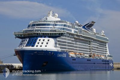
CELEBRITY EDGE
Passenger
Current Trip
| Time Travelled | 8 h, 16 mins |
|---|---|
| Remaining Time | --- |
| Distance Travelled | 145.54 nm |
| Remaining Distance | --- |
| AVG Speed | 18.3 Knots |
| MAX Speed | 21.2 Knots |
| AVG Wind | 9.6 knots |
| MAX Wind | 16 knots |
| MIN Temp | 8.9°C / 48.02°F |
| MAX Temp | 19.4°C / 66.92°F |
| Draught | 8.2 m |
| Position Received | 1 m ago |
Current Position
| Longitude | -125.23414° |
|---|---|
| Latitude | 48.52565° |
| Status | Under way using engine |
| Speed | 14.7 Knots |
| Course | 289.6° |
| Area | North Pacific Ocean |
| Station | T-AIS |
| Position Received | 1 m ago |
Info
Information
The current position of CELEBRITY EDGE is in North Pacific Ocean with coordinates 48.52565° / -125.23414° as reported on 2024-06-01 09:00 by AIS to our vessel tracker app. The vessel's current speed is 14.7 Knots and is heading at the port of KETCHIKAN. The estimated time of arrival as calculated by vessel tracking app is 2024-06-02 14:00 LT
The vessel CELEBRITY EDGE (IMO: 9812705, MMSI: 248325000) is a Passenger It's sailing under the flag of [MT] Malta.
In this page you can find informations about the vessels current position, last detected port calls, and current voyage information. If the vessels is not in coverage by AIS you will find the latest position.
The current position of CELEBRITY EDGE is detected by our AIS receivers and we are not responsible for the reliability of the data. The last position was recorded while the vessel was in Coverage by the Ais receivers of our vessel tracking app.
The current draught of CELEBRITY EDGE as reported by AIS is 8.2 meters
Weather
| Temperature | 10.5°C / 50.9°F |
|---|---|
| Wind Speed | 2 knots |
| Direction | 304° NW |
| Pressure | 1015.8 hPa |
| Humidity | 91.7 % |
| Cloud Coverage | 100 % |
Featured Company
Last Port Calls
| Port | Arrival | Departure | Time In Port |
|---|---|---|---|
| 2024-05-31 12:28 | 2024-06-01 00:45 | 12 h | |
| 2024-05-30 23:36 | 2024-05-31 07:03 | 7 h | |
| 2024-05-28 14:35 | 2024-05-29 02:40 | 12 h | |
| 2024-05-27 20:42 | 2024-05-28 07:55 | 11 h | |
| 2024-05-26 13:11 | 2024-05-27 00:35 | 11 h | |
| 2024-05-24 12:25 | 2024-05-24 23:08 | 10 h | |
| 2024-05-23 23:32 | 2024-05-24 06:53 | 7 h | |
| 2024-05-21 13:54 | 2024-05-22 02:14 | 12 h | |
| 2024-05-20 20:42 | 2024-05-21 06:26 | 9 h | |
| 2024-05-19 13:46 | 2024-05-20 00:46 | 11 h |
Most Visited Ports (Last year)
| Port | Arrivals | |
|---|---|---|
| 20 | ||
| 19 | ||
| 14 | ||
| 12 | ||
| 12 | ||
| 7 |
Last Trips
| Origin | Departure | Destination | Arrival | Distance | |
|---|---|---|---|---|---|
| 2024-05-31 00:03 | 2024-05-31 05:28 | 83.91 nm | |||
| 2024-05-28 18:40 | 2024-05-30 16:36 | 900.33 nm | |||
| 2024-05-27 23:55 | 2024-05-28 06:35 | 97.69 nm | |||
| 2024-05-26 16:35 | 2024-05-27 12:42 | 335.27 nm | |||
| 2024-05-24 16:08 | 2024-05-26 05:11 | 649.82 nm | |||
| 2024-05-23 23:53 | 2024-05-24 05:25 | 83.74 nm | |||
| 2024-05-21 18:14 | 2024-05-23 16:32 | 902.74 nm | |||
| 2024-05-20 22:26 | 2024-05-21 05:54 | 95.51 nm | |||
| 2024-05-19 16:46 | 2024-05-20 12:42 | 335.88 nm | |||
| 2024-05-17 16:36 | 2024-05-19 05:46 | 651.46 nm |
Events
| Time | Event | Details | Position / Dest | Info |
|---|---|---|---|---|
| 2024-06-01 07:39 | Change Sea Area | Canadian part of the North Pacific Ocean Canadian part of the The Coastal Waters of Southeast Alaska and British Columbia |
48.51745 / -124.75016
North Pacific Ocean
US KTN
|
Speed: 14.6 kn Course: 276.1° |
| 2024-06-01 04:32 | Change Sea Area | Canadian part of the The Coastal Waters of Southeast Alaska and British Columbia United States part of the The Coastal Waters of Southeast Alaska and British Columbia |
48.24144 / -123.49050
The Coastal Waters of Southeast Alaska and British Columbia
US KTN
|
Speed: 16.8 kn Course: 302.5° |
| 2024-06-01 02:17 | Draught Changed | 8.2 8 |
48.07017 / -122.63806
US KTN
|
Speed: 21.1 kn Course: 349.9° |
| 2024-06-01 02:17 | ETA Changed | 2024/06/02 14:00 |
48.07017 / -122.63806
US KTN
|
Speed: 21.1 kn Course: 349.9° |
| 2024-06-01 02:11 | Draught Changed | 8 8.2 |
48.03581 / -122.62768
US KTN
|
Speed: 20.9 kn Course: 346.1° |
| 2024-06-01 00:45 | PORT DEPARTURE |
|
47.62073 / -122.39277
US KTN
|
Speed: 10.2 kn Course: 253° |
| 2024-06-01 00:43 | START Moving |
47.62271 / -122.38589
[US] SEATTLE
|
Speed: 3.2 kn Course: 253° |
|
| 2024-06-01 00:29 | ETA Changed | 2024/06/02 14:00 2024/06/02 13:50 |
47.62915 / -122.38402
[US] SEATTLE
|
Speed: Course: 1° |
| 2024-06-01 00:28 | Status Changed | Under way using engine Moored |
47.62915 / -122.38402
[US] SEATTLE
|
Speed: 0.1 kn Course: 1° |
| 2024-05-31 19:45 | ETA Changed | 2024/06/02 13:50 2024/05/31 12:00 |
47.62915 / -122.38401
[US] SEATTLE
|
Speed: Course: 1° |