
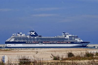
CELEBRITY INFINITY
Passengers Ship
Current Trip
| Time Travelled | 1 day |
|---|---|
| Remaining Time | 6 h, 6 mins |
| Distance Travelled | 248.78 nm |
| Remaining Distance | 57.35 nm |
| AVG Speed | 9.1 Knots |
| MAX Speed | 9.9 Knots |
| AVG Wind | 9.4 knots |
| MAX Wind | 15 knots |
| MIN Temp | 19°C / 66.2°F |
| MAX Temp | 24.2°C / 75.56°F |
| Draught | 8.3 m |
| Position Received | 1 m ago |
Current Position
| Longitude | 23.67832° |
|---|---|
| Latitude | 37.23143° |
| Status | Under way using engine |
| Speed | 9.3 Knots |
| Course | 233.6° |
| Area | Aegean Sea |
| Station | T-AIS |
| Position Received | 1 m ago |
Info
Information
The current position of CELEBRITY INFINITY is in Aegean Sea with coordinates 37.23143° / 23.67832° as reported on 2024-05-23 20:58 by AIS to our vessel tracker app. The vessel's current speed is 9.3 Knots and is heading at the port of NAFPLIO. The estimated time of arrival as calculated by vessel tracking app is 2024-05-24 03:05 LT
The vessel CELEBRITY INFINITY (IMO: 9189421, MMSI: 249048000) is a Passengers Ship that was built in 2001 ( 23 years old ). It's sailing under the flag of [MT] Malta.
In this page you can find informations about the vessels current position, last detected port calls, and current voyage information. If the vessels is not in coverage by AIS you will find the latest position.
The current position of CELEBRITY INFINITY is detected by our AIS receivers and we are not responsible for the reliability of the data. The last position was recorded while the vessel was in Coverage by the Ais receivers of our vessel tracking app.
The current draught of CELEBRITY INFINITY as reported by AIS is 8.3 meters
Weather
| Temperature | 20.9°C / 69.62°F |
|---|---|
| Wind Speed | 8 knots |
| Direction | 100° E |
| Pressure | 1014 hPa |
| Humidity | 69.4 % |
| Cloud Coverage | --- |
Featured Company
Last Port Calls
| Port | Arrival | Departure | Time In Port |
|---|---|---|---|
| 2024-05-22 03:42 | 2024-05-22 17:24 | 13 h | |
| 2024-05-19 04:44 | 2024-05-19 17:44 | 12 h | |
| 2024-05-18 04:17 | 2024-05-18 17:12 | 12 h | |
| 2024-05-16 01:31 | 2024-05-16 15:08 | 13 h | |
| 2024-05-15 03:53 | 2024-05-15 15:28 | 11 h | |
| 2024-05-13 04:49 | 2024-05-13 13:54 | 9 h | |
| 2024-05-12 03:12 | 2024-05-12 15:00 | 11 h | |
| 2024-05-09 03:37 | 2024-05-10 16:58 | 1 d | |
| 2024-05-07 06:23 | 2024-05-07 18:20 | 11 h | |
| 2024-05-06 00:40 | 2024-05-06 13:51 | 13 h |
Last Trips
| Origin | Departure | Destination | Arrival | Distance | |
|---|---|---|---|---|---|
| 2024-05-19 20:44 | 2024-05-22 06:42 | 491.27 nm | |||
| 2024-05-18 20:12 | 2024-05-19 07:44 | 136.74 nm | |||
| 2024-05-16 18:08 | 2024-05-18 07:17 | 180.05 nm | |||
| 2024-05-15 18:28 | 2024-05-16 04:31 | 134.30 nm | |||
| 2024-05-13 16:54 | 2024-05-15 06:53 | 305.56 nm | |||
| 2024-05-12 18:00 | 2024-05-13 07:49 | 177.98 nm | |||
| 2024-05-10 19:58 | 2024-05-12 06:12 | 354.05 nm | |||
| 2024-05-07 21:20 | 2024-05-09 06:37 | 344.86 nm | |||
| 2024-05-06 16:51 | 2024-05-07 09:23 | 262.95 nm | |||
| 2024-05-05 17:23 | 2024-05-06 03:40 | 134.10 nm |
Events
| Time | Event | Details | Position / Dest | Info |
|---|---|---|---|---|
| 2024-05-23 13:29 | Status Changed | Under way using engine Default |
38.04597 / 24.62708
GR NAF
|
Speed: 9 kn Course: 186° |
| 2024-05-23 13:05 | Status Changed | Default Under way using engine |
38.10667 / 24.63833
GR NAF
|
Speed: 8.9 kn Course: 183° |
| 2024-05-23 10:20 | Status Changed | Under way using engine Default |
38.48750 / 24.48117
GR NAF
|
Speed: 9 kn Course: 151° |
| 2024-05-23 10:05 | Status Changed | Default Under way using engine |
38.52167 / 24.45667
GR NAF
|
Speed: 9 kn Course: 151.4° |
| 2024-05-23 08:45 | ETA Changed | 2024/05/24 03:30 2024/05/23 21:30 |
38.70996 / 24.35678
GR NAF
|
Speed: 9.2 kn Course: 158.4° |
| 2024-05-23 08:33 | Status Changed | Under way using engine Default |
38.73749 / 24.34243
GR NAF
|
Speed: 9 kn Course: 158° |
| 2024-05-23 08:33 | IN Coverage |
38.73633 / 24.34302
Aegean Sea
GR NAF
|
Speed: 9.3 kn Course: 158.3° |
|
| 2024-05-23 03:25 | Status Changed | Default Under way using engine |
39.39667 / 23.85500
GR NAF
|
Speed: 9.1 kn Course: 125.8° |
| 2024-05-23 03:13 | OUT of Coverage |
39.41343 / 23.82397
Aegean Sea
GR NAF
|
Speed: 9.1 kn Course: 125.8° |
|
| 2024-05-23 02:59 | Status Changed | Under way using engine Default |
39.43352 / 23.78769
GR NAF
|
Speed: 9 kn Course: 126° |