
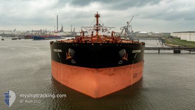
CELESTE NOVA
Tanker
Current Trip
MOMON
| Time Travelled | 6 days |
|---|---|
| Remaining Time | --- |
| Distance Travelled | 714.97 nm |
| Remaining Distance | --- |
| AVG Speed | 6.8 Knots |
| MAX Speed | 11.9 Knots |
| AVG Wind | 16.3 knots |
| MAX Wind | 25 knots |
| MIN Temp | 9.1°C / 48.38°F |
| MAX Temp | 14.8°C / 58.64°F |
| Draught | 11.6 m |
| Position Received | Now |
Current Position
| Longitude | 3.96365° |
|---|---|
| Latitude | 60.53579° |
| Status | Under way using engine |
| Speed | 4.4 Knots |
| Course | 56° |
| Area | North Sea |
| Station | T-AIS |
| Position Received | Now |
Info
Information
The current position of CELESTE NOVA is in North Sea with coordinates 60.53579° / 3.96365° as reported on 2024-05-20 18:31 by AIS to our vessel tracker app. The vessel's current speed is 4.4 Knots
The vessel CELESTE NOVA (IMO: 9534054, MMSI: 636020434) is a Tanker It's sailing under the flag of [LR] Liberia.
In this page you can find informations about the vessels current position, last detected port calls, and current voyage information. If the vessels is not in coverage by AIS you will find the latest position.
The current position of CELESTE NOVA is detected by our AIS receivers and we are not responsible for the reliability of the data. The last position was recorded while the vessel was in Coverage by the Ais receivers of our vessel tracking app.
The current draught of CELESTE NOVA as reported by AIS is 11.6 meters
Weather
| Temperature | 10.5°C / 50.9°F |
|---|---|
| Wind Speed | 10 knots |
| Direction | 3° N |
| Pressure | 1017.9 hPa |
| Humidity | 79.6 % |
| Cloud Coverage | 16 % |
Featured Company
Last Trips
Events
| Time | Event | Details | Position / Dest | Info |
|---|---|---|---|---|
| 2024-05-20 15:08 | START Moving |
60.30218 / 3.42771
MOMON
|
Speed: 3.1 kn Course: 56° |
|
| 2024-05-20 12:16 | STOP Moving |
60.32547 / 3.43867
MOMON
|
Speed: 0.3 kn Course: 75° |
|
| 2024-05-20 10:43 | ETA Changed | 2024/05/20 22:01 2024/05/19 22:01 |
60.30408 / 3.46891
MOMON
|
Speed: 7.4 kn Course: 318.5° |
| 2024-05-20 10:22 | ETA Changed | 2024/05/19 22:01 2024/05/17 20:00 |
60.26084 / 3.54252
MOMON
|
Speed: 11.1 kn Course: 320.1° |
| 2024-05-20 09:09 | START Moving |
60.10014 / 3.80094
MOMON
|
Speed: 3.1 kn Course: 315° |
|
| 2024-05-20 01:18 | STOP Moving |
60.30455 / 3.47734
MOMON
|
Speed: 0.3 kn Course: 63° |
|
| 2024-05-19 08:05 | START Moving |
60.08539 / 3.63718
MOMON
|
Speed: 3.4 kn Course: 38° |
|
| 2024-05-19 01:06 | STOP Moving |
60.18328 / 3.65785
MOMON
|
Speed: 0.3 kn Course: 60° |
|
| 2024-05-18 14:06 | START Moving |
60.21616 / 3.75245
MOMON
|
Speed: 3.1 kn Course: 279° |
|
| 2024-05-17 15:11 | STOP Moving |
60.20936 / 3.60010
MOMON
|
Speed: 0.3 kn Course: 5° |