
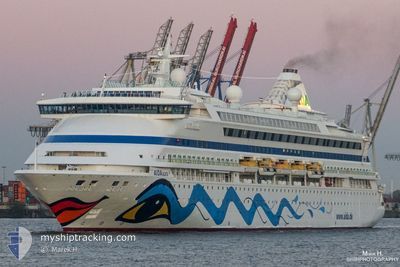
CELESTYAL DISCOVERY
Passengers Ship
Current Trip
| Time Travelled | 2 h, 22 mins |
|---|---|
| Remaining Time | 12 mins |
| Distance Travelled | 38.41 nm |
| Remaining Distance | 10.44 nm |
| AVG Speed | 18.9 Knots |
| MAX Speed | 19.2 Knots |
| AVG Wind | 14.5 knots |
| MAX Wind | 18.3 knots |
| MIN Temp | 25.2°C / 77.36°F |
| MAX Temp | 27.6°C / 81.68°F |
| Draught | 6.3 m |
| Position Received | 4 m ago |
Current Position
| Longitude | 26.66022° |
|---|---|
| Latitude | 37.38805° |
| Status | Under way using engine |
| Speed | 18.7 Knots |
| Course | 201.1° |
| Area | Aegean Sea |
| Station | T-AIS |
| Position Received | 4 m ago |
Info
Information
The current position of CELESTYAL DISCOVERY is in Aegean Sea with coordinates 37.38805° / 26.66022° as reported on 2024-06-08 12:43 by AIS to our vessel tracker app. The vessel's current speed is 18.7 Knots and is heading at the port of PATMOS. The estimated time of arrival as calculated by vessel tracking app is 2024-06-08 13:00 LT
The vessel CELESTYAL DISCOVERY (IMO: 9221566, MMSI: 256667000) is a Passengers Ship that was built in 2003 ( 21 years old ). It's sailing under the flag of [MT] Malta.
In this page you can find informations about the vessels current position, last detected port calls, and current voyage information. If the vessels is not in coverage by AIS you will find the latest position.
The current position of CELESTYAL DISCOVERY is detected by our AIS receivers and we are not responsible for the reliability of the data. The last position was recorded while the vessel was in Coverage by the Ais receivers of our vessel tracking app.
The current draught of CELESTYAL DISCOVERY as reported by AIS is 6.3 meters
Weather
| Temperature | 25.3°C / 77.54°F |
|---|---|
| Wind Speed | 16 knots |
| Direction | 317° NW |
| Pressure | 1006.7 hPa |
| Humidity | 66.6 % |
| Cloud Coverage | --- |
Featured Company
Last Port Calls
| Port | Arrival | Departure | Time In Port |
|---|---|---|---|
| 2024-06-08 03:03 | 2024-06-08 10:26 | 7 h | |
| 2024-06-07 15:04 | 2024-06-07 19:57 | 4 h | |
| 2024-06-07 01:25 | 2024-06-07 10:06 | 8 h | |
| 2024-06-06 12:58 | 2024-06-06 19:12 | 6 h | |
| 2024-06-06 03:09 | 2024-06-06 09:20 | 6 h | |
| 2024-06-05 03:09 | 2024-06-05 14:48 | 11 h | |
| 2024-06-04 02:58 | 2024-06-04 10:12 | 7 h | |
| 2024-06-03 01:20 | 2024-06-03 10:16 | 8 h | |
| 2024-06-02 13:10 | 2024-06-02 18:27 | 5 h | |
| 2024-06-02 03:06 | 2024-06-02 09:34 | 6 h |
Last Trips
| Origin | Departure | Destination | Arrival | Distance | |
|---|---|---|---|---|---|
| 2024-06-07 22:57 | 2024-06-08 06:03 | 99.90 nm | |||
| 2024-06-07 13:06 | 2024-06-07 18:04 | 69.00 nm | |||
| 2024-06-06 22:12 | 2024-06-07 04:25 | 106.62 nm | |||
| 2024-06-06 12:20 | 2024-06-06 15:58 | 65.27 nm | |||
| 2024-06-05 17:48 | 2024-06-06 06:09 | 166.93 nm | |||
| 2024-06-04 13:12 | 2024-06-05 06:09 | 159.94 nm | |||
| 2024-06-03 13:16 | 2024-06-04 05:58 | 167.35 nm | |||
| 2024-06-02 21:27 | 2024-06-03 04:20 | 106.54 nm | |||
| 2024-06-02 12:34 | 2024-06-02 16:10 | 65.44 nm | |||
| 2024-06-01 13:27 | 2024-06-02 06:06 | 185.59 nm |
Events
| Time | Event | Details | Position / Dest | Info |
|---|---|---|---|---|
| 2024-06-08 12:38 | Status Changed | Under way using engine Default |
37.39535 / 26.66372
GR PMS
|
Speed: 19.1 kn Course: 214° |
| 2024-06-08 12:30 | Status Changed | Default Under way using engine |
37.43057 / 26.68528
GR PMS
|
Speed: 19.1 kn Course: 223.7° |
| 2024-06-08 11:36 | Status Changed | Under way using engine Default |
37.64930 / 26.95182
GR PMS
|
Speed: 19 kn Course: 224° |
| 2024-06-08 11:31 | Destination Changed | GR PMS TK KUS |
37.67588 / 26.98425
GR PMS
|
Speed: 18.9 kn Course: 224.2° |
| 2024-06-08 11:31 | ETA Changed | 2024/06/08 12:30 2024/06/08 02:50 |
37.67588 / 26.98425
GR PMS
|
Speed: 18.9 kn Course: 224.2° |
| 2024-06-08 11:30 | Status Changed | Default Under way using engine |
37.66167 / 26.96666
GR PMS
|
Speed: 18.9 kn Course: 224.2° |
| 2024-06-08 11:26 | Status Changed | Under way using engine Default |
37.67588 / 26.98425
TK KUS
|
Speed: 19 kn Course: 223° |
| 2024-06-08 11:26 | Change Sea Area | Greek part of the Aegean Sea Turkish part of the Aegean Sea |
37.67588 / 26.98425
Aegean Sea
|
Speed: 18.9 kn Course: 224.2° |
| 2024-06-08 11:24 | IN Coverage |
37.67588 / 26.98425
Aegean Sea
|
Speed: 18.9 kn Course: 224.2° |
|
| 2024-06-08 10:26 | PORT DEPARTURE |
|
37.84402 / 27.20063
TK KUS
|
Speed: 3.1 kn Course: 280° |