
CELSIUS GENEVA
Tanker D
Current Trip
| Time Travelled | --- |
|---|---|
| Remaining Time | --- |
| Distance Travelled | 9181.35 nm |
| Remaining Distance | --- |
| AVG Speed | 12.4 Knots |
| MAX Speed | 20.7 Knots |
| AVG Wind | 13.7 knots |
| MAX Wind | 36.3 knots |
| MIN Temp | 12.2°C / 53.96°F |
| MAX Temp | 29°C / 84.2°F |
| Draught | 11 m |
| Position Received | 13 h, 39 m ago |
Current Position
| Longitude | -65.89735° |
|---|---|
| Latitude | 19.63297° |
| Status | Under way using engine |
| Speed | 18.1 Knots |
| Course | 88.5° |
| Area | North Atlantic Ocean |
| Station | T-AIS |
| Position Received | 13 h, 39 m ago |
Info
Information
The current position of CELSIUS GENEVA is in North Atlantic Ocean with coordinates 19.63297° / -65.89735° as reported on 2024-05-28 19:37 by AIS to our vessel tracker app. The vessel's current speed is 18.1 Knots and is heading at the port of RIO DE JANEIRO. The estimated time of arrival as calculated by vessel tracking app is 2024-06-06 15:00 LT
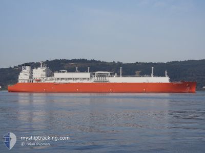
The vessel CELSIUS GENEVA (IMO: 9945435, MMSI: 538010515) is a Tanker D It's sailing under the flag of [MH] Marshall Is.
In this page you can find informations about the vessels current position, last detected port calls, and current voyage information. If the vessels is not in coverage by AIS you will find the latest position.
The current position of CELSIUS GENEVA is detected by our AIS receivers and we are not responsible for the reliability of the data. The last position was recorded while the vessel was in Coverage by the Ais receivers of our vessel tracking app.
The current draught of CELSIUS GENEVA as reported by AIS is 11 meters
Weather
| Temperature | 27.7°C / 81.86°F |
|---|---|
| Wind Speed | 13 knots |
| Direction | 101° E |
| Pressure | 1016.3 hPa |
| Humidity | 76.5 % |
| Cloud Coverage | 100 % |
Featured Company
Most Visited Ports (Last year)
| Port | Arrivals | |
|---|---|---|
| 2 |
Events
| Time | Event | Details | Position / Dest | Info |
|---|---|---|---|---|
| 2024-05-28 19:42 | Status Changed | Default Under way using engine |
19.63333 / -65.86833
BR RIO
|
Speed: 18.1 kn Course: 88.5° |
| 2024-05-28 19:37 | OUT of Coverage |
19.63297 / -65.89735
North Atlantic Ocean
BR RIO
|
Speed: 18.1 kn Course: 88.5° |
|
| 2024-05-28 19:22 | Status Changed | Under way using engine Default |
19.63061 / -65.97853
BR RIO
|
Speed: 18 kn Course: 88° |
| 2024-05-28 19:22 | IN Coverage |
19.63066 / -65.97747
North Atlantic Ocean
BR RIO
|
Speed: 18 kn Course: 87.5° |
|
| 2024-05-28 18:06 | Status Changed | Default Under way using engine |
19.62333 / -66.37500
BR RIO
|
Speed: 17.5 kn Course: 89.7° |
| 2024-05-28 18:00 | Status Changed | Under way using engine Default |
19.62300 / -66.40996
BR RIO
|
Speed: 17.6 kn Course: 89° |
| 2024-05-28 18:00 | OUT of Coverage |
19.62300 / -66.40996
North Atlantic Ocean
BR RIO
|
Speed: 17.5 kn Course: 89.7° |
|
| 2024-05-28 17:33 | Status Changed | Default Under way using engine |
19.62162 / -66.54583
BR RIO
|
Speed: 17.6 kn Course: 89.2° |
| 2024-05-28 17:29 | Status Changed | Under way using engine Default |
19.62129 / -66.56975
BR RIO
|
Speed: 17.6 kn Course: 89° |
| 2024-05-28 17:10 | Status Changed | Default Under way using engine |
19.61985 / -66.66630
BR RIO
|
Speed: 17.8 kn Course: 88.6° |