
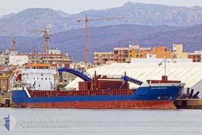
CELTIC AMBASSADOR
General Cargo
Current Trip
| Time Travelled | 4 days |
|---|---|
| Remaining Time | 2 days |
| Distance Travelled | 1155.79 nm |
| Remaining Distance | 806.53 nm |
| AVG Speed | 10.6 Knots |
| MAX Speed | 12.7 Knots |
| AVG Wind | 10.5 knots |
| MAX Wind | 33.3 knots |
| MIN Temp | 17.9°C / 64.22°F |
| MAX Temp | 20.9°C / 69.62°F |
| Draught | 5 m |
| Position Received | 1 d ago |
Current Position
| Longitude | 12.22847° |
|---|---|
| Latitude | 37.38714° |
| Status | Under way using engine |
| Speed | 10.6 Knots |
| Course | 295.8° |
| Area | Mediterranean Sea - Eastern Basin |
| Station | T-AIS |
| Position Received | 1 d ago |
Info
Information
The current position of CELTIC AMBASSADOR is in Mediterranean Sea - Eastern Basin with coordinates 37.38714° / 12.22847° as reported on 2024-05-18 01:12 by AIS to our vessel tracker app. The vessel's current speed is 10.6 Knots and is heading at the port of CASABLANCA. The estimated time of arrival as calculated by vessel tracking app is 2024-05-21 23:04 LT
The vessel CELTIC AMBASSADOR (IMO: 9312705, MMSI: 232033027) is a General Cargo that was built in 2005 ( 19 years old ). It's sailing under the flag of [GB] United Kingdom.
In this page you can find informations about the vessels current position, last detected port calls, and current voyage information. If the vessels is not in coverage by AIS you will find the latest position.
The current position of CELTIC AMBASSADOR is detected by our AIS receivers and we are not responsible for the reliability of the data. The last position was recorded while the vessel was in Coverage by the Ais receivers of our vessel tracking app.
The current draught of CELTIC AMBASSADOR as reported by AIS is 5 meters
Weather
| Temperature | 18.4°C / 65.12°F |
|---|---|
| Wind Speed | 14 knots |
| Direction | 105° ESE |
| Pressure | 1008.5 hPa |
| Humidity | 89.2 % |
| Cloud Coverage | 100 % |
Featured Company
Last Port Calls
| Port | Arrival | Departure | Time In Port |
|---|---|---|---|
| 2024-05-13 08:36 | 2024-05-14 15:36 | 1 d | |
| 2024-05-06 04:58 | 2024-05-12 14:36 | 6 d | |
| 2024-04-29 12:13 | 2024-05-01 04:31 | 1 d | |
| 2024-04-23 12:41 | 2024-04-26 16:32 | 3 d | |
| 2024-04-10 22:35 | 2024-04-12 21:02 | 1 d | |
| 2024-04-10 18:52 | 2024-04-10 20:08 | 1 h | |
| 2024-04-08 22:26 | 2024-04-10 17:34 | 1 d | |
| 2024-03-25 11:36 | 2024-04-01 20:03 | 7 d | |
| 2024-03-19 23:20 | 2024-03-20 22:12 | 22 h | |
| 2024-03-05 06:05 | 2024-03-13 11:12 | 8 d |
Last Trips
| Origin | Departure | Destination | Arrival | Distance | |
|---|---|---|---|---|---|
| 2024-05-12 16:36 | 2024-05-13 10:36 | 68.82 nm | |||
| 2024-05-01 07:31 | 2024-05-06 06:58 | 708.06 nm | |||
| 2024-04-26 18:32 | 2024-04-29 15:13 | 386.93 nm | |||
| 2024-04-12 23:02 | 2024-04-23 14:41 | 2836.80 nm | |||
| 2024-04-10 22:08 | 2024-04-11 00:35 | 23.09 nm | |||
| 2024-04-10 19:34 | 2024-04-10 20:52 | 9.07 nm | |||
| 2024-04-01 21:03 | 2024-04-09 00:26 | 1657.04 nm | |||
| 2024-03-20 23:12 | 2024-03-25 12:36 | 176.66 nm | |||
| 2024-03-13 11:12 | 2024-03-20 00:20 | 1682.20 nm | |||
| 2024-02-17 17:22 | 2024-03-05 06:05 | 3345.21 nm |
Events
| Time | Event | Details | Position / Dest | Info |
|---|---|---|---|---|
| 2024-05-18 01:13 | Status Changed | Default Under way using engine |
37.38833 / 12.22333
MACAS
|
Speed: 10.6 kn Course: 295.8° |
| 2024-05-18 01:12 | OUT of Coverage |
37.38714 / 12.22847
Mediterranean Sea - Eastern Basin
MACAS
|
Speed: 10.6 kn Course: 295.8° |
|
| 2024-05-18 01:01 | Status Changed | Under way using engine Default |
37.37306 / 12.26543
MACAS
|
Speed: 10.7 kn Course: 296° |
| 2024-05-18 00:46 | Status Changed | Default Under way using engine |
37.35333 / 12.31333
MACAS
|
Speed: 10.7 kn Course: 296.3° |
| 2024-05-18 00:37 | Status Changed | Under way using engine Default |
37.34159 / 12.34575
MACAS
|
Speed: 10 kn Course: 295° |
| 2024-05-18 00:31 | Status Changed | Default Under way using engine |
37.33333 / 12.36333
MACAS
|
Speed: 10.9 kn Course: 294.4° |
| 2024-05-18 00:09 | Status Changed | Under way using engine Default |
37.30626 / 12.44163
MACAS
|
Speed: 11.3 kn Course: 295° |
| 2024-05-17 23:51 | Status Changed | Default Under way using engine |
37.28198 / 12.50601
MACAS
|
Speed: 11.5 kn Course: 294° |
| 2024-05-17 23:37 | Status Changed | Under way using engine Default |
37.26405 / 12.55571
MACAS
|
Speed: 11 kn Course: 292° |
| 2024-05-17 23:31 | IN Coverage |
37.26405 / 12.55571
Mediterranean Sea - Eastern Basin
MACAS
|
Speed: 11.4 kn Course: 293° |