
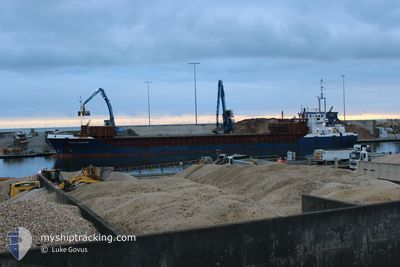
CELTIC FORESTER
General Cargo
Current Trip
| Time Travelled | 10 days |
|---|---|
| Remaining Time | 5 days |
| Distance Travelled | 1964.59 nm |
| Remaining Distance | 1241.78 nm |
| AVG Speed | 8.6 Knots |
| MAX Speed | 12.1 Knots |
| AVG Wind | 13.5 knots |
| MAX Wind | 37.3 knots |
| MIN Temp | 13.3°C / 55.94°F |
| MAX Temp | 24.2°C / 75.56°F |
| Draught | 5.6 m |
| Position Received | 1 d ago |
Current Position
| Longitude | 2.93322° |
|---|---|
| Latitude | 37.07488° |
| Status | Under way using engine |
| Speed | 6.4 Knots |
| Course | 78.6° |
| Area | Mediterranean Sea - Western Basin |
| Station | T-AIS |
| Position Received | 1 d ago |
Info
Information
The current position of CELTIC FORESTER is in Mediterranean Sea - Western Basin with coordinates 37.07488° / 2.93322° as reported on 2024-06-26 12:42 by AIS to our vessel tracker app. The vessel's current speed is 6.4 Knots and is heading at the port of VOLOS. The estimated time of arrival as calculated by vessel tracking app is 2024-07-03 22:54 LT
The vessel CELTIC FORESTER (IMO: 9256171, MMSI: 232020953) is a General Cargo that was built in 2003 ( 21 years old ). It's sailing under the flag of [GB] United Kingdom.
In this page you can find informations about the vessels current position, last detected port calls, and current voyage information. If the vessels is not in coverage by AIS you will find the latest position.
The current position of CELTIC FORESTER is detected by our AIS receivers and we are not responsible for the reliability of the data. The last position was recorded while the vessel was in Coverage by the Ais receivers of our vessel tracking app.
The current draught of CELTIC FORESTER as reported by AIS is 5.6 meters
Weather
| Temperature | 24.1°C / 75.38°F |
|---|---|
| Wind Speed | 17 knots |
| Direction | 76° ENE |
| Pressure | 1011.1 hPa |
| Humidity | 80.9 % |
| Cloud Coverage | --- |
Featured Company
Last Port Calls
| Port | Arrival | Departure | Time In Port |
|---|---|---|---|
| 2024-06-17 10:47 | 2024-06-17 22:14 | 11 h | |
| 2024-06-12 19:00 | 2024-06-13 18:52 | 23 h | |
| 2024-06-11 19:14 | 2024-06-11 19:41 | 27 m | |
| 2024-06-11 07:38 | 2024-06-11 08:17 | 39 m | |
| 2024-06-07 09:12 | 2024-06-08 14:46 | 1 d | |
| 2024-06-03 10:47 | 2024-06-04 16:48 | 1 d | |
| 2024-05-29 09:07 | 2024-05-30 18:43 | 1 d | |
| 2024-05-23 06:54 | 2024-05-25 17:07 | 2 d | |
| 2024-05-19 19:40 | 2024-05-20 12:45 | 17 h | |
| 2024-05-16 02:58 | 2024-05-16 18:42 | 15 h |
Last Trips
| Origin | Departure | Destination | Arrival | Distance | |
|---|---|---|---|---|---|
| 2024-06-13 20:52 | 2024-06-17 12:47 | 127.49 nm | |||
| 2024-06-11 20:41 | 2024-06-12 21:00 | 219.89 nm | |||
| 2024-06-11 09:17 | 2024-06-11 20:14 | 0.49 nm | |||
| 2024-06-08 15:46 | 2024-06-11 08:38 | 483.29 nm | |||
| 2024-06-04 17:48 | 2024-06-07 10:12 | 656.84 nm | |||
| 2024-05-30 19:43 | 2024-06-03 11:47 | 862.69 nm | |||
| 2024-05-25 18:07 | 2024-05-29 10:07 | 404.97 nm | |||
| 2024-05-20 14:45 | 2024-05-23 07:54 | 599.14 nm | |||
| 2024-05-16 19:42 | 2024-05-19 21:40 | 202.06 nm | |||
| 2024-05-15 00:45 | 2024-05-16 03:58 | 212.85 nm |
Events
| Time | Event | Details | Position / Dest | Info |
|---|---|---|---|---|
| 2024-06-26 12:53 | Status Changed | Default Under way using engine |
37.07814 / 2.95862
GR VOL
|
Speed: 6.4 kn Course: 78.6° |
| 2024-06-26 12:42 | OUT of Coverage |
37.07488 / 2.93322
Mediterranean Sea - Western Basin
GR VOL
|
Speed: 6.4 kn Course: 78.6° |
|
| 2024-06-26 11:41 | ETA Changed | 2024/07/02 05:00 2024/07/02 03:00 |
37.05676 / 2.80040
GR VOL
|
Speed: 6.3 kn Course: 78.4° |
| 2024-06-26 11:41 | Status Changed | Under way using engine Default |
37.05665 / 2.79968
GR VOL
|
Speed: 6.5 kn Course: 80° |
| 2024-06-26 11:30 | IN Coverage |
37.05723 / 2.80334
Mediterranean Sea - Western Basin
GR VOL
|
Speed: 6.5 kn Course: 78.2° |
|
| 2024-06-26 10:22 | Status Changed | Default Under way using engine |
37.03262 / 2.62060
GR VOL
|
Speed: 6.8 kn Course: 80.4° |
| 2024-06-26 10:16 | OUT of Coverage |
37.03091 / 2.60820
Mediterranean Sea - Western Basin
GR VOL
|
Speed: 6.8 kn Course: 80.4° |
|
| 2024-06-26 09:58 | Status Changed | Under way using engine Default |
37.02525 / 2.56603
GR VOL
|
Speed: 6.9 kn Course: 81° |
| 2024-06-26 09:58 | IN Coverage |
37.02545 / 2.56764
Mediterranean Sea - Western Basin
GR VOL
|
Speed: 6.9 kn Course: 81.9° |
|
| 2024-06-25 19:48 | OUT of Coverage |
36.71121 / .26516
Mediterranean Sea - Western Basin
GR VOL
|
Speed: 8.3 kn Course: 80.5° |