
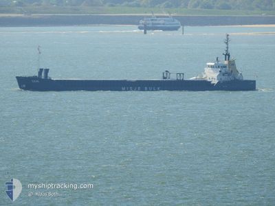
CEMILE
General Cargo
Current Trip
| Time Travelled | 9 days |
|---|---|
| Remaining Time | --- |
| Distance Travelled | 880.05 nm |
| Remaining Distance | --- |
| AVG Speed | 15.4 Knots |
| MAX Speed | 15.4 Knots |
| AVG Wind | 8.2 knots |
| MAX Wind | 19.9 knots |
| MIN Temp | 17.1°C / 62.78°F |
| MAX Temp | 29.1°C / 84.38°F |
| Draught | 5.3 m |
| Position Received | 6 d ago |
Current Position
| Longitude | 33.98683° |
|---|---|
| Latitude | 45.07643° |
| Status | Under way using engine |
| Speed | |
| Course | 263° |
| Area | Black Sea |
| Station | T-AIS |
| Position Received | 6 d ago |
Info
Information
The current position of CEMILE is in Black Sea with coordinates 45.07643° / 33.98683° as reported on 2024-06-06 00:24 by AIS to our vessel tracker app. The vessel's current speed is 0 Knots
The vessel CEMILE (IMO: 8822612, MMSI: 577439000) is a General Cargo that was built in 1991 ( 33 years old ). It's sailing under the flag of [VU] Vanuatu.
In this page you can find informations about the vessels current position, last detected port calls, and current voyage information. If the vessels is not in coverage by AIS you will find the latest position.
The current position of CEMILE is detected by our AIS receivers and we are not responsible for the reliability of the data. The last position was recorded while the vessel was in Coverage by the Ais receivers of our vessel tracking app.
The current draught of CEMILE as reported by AIS is 5.3 meters
Weather
| Temperature | 23.3°C / 73.94°F |
|---|---|
| Wind Speed | 6 knots |
| Direction | 261° W |
| Pressure | 1011.8 hPa |
| Humidity | 81.7 % |
| Cloud Coverage | 2 % |
Featured Company
Last Port Calls
| Port | Arrival | Departure | Time In Port |
|---|---|---|---|
| 2024-05-31 01:22 | 2024-06-02 11:18 | 2 d | |
| 2024-05-26 13:45 | 2024-05-27 19:01 | 1 d | |
| 2024-05-16 04:49 | 2024-05-17 05:16 | 1 d | |
| 2024-05-13 09:38 | 2024-05-15 08:41 | 1 d | |
| 2024-05-02 13:42 | 2024-05-05 22:38 | 3 d | |
| 2024-04-14 21:17 | 2024-04-17 02:50 | 2 d | |
| 2024-04-04 09:04 | 2024-04-05 22:15 | 1 d |
Most Visited Ports (Last year)
| Port | Arrivals | |
|---|---|---|
| 7 | ||
| 3 | ||
| 3 | ||
| 2 | ||
| 2 | ||
| 2 |
Last Trips
| Origin | Departure | Destination | Arrival | Distance | |
|---|---|---|---|---|---|
| 2024-05-27 23:01 | 2024-05-31 04:22 | 586.51 nm | |||
| 2024-05-17 08:16 | 2024-05-26 17:45 | 694.75 nm | |||
| 2024-05-15 11:41 | 2024-05-16 07:49 | 81.17 nm | |||
| 2024-05-06 01:38 | 2024-05-13 12:38 | 738.65 nm | |||
| 2024-04-17 05:50 | 2024-05-02 16:42 | 823.83 nm | |||
| 2024-04-06 01:15 | 2024-04-15 00:17 | 672.32 nm | |||
| 2024-03-25 00:33 | 2024-04-04 12:04 | 779.52 nm |
Events
| Time | Event | Details | Position / Dest | Info |
|---|---|---|---|---|
| 2024-06-11 04:54 | START Moving | 5.27 nm, North of ANAPA |
44.98402 / 37.33358
ROCND
|
Speed: 53.8 kn Course: 191° |
| 2024-06-11 04:52 | STOP Moving | 5.94 nm, North of ANAPA |
44.99505 / 37.33647
ROCND
|
Speed: 0.2 kn Course: 99° |
| 2024-06-11 04:49 | START Moving | 5.77 nm, North of ANAPA |
44.99128 / 37.34059
ROCND
|
Speed: 54 kn Course: 30° |
| 2024-06-09 12:56 | STOP Moving | 12.94 nm, North East of KAVKAZ |
45.46696 / 36.91711
ROCND
|
Speed: 0.2 kn Course: 349° |
| 2024-06-09 12:53 | START Moving | 13.03 nm, North East of KAVKAZ |
45.46934 / 36.91714
ROCND
|
Speed: 32 kn Course: 354° |
| 2024-06-06 00:24 | OUT of Coverage |
45.07643 / 33.98683
Black Sea
|
Speed: Course: 31° |
|
| 2024-06-06 00:24 | STOP Moving |
45.07643 / 33.98683
ROCND
|
Speed: Course: 263° |
|
| 2024-06-06 00:23 | START Moving |
45.07113 / 33.97795
ROCND
|
Speed: 36.2 kn Course: 188° |
|
| 2024-06-06 00:21 | STOP Moving |
45.07448 / 33.97862
ROCND
|
Speed: Course: 271° |
|
| 2024-06-06 00:12 | IN Coverage |
45.06646 / 33.97672
Black Sea
|
Speed: 48.3 kn Course: 199.3° |