
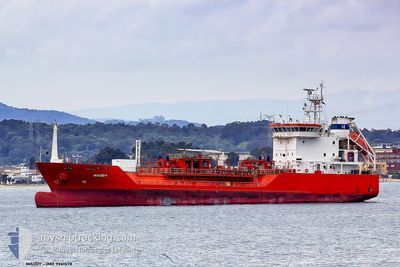
CGAS JUPITER
Lpg Tanker
Current Trip
PT SIE
| Time Travelled | 22 h, 10 mins |
|---|---|
| Remaining Time | --- |
| Distance Travelled | 2.33 nm |
| Remaining Distance | --- |
| AVG Speed | 4 Knots |
| MAX Speed | 4.4 Knots |
| AVG Wind | 14.4 knots |
| MAX Wind | 23.9 knots |
| MIN Temp | 11.1°C / 51.98°F |
| MAX Temp | 16.9°C / 62.42°F |
| Draught | 5.2 m |
| Position Received | 3 m ago |
Current Position
| Longitude | -8.86672° |
|---|---|
| Latitude | 37.91685° |
| Status | At anchor |
| Speed | 0.1 Knots |
| Course | 249° |
| Area | North Atlantic Ocean |
| Station | T-AIS |
| Position Received | 3 m ago |
Info
Information
The current position of CGAS JUPITER is in North Atlantic Ocean with coordinates 37.91685° / -8.86672° as reported on 2024-04-30 15:15 by AIS to our vessel tracker app. The vessel's current speed is 0.1 Knots
The vessel CGAS JUPITER (IMO: 9261578, MMSI: 255802440) is a Lpg Tanker that was built in 2004 ( 20 years old ). It's sailing under the flag of [PT] Portugal.
In this page you can find informations about the vessels current position, last detected port calls, and current voyage information. If the vessels is not in coverage by AIS you will find the latest position.
The current position of CGAS JUPITER is detected by our AIS receivers and we are not responsible for the reliability of the data. The last position was recorded while the vessel was in Coverage by the Ais receivers of our vessel tracking app.
The current draught of CGAS JUPITER as reported by AIS is 5.2 meters
Weather
| Temperature | 16.5°C / 61.7°F |
|---|---|
| Wind Speed | 12 knots |
| Direction | 283° WNW |
| Pressure | 1018 hPa |
| Humidity | 81.6 % |
| Cloud Coverage | 94 % |
Featured Company
Last Port Calls
| Port | Arrival | Departure | Time In Port |
|---|---|---|---|
| 2024-04-29 12:51 | 2024-04-29 17:09 | 4 h | |
| 2024-04-20 13:26 | 2024-04-21 08:06 | 18 h | |
| 2024-04-19 09:45 | 2024-04-19 16:48 | 7 h | |
| 2024-04-18 06:09 | 2024-04-18 13:35 | 7 h | |
| 2024-04-17 06:07 | 2024-04-17 15:42 | 9 h | |
| 2024-04-15 09:29 | 2024-04-15 21:03 | 11 h | |
| 2024-04-14 06:03 | 2024-04-14 19:41 | 13 h | |
| 2024-04-13 10:28 | 2024-04-13 22:16 | 11 h | |
| 2024-04-12 05:52 | 2024-04-12 21:29 | 15 h | |
| 2024-04-11 08:56 | 2024-04-11 15:34 | 6 h |
Most Visited Ports (Last year)
| Port | Arrivals | |
|---|---|---|
| 41 | ||
| 32 | ||
| 30 | ||
| 16 | ||
| 13 | ||
| 12 |
Last Trips
| Origin | Departure | Destination | Arrival | Distance | |
|---|---|---|---|---|---|
| 2024-04-21 09:06 | 2024-04-29 13:51 | 604.95 nm | |||
| 2024-04-19 17:48 | 2024-04-20 14:26 | 214.71 nm | |||
| 2024-04-18 14:35 | 2024-04-19 10:45 | 49.00 nm | |||
| 2024-04-17 16:42 | 2024-04-18 07:09 | 87.30 nm | |||
| 2024-04-15 22:03 | 2024-04-17 07:07 | 226.19 nm | |||
| 2024-04-14 20:41 | 2024-04-15 10:29 | 148.88 nm | |||
| 2024-04-13 23:16 | 2024-04-14 07:03 | 65.55 nm | |||
| 2024-04-12 22:29 | 2024-04-13 11:28 | 115.20 nm | |||
| 2024-04-11 16:34 | 2024-04-12 06:52 | 111.06 nm | |||
| 2024-04-10 04:15 | 2024-04-11 09:56 | 158.53 nm |
Events
| Time | Event | Details | Position / Dest | Info |
|---|---|---|---|---|
| 2024-04-30 14:51 | Status Changed | At anchor Default |
37.91692 / -8.86668
PT SIE
|
Speed: 0.2 kn Course: 283° |
| 2024-04-30 14:48 | Status Changed | Default At anchor |
37.91676 / -8.86671
PT SIE
|
Speed: 0.1 kn Course: 280° |
| 2024-04-30 08:41 | ETA Changed | 2024/04/29 14:00 |
37.91635 / -8.86684
PT SIE
|
Speed: 0.1 kn Course: 299° |
| 2024-04-30 08:05 | ETA Changed | 2024/04/29 14:00 |
37.91688 / -8.86666
PT SIE
|
Speed: Course: 253° |
| 2024-04-30 07:35 | ETA Changed | 2024/04/29 14:00 |
37.91662 / -8.86668
PT SIE
|
Speed: 0.2 kn Course: 285° |
| 2024-04-29 22:16 | ETA Changed | 2024/04/29 14:00 |
37.91601 / -8.86713
PT SIE
|
Speed: 0.2 kn Course: 325° |
| 2024-04-29 19:34 | ETA Changed | 2024/04/29 14:00 |
37.91622 / -8.86688
PT SIE
|
Speed: 0.4 kn Course: 293° |
| 2024-04-29 18:52 | ETA Changed | 2024/04/29 14:00 |
37.91608 / -8.86697
PT SIE
|
Speed: 0.5 kn Course: 327° |
| 2024-04-29 17:39 | STOP Moving | 1.66 nm, South of SINES |
37.91615 / -8.86691
PT SIE
|
Speed: 0.2 kn Course: 319° |
| 2024-04-29 17:31 | Status Changed | At anchor Under way using engine |
37.91691 / -8.86868
PT SIE
|
Speed: 1.8 kn Course: 334° |