
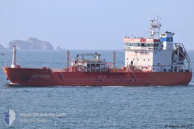
CGAS MATE
Lpg Tanker
Aktuelle Reise
| Trip Time | 2 Tage |
|---|---|
| Trip Distanz | 299.83 nm |
| Durchschnittliche Geschwindigkeit | 11.9 Knoten |
| Maximale Geschwindigkeit | 14.5 Knoten |
| Tiefgang | 5 m |
| Durchschnittliche Windgeschwindigkeit | 21.6 Knoten |
| Maximale Windgeschwindigkeit | 33.8 Knoten |
| Minimale Temperatur | 10.7°C / 51.26°F |
| Maximale Temperatur | 13°C / 55.4°F |
| Position erhalten | 3 m alt |
Aktuelle Position
| Länge | --- |
|---|---|
| Breite | --- |
| Zustand | Moored |
| Geschwindigkeit | |
| Kurs | 195° |
| Gebiet | Kattegat |
| Station | T-AIS |
| Position erhalten | 3 m alt |
Schiffsdetails
Information
Die CGAS MATE befindet sich derzeit in Kattegat mit den Koordinaten 57.69033° / 11.88918°, Diese Position wurde am 2024-11-01 00:31 von unserer Schiffsverfolgungs-App über AIS erfasst. Das Schiff fährt momentan mit einer Geschwindigkeit von 0 Knoten und liegt im Hafen von GOTEBORG .
Das Schiff CGAS MATE (IMO: 9356921, MMSI: 255802940) ist Lpg Tanker das wurde im Jahr 2007 ( 17 Jahre alt ) gebaut. und fährt unter der Flagge von [PT] Portugal.
Auf dieser Seite erhalten Sie Informationen zur aktuellen Position des Schiffes, zu den letzten bekannten Hafenanläufen und zu den aktuellen Reiseinformationen. Sollte das Schiff nicht durch AIS abgedeckt sein, wird die zuletzt erfasste Position angezeigt.
Die CGAS MATE wird durch unsere AIS-Empfänger ermittelt. Wir übernehmen keine Gewähr für die Richtigkeit der Daten. Die letzte Position wurde von unseren AIS-Empfängern aufgezeichnet, während das Schiff in Reichweite war.
Der aktuelle Entwurf von CGAS MATE, wie von AIS gemeldet, betragt 5 meter
Wetter
| Temperatur | 12.2°C / 53.96°F |
|---|---|
| Windgeschwindigkeit | 21 Knoten |
| Windrichtung | 253° WSW |
| Luftdruck | 1006.7 hPa |
| Luftfeuchtigkeit | 86.5 % |
| Wolken | 100 % |
Featured Company
Letzte Hafenanläufe
| Hafen | Ankunft | Abfahrt | Time In Port |
|---|---|---|---|
| 2024-10-31 21:39 | |||
| 2024-10-09 07:32 | 2024-10-29 12:42 | 20 d | |
| 2024-10-05 08:30 | 2024-10-06 12:37 | 1 d | |
| 2024-10-03 03:41 | 2024-10-04 04:00 | 1 d | |
| 2024-09-28 09:38 | 2024-09-30 19:51 | 2 d | |
| 2024-09-23 21:38 | 2024-09-24 17:53 | 20 h | |
| 2024-09-18 06:17 | 2024-09-18 06:41 | 24 m | |
| 2024-09-17 03:51 | 2024-09-18 05:21 | 1 d | |
| 2024-09-14 06:38 | 2024-09-15 06:19 | 23 h | |
| 2024-09-10 09:33 | 2024-09-11 05:49 | 20 h |
Letzte Reisen
| Herkunft | Abfahrt | Ziel | Ankunft | Distanz | |
|---|---|---|---|---|---|
| 2024-10-29 13:42 | 2024-10-31 22:39 | 299.83 nm | |||
| 2024-10-06 14:37 | 2024-10-09 09:32 | 582.63 nm | |||
| 2024-10-04 06:00 | 2024-10-05 10:30 | 308.90 nm | |||
| 2024-09-30 20:51 | 2024-10-03 05:41 | 643.90 nm | |||
| 2024-09-24 19:53 | 2024-09-28 10:38 | 927.45 nm | |||
| 2024-09-18 08:41 | 2024-09-23 23:38 | 467.51 nm | |||
| 2024-09-18 07:21 | 2024-09-18 08:17 | 5.13 nm | |||
| 2024-09-15 08:19 | 2024-09-17 05:51 | 483.46 nm | |||
| 2024-09-11 07:49 | 2024-09-14 08:38 | 431.05 nm | |||
| 2024-09-06 11:13 | 2024-09-10 11:33 | 480.65 nm |
Events
| Zeit | Ereignis | Details | Position / Ziel | Information |
|---|---|---|---|---|
| 2024-11-01 00:06 | geänderte voraussichtliche Ankunftszeit | 2025/10/31 21:00 2024/10/31 21:00 |
57.69033 / 11.88922
[SE] GOTEBORG
|
Geschwindigkeit: Kurs: 195° |
| 2024-10-31 22:23 | geänderter Status | Moored Under way using engine |
57.69045 / 11.88923
[SE] GOTEBORG
|
Geschwindigkeit: 0.2 kn Kurs: 195° |
| 2024-10-31 22:07 | STOP Bewegung |
57.69005 / 11.89055
[SE] GOTEBORG
|
Geschwindigkeit: 0.3 kn Kurs: 215° |
|
| 2024-10-31 21:39 | ZIELHAFEN |
|
57.68020 / 11.82355
[SE] GOTEBORG
|
Geschwindigkeit: 9.8 kn Kurs: 77° |
| 2024-10-31 19:49 | Ändere Seegebiet | Swedish part of the Kattegat Danish part of the Kattegat |
57.55305 / 11.31570
Kattegat
SEGOT
|
Geschwindigkeit: 11.8 kn Kurs: 98° |
| 2024-10-31 18:16 | geänderte voraussichtliche Ankunftszeit | 2024/10/31 21:00 2024/10/31 22:00 |
57.62023 / 10.78405
SEGOT
|
Geschwindigkeit: 11.6 kn Kurs: 110° |
| 2024-10-31 17:41 | START Bewegung | 2.67 nm, South of SKAGEN |
57.67007 / 10.61517
SEGOT
|
Geschwindigkeit: 4.4 kn Kurs: 149° |
| 2024-10-31 17:36 | geänderter Status | Under way using engine At anchor |
57.67125 / 10.61248
SEGOT
|
Geschwindigkeit: 0.8 kn Kurs: 251° |
| 2024-10-31 16:09 | geänderter Tiefgang | 5 4.9 |
57.67190 / 10.61510
SEGOT
|
Geschwindigkeit: 0.1 kn Kurs: 247° |
| 2024-10-31 16:09 | geänderte voraussichtliche Ankunftszeit | 2024/10/31 22:00 2024/11/01 09:30 |
57.67190 / 10.61510
SEGOT
|
Geschwindigkeit: 0.1 kn Kurs: 247° |