
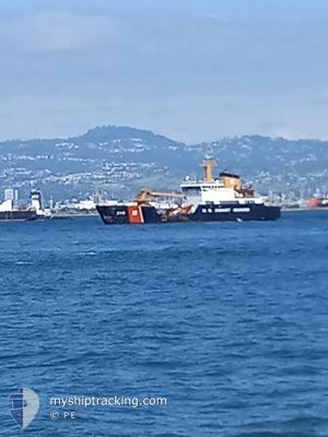
CGC ALDER
Buoy-laying Vessel
Current Trip
| Trip Time | 1 day |
|---|---|
| Trip Distance | 18.23 nm |
| AVG Speed | 6.7 Knots |
| MAX Speed | 6.7 Knots |
| Draught | 4 m |
| AVG Wind | 7.8 knots |
| MAX Wind | 10.4 knots |
| MIN Temp | 14.6°C / 58.28°F |
| MAX Temp | 25.3°C / 77.54°F |
| Position Received | 1 d ago |
Current Position
| Longitude | -122.36095° |
|---|---|
| Latitude | 37.80877° |
| Status | Under way using engine |
| Speed | |
| Course | --- |
| Area | North Pacific Ocean |
| Station | T-AIS |
| Position Received | 1 d ago |
Info
Information
The current position of CGC ALDER is in North Pacific Ocean with coordinates 37.80877° / -122.36095° as reported on 2024-06-05 21:17 by AIS to our vessel tracker app. The vessel's current speed is 0 Knots and is currently inside the port of TREASURE ISLAND.
The vessel CGC ALDER (IMO: 9271145, MMSI: 369953000) is a Buoy-laying Vessel that was built in 2004 ( 20 years old ). It's sailing under the flag of [US] USA.
In this page you can find informations about the vessels current position, last detected port calls, and current voyage information. If the vessels is not in coverage by AIS you will find the latest position.
The current position of CGC ALDER is detected by our AIS receivers and we are not responsible for the reliability of the data. The last position was recorded while the vessel was in Coverage by the Ais receivers of our vessel tracking app.
The current draught of CGC ALDER as reported by AIS is 4 meters
Weather
| Temperature | 23.3°C / 73.94°F |
|---|---|
| Wind Speed | 8 knots |
| Direction | 290° WNW |
| Pressure | 1010.8 hPa |
| Humidity | 51.5 % |
| Cloud Coverage | 26 % |
Featured Company
Last Port Calls
| Port | Arrival | Departure | Time In Port |
|---|---|---|---|
| 2024-06-05 20:59 | |||
| 2024-05-19 00:04 | 2024-06-04 19:14 | 16 d | |
| 2024-05-13 18:15 | 2024-05-14 01:15 | 6 h | |
| 2024-04-23 19:50 | 2024-05-11 15:38 | 17 d | |
| 2024-04-15 19:41 |
Most Visited Ports (Last year)
| Port | Arrivals | |
|---|---|---|
| 10 | ||
| 1 | ||
| 1 | ||
| 1 | ||
| 1 |
Last Trips
| Origin | Departure | Destination | Arrival | Distance | |
|---|---|---|---|---|---|
| 2024-06-04 12:14 | 2024-06-05 13:59 | 18.23 nm | |||
| 2024-05-13 18:15 | 2024-05-18 17:04 | 437.72 nm | |||
| 2024-05-11 08:38 | 2024-05-13 11:15 | 290.09 nm | |||
| 2024-04-15 12:41 | 2024-04-23 12:50 | 914.85 nm |
Events
| Time | Event | Details | Position / Dest | Info |
|---|---|---|---|---|
| 2024-06-05 21:18 | Status Changed | Default Under way using engine |
37.80877 / -122.36094
[US] TREASURE ISLAND
|
Speed: Course: 511° |
| 2024-06-05 21:17 | OUT of Coverage |
37.80877 / -122.36095
North Pacific Ocean
[US] TREASURE ISLAND
|
Speed: Course: 243.3° |
|
| 2024-06-05 21:14 | STOP Moving |
37.80882 / -122.36079
[US] TREASURE ISLAND
|
Speed: 0.1 kn Course: 511° |
|
| 2024-06-05 20:59 | PORT ARRIVAL |
|
37.81661 / -122.35695
[US] TREASURE ISLAND
|
Speed: 5 kn Course: 159.9° |
| 2024-06-05 19:54 | START Moving | 1.91 nm, South West of CHEVRON SF |
37.89524 / -122.42568
USSFO
|
Speed: 3.2 kn Course: 146.9° |
| 2024-06-05 19:43 | Status Changed | Under way using engine At anchor |
37.89827 / -122.42804
USSFO
|
Speed: 1 kn Course: 511° |
| 2024-06-05 18:42 | Status Changed | At anchor Default |
37.89849 / -122.42829
USSFO
|
Speed: Course: -1° |
| 2024-06-05 18:36 | Status Changed | Default At anchor |
37.89845 / -122.42830
USSFO
|
Speed: Course: 511° |
| 2024-06-05 17:45 | Status Changed | At anchor Default |
37.89847 / -122.42827
USSFO
|
Speed: 0.1 kn Course: -1° |
| 2024-06-05 17:36 | Status Changed | Default At anchor |
37.89846 / -122.42829
USSFO
|
Speed: Course: 511° |