
CHACABUCO
Cargo
Current Trip
| Time Travelled | 3 days |
|---|---|
| Remaining Time | 7 days |
| Distance Travelled | 1394.57 nm |
| Remaining Distance | 3817.73 nm |
| AVG Speed | 16.6 Knots |
| MAX Speed | 20.4 Knots |
| AVG Wind | 14.7 knots |
| MAX Wind | 22 knots |
| MIN Temp | 25.6°C / 78.08°F |
| MAX Temp | 29.7°C / 85.46°F |
| Draught | 10.8 m |
| Position Received | 16 h, 26 m ago |
Current Position
| Longitude | -79.44479° |
|---|---|
| Latitude | 26.16646° |
| Status | Under way using engine |
| Speed | 20.2 Knots |
| Course | 9.8° |
| Area | North Atlantic Ocean |
| Station | T-AIS |
| Position Received | 16 h, 26 m ago |
Info
Information
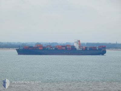
The current position of CHACABUCO is in North Atlantic Ocean with coordinates 26.16646° / -79.44479° as reported on 2024-06-17 19:04 by AIS to our vessel tracker app. The vessel's current speed is 20.2 Knots and is heading at the port of LE HAVRE. The estimated time of arrival as calculated by vessel tracking app is 2024-06-25 20:56 LT
The vessel CHACABUCO (IMO: 92959679, MMSI: 636092679) is a Cargo It's sailing under the flag of [LR] Liberia.
In this page you can find informations about the vessels current position, last detected port calls, and current voyage information. If the vessels is not in coverage by AIS you will find the latest position.
The current position of CHACABUCO is detected by our AIS receivers and we are not responsible for the reliability of the data. The last position was recorded while the vessel was in Coverage by the Ais receivers of our vessel tracking app.
The current draught of CHACABUCO as reported by AIS is 10.8 meters
Weather
| Temperature | 25.7°C / 78.26°F |
|---|---|
| Wind Speed | 20 knots |
| Direction | 74° ENE |
| Pressure | 1016.8 hPa |
| Humidity | 79.3 % |
| Cloud Coverage | 71 % |
Featured Company
Last Port Calls
| Port | Arrival | Departure | Time In Port |
|---|---|---|---|
| 2024-06-13 08:15 | 2024-06-15 00:15 | 1 d | |
| 2024-06-10 11:24 | 2024-06-11 18:54 | 1 d | |
| 2024-05-25 12:56 | 2024-05-26 12:26 | 23 h | |
| 2024-05-24 02:39 | 2024-05-24 13:40 | 11 h | |
| 2024-05-20 07:53 | 2024-05-21 13:49 | 1 d | |
| 2024-05-18 03:41 | 2024-05-18 17:14 | 13 h | |
| 2024-05-16 08:36 | 2024-05-17 01:07 | 16 h | |
| 2024-04-26 16:32 | 2024-04-28 06:06 | 1 d | |
| 2024-04-24 04:00 | 2024-04-25 04:19 | 1 d | |
| 2024-04-05 21:46 | 2024-04-06 11:03 | 13 h |
Last Trips
| Origin | Departure | Destination | Arrival | Distance | |
|---|---|---|---|---|---|
| 2024-06-11 13:54 | 2024-06-13 03:15 | 503.69 nm | |||
| 2024-05-26 14:26 | 2024-06-10 06:24 | 5626.29 nm | |||
| 2024-05-24 15:40 | 2024-05-25 14:56 | 152.25 nm | |||
| 2024-05-21 15:49 | 2024-05-24 04:39 | 337.65 nm | |||
| 2024-05-18 18:14 | 2024-05-20 09:53 | 202.19 nm | |||
| 2024-05-17 03:07 | 2024-05-18 04:41 | 265.73 nm | |||
| 2024-04-28 01:06 | 2024-05-16 10:36 | 5008.29 nm | |||
| 2024-04-24 23:19 | 2024-04-26 11:32 | 502.48 nm | |||
| 2024-04-06 13:03 | 2024-04-23 23:00 | 5833.55 nm | |||
| 2024-04-05 14:59 | 2024-04-05 23:46 | 121.99 nm |
Events
| Time | Event | Details | Position / Dest | Info |
|---|---|---|---|---|
| 2024-06-17 19:13 | Status Changed | Default Under way using engine |
26.21268 / -79.43564
FRLEH
|
Speed: 20.2 kn Course: 9.8° |
| 2024-06-17 19:04 | OUT of Coverage |
26.16646 / -79.44479
North Atlantic Ocean
FRLEH
|
Speed: 20.2 kn Course: 9.8° |
|
| 2024-06-17 18:54 | Status Changed | Under way using engine Default |
26.11016 / -79.45616
FRLEH
|
Speed: 20.3 kn Course: 10° |
| 2024-06-17 18:16 | Status Changed | Default Under way using engine |
25.89940 / -79.49943
FRLEH
|
Speed: 20.2 kn Course: 10.4° |
| 2024-06-17 17:05 | Draught Changed | 10.8 11.2 |
25.50176 / -79.56383
FRLEH
|
Speed: 20 kn Course: 11.5° |
| 2024-06-17 17:05 | ETA Changed | 2024/06/27 11:00 2024/06/27 13:00 |
25.50176 / -79.56383
FRLEH
|
Speed: 20 kn Course: 11.5° |
| 2024-06-17 16:48 | Change Sea Area | Bahamas part of the North Atlantic Ocean United States part of the Gulf of Mexico |
25.40971 / -79.57653
North Atlantic Ocean
FRLEH
|
Speed: 20.2 kn Course: 4.7° |
| 2024-06-17 16:48 | Status Changed | Under way using engine Default |
25.40971 / -79.57653
FRLEH
|
Speed: 20.2 kn Course: 0° |
| 2024-06-17 16:40 | IN Coverage |
25.40971 / -79.57653
North Atlantic Ocean
FRLEH
|
Speed: 20.2 kn Course: 4.7° |
|
| 2024-06-15 05:50 | OUT of Coverage |
28.54794 / -94.41648
Gulf of Mexico
FRLEH
|
Speed: 13 kn Course: 180.8° |